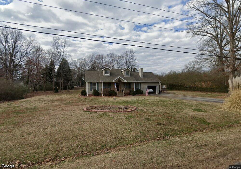
5183 Southland Dr High Point, NC 27263
Estimated Value: $205,338 - $250,000
--
Bed
2
Baths
1,113
Sq Ft
$208/Sq Ft
Est. Value
About This Home
This home is located at 5183 Southland Dr, High Point, NC 27263 and is currently estimated at $231,335, approximately $207 per square foot. 5183 Southland Dr is a home located in Randolph County with nearby schools including New Market Elementary School, Randleman Middle School, and Randleman High School.
Ownership History
Date
Name
Owned For
Owner Type
Purchase Details
Closed on
Sep 24, 2008
Sold by
Federal Home Loan Mortgage Corporation
Bought by
Grose Brian S
Current Estimated Value
Home Financials for this Owner
Home Financials are based on the most recent Mortgage that was taken out on this home.
Original Mortgage
$99,085
Outstanding Balance
$65,541
Interest Rate
6.49%
Mortgage Type
VA
Estimated Equity
$165,794
Purchase Details
Closed on
Jun 9, 2008
Sold by
White Mark F and White Linda P
Bought by
Federal Home Loan Mortgage Corporation
Create a Home Valuation Report for This Property
The Home Valuation Report is an in-depth analysis detailing your home's value as well as a comparison with similar homes in the area
Home Values in the Area
Average Home Value in this Area
Purchase History
| Date | Buyer | Sale Price | Title Company |
|---|---|---|---|
| Grose Brian S | -- | Chicago Title Insurance Co | |
| Federal Home Loan Mortgage Corporation | $87,136 | None Available |
Source: Public Records
Mortgage History
| Date | Status | Borrower | Loan Amount |
|---|---|---|---|
| Open | Grose Brian S | $99,085 |
Source: Public Records
Tax History Compared to Growth
Tax History
| Year | Tax Paid | Tax Assessment Tax Assessment Total Assessment is a certain percentage of the fair market value that is determined by local assessors to be the total taxable value of land and additions on the property. | Land | Improvement |
|---|---|---|---|---|
| 2025 | $1,180 | $181,480 | $42,690 | $138,790 |
| 2024 | $1,180 | $181,480 | $42,690 | $138,790 |
| 2023 | $1,180 | $181,480 | $42,690 | $138,790 |
| 2022 | $1,016 | $129,790 | $28,980 | $100,810 |
| 2021 | $1,016 | $129,790 | $28,980 | $100,810 |
| 2020 | $1,007 | $129,790 | $28,980 | $100,810 |
| 2019 | $1,007 | $129,790 | $28,980 | $100,810 |
| 2018 | $911 | $113,530 | $22,390 | $91,140 |
| 2016 | $888 | $113,527 | $22,390 | $91,137 |
| 2015 | $890 | $113,527 | $22,390 | $91,137 |
| 2014 | $890 | $113,527 | $22,390 | $91,137 |
Source: Public Records
Map
Nearby Homes
- 8434 Us Highway 311
- 5590 Old Cedar Square Rd
- 0 Hughes Farm Rd Unit 1201373
- 3368 Old Glenola Rd
- 0 Old Cedar Square Rd
- 2994 Stanley Rd Unit 13
- 9116 Us Highway 311
- 3796 Wood Village Dr
- 4869 Old Edgar Rd
- 136 Royal Pines Dr
- 138 Royal Pines Dr
- 0 Windemere Cir
- 0 Arbor Dr
- 0 Village Dr
- Newport Plan at Royal Pines
- Greensboro Plan at Royal Pines
- Fairfield Plan at Royal Pines
- Jamestown Plan at Royal Pines
- Hanover Plan at Royal Pines
- Asheville Plan at Royal Pines
- 5171 Southland Dr
- 5169 Ridgeview Rd
- 5726 Edgar Rd
- 5161 Southland Dr
- 5176 Southland Dr
- 5181 Ridgeview Rd
- 5192 Southland Dr
- 5694 Edgar Rd
- 5164 Southland Dr
- 5151 Southland Dr
- 5162 Ridgeview Rd
- 5172 Ridgeview Rd
- 5688 Edgar Rd
- 5188 Ridgeview Rd
- 5154 Southland Dr
- 4994 Ridgeview Rd
- 4971 Ridgeview Rd
- 4984 Ridgeview Rd
- 5135 Southland Dr
- 5816 Edgar Rd