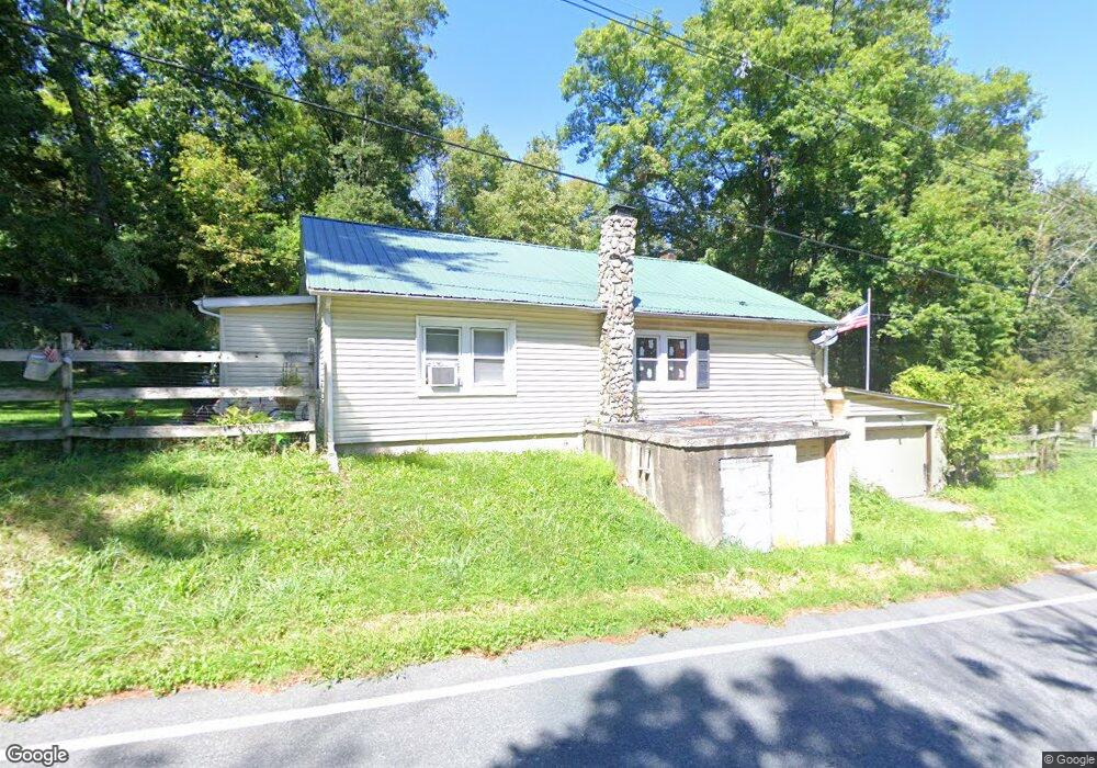
519 Delaware Rd Blairstown, NJ 07825
Estimated Value: $267,512 - $353,000
--
Bed
--
Bath
1,170
Sq Ft
$263/Sq Ft
Est. Value
About This Home
This home is located at 519 Delaware Rd, Blairstown, NJ 07825 and is currently estimated at $308,128, approximately $263 per square foot. 519 Delaware Rd is a home located in Warren County with nearby schools including Hope Township Elementary School.
Ownership History
Date
Name
Owned For
Owner Type
Purchase Details
Closed on
Dec 6, 2006
Sold by
Charles Kimberly A
Bought by
Jones John
Current Estimated Value
Home Financials for this Owner
Home Financials are based on the most recent Mortgage that was taken out on this home.
Original Mortgage
$130,500
Interest Rate
6.14%
Mortgage Type
Purchase Money Mortgage
Purchase Details
Closed on
Sep 20, 2000
Sold by
Stopp Ronald
Bought by
Charles Kimberly and Jones John
Home Financials for this Owner
Home Financials are based on the most recent Mortgage that was taken out on this home.
Original Mortgage
$83,250
Interest Rate
7.94%
Create a Home Valuation Report for This Property
The Home Valuation Report is an in-depth analysis detailing your home's value as well as a comparison with similar homes in the area
Home Values in the Area
Average Home Value in this Area
Purchase History
| Date | Buyer | Sale Price | Title Company |
|---|---|---|---|
| Jones John | $45,000 | None Available | |
| Charles Kimberly | $84,000 | -- |
Source: Public Records
Mortgage History
| Date | Status | Borrower | Loan Amount |
|---|---|---|---|
| Previous Owner | Jones John | $130,500 | |
| Previous Owner | Charles Kimberly | $83,250 |
Source: Public Records
Tax History Compared to Growth
Tax History
| Year | Tax Paid | Tax Assessment Tax Assessment Total Assessment is a certain percentage of the fair market value that is determined by local assessors to be the total taxable value of land and additions on the property. | Land | Improvement |
|---|---|---|---|---|
| 2025 | $5,396 | $157,600 | $45,000 | $112,600 |
| 2024 | $5,034 | $157,600 | $45,000 | $112,600 |
| 2023 | $4,830 | $157,600 | $45,000 | $112,600 |
| 2022 | $4,830 | $157,600 | $45,000 | $112,600 |
| 2021 | $4,692 | $157,600 | $45,000 | $112,600 |
| 2020 | $4,748 | $157,600 | $45,000 | $112,600 |
| 2019 | $4,504 | $157,600 | $45,000 | $112,600 |
| 2018 | $4,504 | $157,600 | $45,000 | $112,600 |
| 2017 | $4,226 | $166,300 | $87,200 | $79,100 |
| 2016 | $4,206 | $166,300 | $87,200 | $79,100 |
| 2015 | $4,177 | $166,300 | $87,200 | $79,100 |
| 2014 | $3,976 | $166,300 | $87,200 | $79,100 |
Source: Public Records
Map
Nearby Homes
- 19-23-29 Swayze Mill Rd
- 522 Delaware Rd
- 12 Locust Lake Rd
- 95 Auble Rd
- 28 Sarepta Rd
- 55 Valley St
- 6 Charles St
- 18 Ann St
- 22 N Riverview Ave
- 0 Chippewa Cir
- 52 Chippawa Cir
- 96 Lenape Trail
- 82 Lenape Trail
- 22 Hissim Rd
- 44 Lake Just It Rd
- 135 N Locust Lake Rd
- 138 Lakeside Dr W
- 1118 Belvidere Corner Rd
- 341 Mount Hermon Rd
- 178 Lakeside Dr
- 527 Delaware Rd
- 524 Delaware Rd
- 262 Honey Run Rd
- 101 Nightingale Rd
- 103 Nightingale Rd
- 520 Delaware Rd
- 109 Nightingale Rd
- 107 Nightingale Rd
- 113 Nightingale Rd
- 111 Nightingale Rd
- 502 Delaware Rd
- 115 Nightingale Rd
- 110 Nightingale Rd
- 543 Delaware Rd
- 117 Nightingale Rd
- 556 Delaware Rd
- 119 Nightingale Rd
- 120 Koeck Rd
- 123 Nightingale Rd
- 121 Nightingale Rd