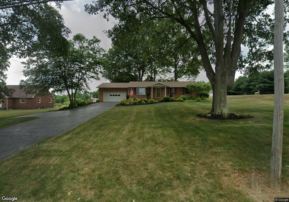
5199 Meese Rd NE Louisville, OH 44641
Estimated Value: $250,000 - $280,000
3
Beds
2
Baths
1,576
Sq Ft
$167/Sq Ft
Est. Value
About This Home
This home is located at 5199 Meese Rd NE, Louisville, OH 44641 and is currently estimated at $263,297, approximately $167 per square foot. 5199 Meese Rd NE is a home located in Stark County with nearby schools including Louisville High School and St. Thomas Aquinas High School & Middle School.
Ownership History
Date
Name
Owned For
Owner Type
Purchase Details
Closed on
Apr 23, 2018
Sold by
Brien Timothy S O and Brien Karen H O
Bought by
Brien Timothy S O and Brien Karen H O
Current Estimated Value
Purchase Details
Closed on
Apr 18, 2000
Sold by
Obrien Timothy S and Obrien Karen H
Bought by
Obrien Timothy S and Obrien Karen H
Create a Home Valuation Report for This Property
The Home Valuation Report is an in-depth analysis detailing your home's value as well as a comparison with similar homes in the area
Home Values in the Area
Average Home Value in this Area
Purchase History
| Date | Buyer | Sale Price | Title Company |
|---|---|---|---|
| Brien Timothy S O | -- | None Available | |
| Obrien Timothy S | -- | -- |
Source: Public Records
Tax History Compared to Growth
Tax History
| Year | Tax Paid | Tax Assessment Tax Assessment Total Assessment is a certain percentage of the fair market value that is determined by local assessors to be the total taxable value of land and additions on the property. | Land | Improvement |
|---|---|---|---|---|
| 2025 | -- | $79,840 | $18,240 | $61,600 |
| 2024 | -- | $79,840 | $18,240 | $61,600 |
| 2023 | $2,410 | $58,740 | $12,920 | $45,820 |
| 2022 | $2,436 | $58,740 | $12,920 | $45,820 |
| 2021 | $2,870 | $58,740 | $12,920 | $45,820 |
| 2020 | $2,420 | $52,330 | $11,620 | $40,710 |
| 2019 | $2,430 | $52,330 | $11,620 | $40,710 |
| 2018 | $2,422 | $52,330 | $11,620 | $40,710 |
| 2017 | $2,388 | $49,250 | $10,890 | $38,360 |
| 2016 | $2,171 | $45,780 | $7,420 | $38,360 |
| 2015 | $2,176 | $45,780 | $7,420 | $38,360 |
| 2014 | $52 | $39,940 | $6,480 | $33,460 |
| 2013 | $1,030 | $39,940 | $6,480 | $33,460 |
Source: Public Records
Map
Nearby Homes
- 5495 Meese Rd NE
- 2015 E Main St
- 203 Brookfield St
- 6052 N Nickelplate St
- 0 Michigan Blvd
- 1170 Winding Ridge Ave
- 910 Crosswyck Cir
- 1812 E Broad St
- 1715 High St
- 316 E Reno Dr
- 308 Superior St
- 5474 Ravenna Ave
- 325 Lincoln Ave
- 5765 Maplegrove St
- 428 Honeycrisp Dr NE
- 3047 Mcintosh Dr NE
- 432 Honeycrisp Dr NE
- 2962 Mcintosh Dr NE
- 2963 Mcintosh Dr NE
- 430 Honeycrisp Dr NE
- 5191 Meese Rd NE
- 5241 Meese Rd
- 5261 Meese Rd
- 5202 Meese Rd
- 5190 Meese Rd
- 5295 Meese Rd
- 5270 Meese Rd
- 5265 Meese Rd NE
- 5345 Meese Rd
- 5340 Meese Rd
- 5432 Meese Rd NE
- 5065 Meese Rd NE
- 5065 Meese Rd NE
- 5056 Meese Rd NE
- 5056 Meese Rd
- 5047 Meese Rd
- 5034 Meese Rd NE
- 5034 Meese Rd
- 5023 Meese Rd
- 8855 Scott St