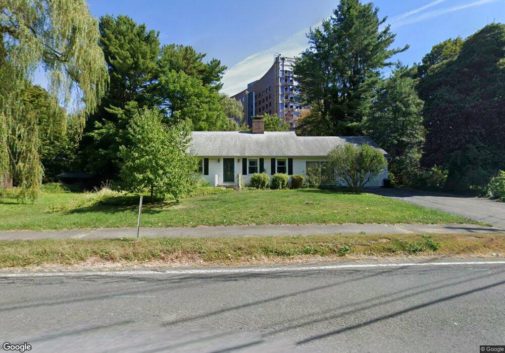
52 Homestead Ave Holyoke, MA 01040
Estimated Value: $269,000 - $339,000
2
Beds
1
Bath
1,200
Sq Ft
$261/Sq Ft
Est. Value
About This Home
This home is located at 52 Homestead Ave, Holyoke, MA 01040 and is currently estimated at $312,705, approximately $260 per square foot. 52 Homestead Ave is a home located in Hampden County with nearby schools including Harriet Bishop Elementary School, Lt. Elmer J. McMahon Elementary School, and Holyoke High School.
Ownership History
Date
Name
Owned For
Owner Type
Purchase Details
Closed on
Jun 26, 2025
Sold by
Deforge Jeanette M
Bought by
Deforge Lt and Deforge
Current Estimated Value
Purchase Details
Closed on
Feb 28, 2001
Sold by
Landers Helen B Est and Bell
Bought by
Deforge Jeanette M
Home Financials for this Owner
Home Financials are based on the most recent Mortgage that was taken out on this home.
Original Mortgage
$94,000
Interest Rate
7%
Mortgage Type
Purchase Money Mortgage
Create a Home Valuation Report for This Property
The Home Valuation Report is an in-depth analysis detailing your home's value as well as a comparison with similar homes in the area
Home Values in the Area
Average Home Value in this Area
Purchase History
| Date | Buyer | Sale Price | Title Company |
|---|---|---|---|
| Deforge Lt | -- | -- | |
| Deforge Lt | -- | -- | |
| Deforge Jeanette M | $119,000 | -- | |
| Deforge Jeanette M | $119,000 | -- |
Source: Public Records
Mortgage History
| Date | Status | Borrower | Loan Amount |
|---|---|---|---|
| Previous Owner | Deforge Jeanette M | $94,000 |
Source: Public Records
Tax History Compared to Growth
Tax History
| Year | Tax Paid | Tax Assessment Tax Assessment Total Assessment is a certain percentage of the fair market value that is determined by local assessors to be the total taxable value of land and additions on the property. | Land | Improvement |
|---|---|---|---|---|
| 2025 | $4,084 | $233,900 | $57,500 | $176,400 |
| 2024 | $3,854 | $203,400 | $54,800 | $148,600 |
| 2023 | $3,694 | $196,900 | $54,800 | $142,100 |
| 2022 | $3,584 | $186,100 | $54,800 | $131,300 |
| 2021 | $3,227 | $176,900 | $52,500 | $124,400 |
| 2020 | $3,200 | $167,700 | $52,500 | $115,200 |
| 2019 | $2,344 | $160,100 | $52,500 | $107,600 |
| 2018 | $2,760 | $154,500 | $52,500 | $102,000 |
| 2017 | $2,962 | $154,500 | $52,500 | $102,000 |
| 2016 | $2,967 | $155,200 | $54,100 | $101,100 |
| 2015 | $2,955 | $155,200 | $54,100 | $101,100 |
Source: Public Records
Map
Nearby Homes
- 34 Maple Crest Cir Unit B
- 33 Maple Crest Cir Unit D
- 15 Maple Crest Cir Unit D
- 43 King St
- 46 Cherry Hill
- 42 Arnodale Ave
- 78 Calumet Rd
- 70-72 Westfield Rd
- 1793 Northampton St
- 1705-1707 Northampton St
- 84 Woodland St
- 15 Chapman Ave
- 1678 Northampton St
- 23 Scott Hollow Dr
- 104 Saint James Ave
- 268-270 Sargeant St
- 69 Gates St
- 13 Willow St
- 414 South St
- 133-135 Brown Ave
- 66 Homestead Ave
- 44 Homestead Ave
- 51 Homestead Ave
- 51 Homestead Ave Unit 1
- 78 Homestead Ave
- 41 Homestead Ave
- 65 Homestead Ave
- 32 Homestead Ave
- 000001 Confidential
- Lot 8 B&C Southampton Rd
- Map 218-7 Northampton St
- Lots 13,15 Rock Valley Rd
- 112 Rear Bowers St
- 211/214 Walnut and Pine
- 37 Homestead Ave
- 90 Homestead Ave
- 75 Homestead Ave
- 33 Homestead Ave
- 22 Homestead Ave
- 23 Homestead Ave