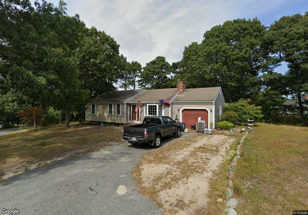
52 Kingswear Cir South Dennis, MA 02660
South Dennis NeighborhoodEstimated Value: $559,659 - $606,000
3
Beds
2
Baths
1,001
Sq Ft
$590/Sq Ft
Est. Value
About This Home
This home is located at 52 Kingswear Cir, South Dennis, MA 02660 and is currently estimated at $590,415, approximately $589 per square foot. 52 Kingswear Cir is a home located in Barnstable County with nearby schools including Dennis-Yarmouth Regional High School and St. Pius X. School.
Ownership History
Date
Name
Owned For
Owner Type
Purchase Details
Closed on
Oct 2, 2008
Sold by
Rockwood Robert L and Rockwood Susanne T
Bought by
Rockwood Robert L
Current Estimated Value
Purchase Details
Closed on
May 17, 1996
Sold by
Hull Harding E and Quirk Mary H
Bought by
Rockwood Robert L
Home Financials for this Owner
Home Financials are based on the most recent Mortgage that was taken out on this home.
Original Mortgage
$107,100
Interest Rate
7.77%
Mortgage Type
Purchase Money Mortgage
Create a Home Valuation Report for This Property
The Home Valuation Report is an in-depth analysis detailing your home's value as well as a comparison with similar homes in the area
Home Values in the Area
Average Home Value in this Area
Purchase History
| Date | Buyer | Sale Price | Title Company |
|---|---|---|---|
| Rockwood Robert L | -- | -- | |
| Rockwood Robert L | $110,000 | -- |
Source: Public Records
Mortgage History
| Date | Status | Borrower | Loan Amount |
|---|---|---|---|
| Previous Owner | Rockwood Robert L | $200,000 | |
| Previous Owner | Rockwood Robert L | $107,100 |
Source: Public Records
Tax History Compared to Growth
Tax History
| Year | Tax Paid | Tax Assessment Tax Assessment Total Assessment is a certain percentage of the fair market value that is determined by local assessors to be the total taxable value of land and additions on the property. | Land | Improvement |
|---|---|---|---|---|
| 2025 | $2,302 | $531,600 | $144,500 | $387,100 |
| 2024 | $2,199 | $500,900 | $139,000 | $361,900 |
| 2023 | $2,127 | $455,400 | $126,300 | $329,100 |
| 2022 | $2,072 | $370,000 | $126,500 | $243,500 |
| 2021 | $1,968 | $326,300 | $124,000 | $202,300 |
| 2020 | $1,877 | $307,700 | $124,000 | $183,700 |
| 2019 | $1,834 | $297,200 | $133,700 | $163,500 |
| 2018 | $1,676 | $264,400 | $115,700 | $148,700 |
| 2017 | $1,597 | $259,700 | $115,700 | $144,000 |
| 2016 | $1,598 | $244,700 | $121,500 | $123,200 |
| 2015 | $1,566 | $244,700 | $121,500 | $123,200 |
| 2014 | $1,443 | $227,300 | $104,100 | $123,200 |
Source: Public Records
Map
Nearby Homes
- 17 Margate Ln
- 10 Joanne Dr
- 15 Captain Jud Rd
- 25 Skerry Rd
- 153 Bayridge Dr
- 7 Vinland Dr
- 1 Norseman Dr
- 17 Fairmount Rd
- 17 Fairmount Rd
- 4 Ebb Rd
- 6 Hawthorn St
- 62 Old Fish House Rd
- 118 Driftwood Ln
- 129 Driftwood Ln
- 13 Covey Dr
- 32 Captain Walsh Dr
- 111 Merchant Ave
- 20 Sycamore Ln
- 4 Old Colony Way
- 432 Old Chatham Rd Unit 403
- 10 Cornwall Rd
- 5 Sheffield Ave
- 9 Sheffield Ave
- 53 Kingswear Cir
- 60 Kingswear Cir
- 59 Kingswear Cir
- 3 Margate Ln
- 47 Kingswear Cir
- 16 Cornwall Rd
- 63 Kingswear Cir
- 1 Openfield Rd
- 15 Sheffield Ave
- 84 Cassidy Ave
- 43 Kingswear Cir
- 86 Cassidy Ave
- 80 Cassidy Ave
- 66 Kingswear Cir
- 6 Sheffield Ave
- 10 Sheffield Ave
- 9 Margate Ln