Estimated Value: $251,355 - $310,000
--
Bed
2
Baths
1,932
Sq Ft
$144/Sq Ft
Est. Value
About This Home
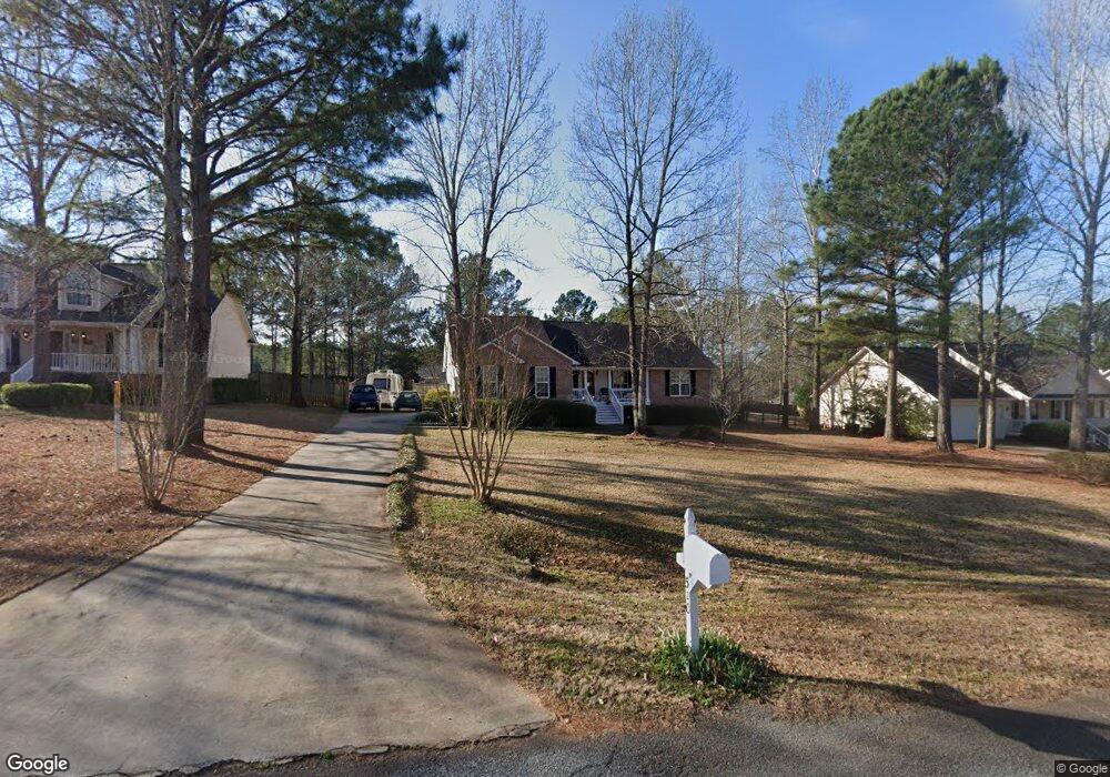
This home is located at 520 Aarons Cir, Gray, GA 31032 and is currently estimated at $278,589, approximately $144 per square foot. 520 Aarons Cir is a home located in Jones County with nearby schools including Turner Woods Elementary School, Gray Station Middle School, and Jones County High School.
Ownership History
Date
Name
Owned For
Owner Type
Purchase Details
Closed on
Oct 16, 2009
Sold by
Lucik Donald W
Bought by
Canfield Donald Robert
Current Estimated Value
Purchase Details
Closed on
Oct 15, 2009
Sold by
Rackley Lance W
Bought by
Lucik Donald W
Purchase Details
Closed on
Dec 27, 2002
Sold by
Shiver Joel
Bought by
Hubbard Roy C and Hubbard Sr
Purchase Details
Closed on
May 31, 2002
Sold by
Hubbard Roy C and Hubbard Sr
Bought by
Rackley Laura T
Purchase Details
Closed on
Sep 27, 2000
Bought by
Shiver Joel
Create a Home Valuation Report for This Property
The Home Valuation Report is an in-depth analysis detailing your home's value as well as a comparison with similar homes in the area
Home Values in the Area
Average Home Value in this Area
Purchase History
| Date | Buyer | Sale Price | Title Company |
|---|---|---|---|
| Canfield Donald Robert | -- | -- | |
| Canfield Donald Robert | -- | -- | |
| Lucik Donald W | $150,000 | -- | |
| Lucik Donald W | $150,000 | -- | |
| Hubbard Roy C | $21,000 | -- | |
| Rackley Laura T | $144,000 | -- | |
| Shiver Joel | $36,000 | -- |
Source: Public Records
Tax History Compared to Growth
Tax History
| Year | Tax Paid | Tax Assessment Tax Assessment Total Assessment is a certain percentage of the fair market value that is determined by local assessors to be the total taxable value of land and additions on the property. | Land | Improvement |
|---|---|---|---|---|
| 2023 | $1,575 | $61,175 | $10,800 | $50,375 |
| 2022 | $1,567 | $60,959 | $10,584 | $50,375 |
| 2021 | $1,568 | $60,959 | $10,584 | $50,375 |
| 2020 | $1,457 | $57,843 | $10,584 | $47,259 |
| 2019 | $1,457 | $57,843 | $10,584 | $47,259 |
| 2018 | $1,457 | $57,843 | $10,584 | $47,259 |
| 2017 | $1,457 | $57,843 | $10,584 | $47,259 |
| 2016 | $1,457 | $57,843 | $10,584 | $47,259 |
| 2015 | $1,570 | $57,843 | $10,584 | $47,259 |
| 2014 | $1,427 | $57,843 | $10,584 | $47,259 |
Source: Public Records
Map
Nearby Homes
- 140 Lite-N-tie Rd
- 664 Aarons Cir
- 229 Lite N Tie Rd
- 00 Hidden Hills Ct
- 0 Clinton Crossing Dr Unit M181966
- 146 Lite N Tie Rd
- 250 Stone Brooke Dr Unit LOT 133
- 250 Stone Brooke Dr
- 266 Clinton Crossing Dr
- 0 Clinton Crossing Unit 10637924
- 151 Stone Brooke Dr
- 151 Stone Brooke Dr Unit LOT 5
- Bedford Plan at Stone Brooke
- Auburn Plan at Stone Brooke
- Franklin Plan at Stone Brooke
- Peachwood Plan at Stone Brooke
- Woodbury Plan at Stone Brooke
- 408 Railroad St
- LOT 1 C Georgia 18
- 1023 Boulder Dr Unit LOT 65
- 518 Aarons Cir
- 518 Aarons Cir Unit 21
- 518 Aarons Cir
- 518 Aarons Cir Unit 21
- 524 Aarons Cir
- 329 Caitlyn Ct
- 512 Aarons Cir
- 530 Aarons Cir
- 326 Caitlyn Ct
- 523 Aaron Cir
- 523 Aarons Cir
- 517 Aarons Cir
- 325 Caitlyn Ct
- 527 Aarons Cir
- 402 Wesley Ln
- 513 Aarons Cir
- 323 Lite N Tie Rd
- 590 Aarons Cir
- 531 Aarons Cir
- 331 Lite-N-tie Rd