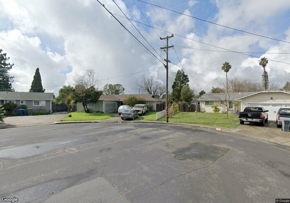
520 Anson Ct Rohnert Park, CA 94928
Estimated Value: $662,000 - $814,000
4
Beds
2
Baths
1,300
Sq Ft
$551/Sq Ft
Est. Value
About This Home
This home is located at 520 Anson Ct, Rohnert Park, CA 94928 and is currently estimated at $715,934, approximately $550 per square foot. 520 Anson Ct is a home located in Sonoma County with nearby schools including Rancho Cotate High School, Cross & Crown Lutheran School, and Bridghaven.
Ownership History
Date
Name
Owned For
Owner Type
Purchase Details
Closed on
Feb 19, 2022
Sold by
Snyder Randy H and Snyder Nora H
Bought by
Randy Snyder And Nora H Snyder Revocable
Current Estimated Value
Purchase Details
Closed on
Aug 14, 1998
Sold by
Snyder Randy S and Snyder Nora H
Bought by
Snyder Randy S and Snyder Nora H
Home Financials for this Owner
Home Financials are based on the most recent Mortgage that was taken out on this home.
Original Mortgage
$98,700
Interest Rate
6.91%
Purchase Details
Closed on
Nov 29, 1989
Bought by
Snyder Randy S and Snyder Nora H
Create a Home Valuation Report for This Property
The Home Valuation Report is an in-depth analysis detailing your home's value as well as a comparison with similar homes in the area
Home Values in the Area
Average Home Value in this Area
Purchase History
| Date | Buyer | Sale Price | Title Company |
|---|---|---|---|
| Randy Snyder And Nora H Snyder Revocable | -- | None Listed On Document | |
| Snyder Randy | -- | None Listed On Document | |
| Snyder Randy S | $94,000 | North Bay Title Co | |
| Snyder Randy S | $150,000 | -- |
Source: Public Records
Mortgage History
| Date | Status | Borrower | Loan Amount |
|---|---|---|---|
| Previous Owner | Snyder Randy S | $98,700 |
Source: Public Records
Tax History Compared to Growth
Tax History
| Year | Tax Paid | Tax Assessment Tax Assessment Total Assessment is a certain percentage of the fair market value that is determined by local assessors to be the total taxable value of land and additions on the property. | Land | Improvement |
|---|---|---|---|---|
| 2025 | $3,142 | $275,941 | $110,373 | $165,568 |
| 2024 | $3,142 | $270,531 | $108,209 | $162,322 |
| 2023 | $3,142 | $265,228 | $106,088 | $159,140 |
| 2022 | $3,078 | $260,028 | $104,008 | $156,020 |
| 2021 | $3,051 | $254,930 | $101,969 | $152,961 |
| 2020 | $3,093 | $252,317 | $100,924 | $151,393 |
| 2019 | $3,052 | $247,371 | $98,946 | $148,425 |
| 2018 | $2,993 | $242,521 | $97,006 | $145,515 |
| 2017 | $2,941 | $237,766 | $95,104 | $142,662 |
| 2016 | $2,815 | $233,105 | $93,240 | $139,865 |
| 2015 | $2,746 | $229,605 | $91,840 | $137,765 |
| 2014 | $2,725 | $225,108 | $90,041 | $135,067 |
Source: Public Records
Map
Nearby Homes
- 530 Anson Ct
- 566 Santa Alicia Dr
- 478 Santa Alicia Dr
- 7301 Willlowglen Dr
- 7316 Willowglen Dr
- 77 Walnut Cir
- 138 Walnut Cir
- 746 Bernadette Ave
- 229 Arlen Dr
- 950 Santa Alicia Dr
- 7530 Bernice Ave
- 211 Apple Ln
- 6440 Country Club Dr
- 21 Avram Ave
- 11 Avram Ave
- 7449 Adrian Dr
- 6469 Meadow Pines Ave
- 928 Civic Center Dr
- 219 College View Dr
- 1022 Civic Center Dr Unit 33
