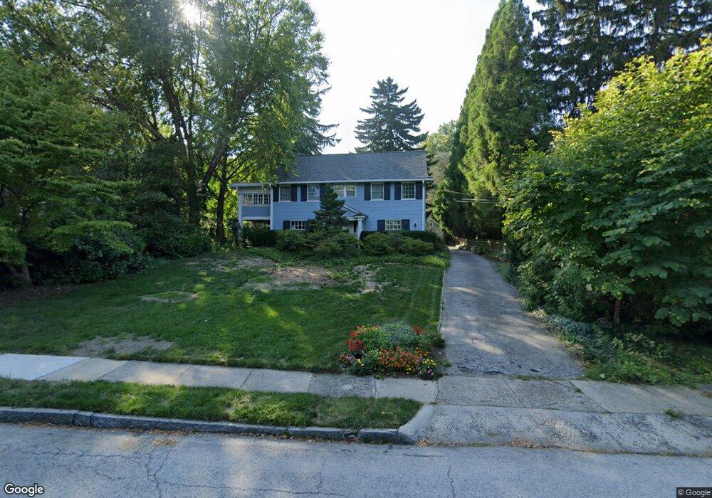
520 Cedar Ln Swarthmore, PA 19081
Estimated Value: $767,757 - $880,000
4
Beds
3
Baths
2,414
Sq Ft
$343/Sq Ft
Est. Value
About This Home
This home is located at 520 Cedar Ln, Swarthmore, PA 19081 and is currently estimated at $828,939, approximately $343 per square foot. 520 Cedar Ln is a home located in Delaware County with nearby schools including Swarthmore-Rutledge School, Strath Haven Middle School, and Strath Haven High School.
Ownership History
Date
Name
Owned For
Owner Type
Purchase Details
Closed on
Nov 13, 1995
Sold by
Young Ralph G and Young Lillian B
Bought by
Meloy Michael M and Meloy Lise Potter
Current Estimated Value
Home Financials for this Owner
Home Financials are based on the most recent Mortgage that was taken out on this home.
Original Mortgage
$268,000
Outstanding Balance
$3,702
Interest Rate
7.47%
Mortgage Type
Purchase Money Mortgage
Estimated Equity
$825,237
Purchase Details
Closed on
Apr 5, 1994
Sold by
Young Ralph G and Young Lillian B
Bought by
Young Ralph G and Young Lillian B
Create a Home Valuation Report for This Property
The Home Valuation Report is an in-depth analysis detailing your home's value as well as a comparison with similar homes in the area
Home Values in the Area
Average Home Value in this Area
Purchase History
| Date | Buyer | Sale Price | Title Company |
|---|---|---|---|
| Meloy Michael M | $335,000 | -- | |
| Young Ralph G | -- | -- |
Source: Public Records
Mortgage History
| Date | Status | Borrower | Loan Amount |
|---|---|---|---|
| Open | Meloy Michael M | $268,000 |
Source: Public Records
Tax History Compared to Growth
Tax History
| Year | Tax Paid | Tax Assessment Tax Assessment Total Assessment is a certain percentage of the fair market value that is determined by local assessors to be the total taxable value of land and additions on the property. | Land | Improvement |
|---|---|---|---|---|
| 2025 | $11,946 | $331,490 | $163,610 | $167,880 |
| 2024 | $11,946 | $331,490 | $163,610 | $167,880 |
| 2023 | $11,483 | $331,490 | $163,610 | $167,880 |
| 2022 | $11,179 | $331,490 | $163,610 | $167,880 |
| 2021 | $18,207 | $331,490 | $163,610 | $167,880 |
| 2020 | $16,202 | $277,710 | $121,990 | $155,720 |
| 2019 | $15,794 | $277,710 | $121,990 | $155,720 |
| 2018 | $15,533 | $277,710 | $0 | $0 |
| 2017 | $15,184 | $277,710 | $0 | $0 |
| 2016 | $1,524 | $277,710 | $0 | $0 |
| 2015 | $1,524 | $277,710 | $0 | $0 |
| 2014 | $1,524 | $277,710 | $0 | $0 |
Source: Public Records
Map
Nearby Homes
- 519 Walnut Ln Unit 1
- 606 Ogden Ave
- 651 N Chester Rd
- 1521 Snead Green Unit Z194
- 1366 Nicklaus Dr Unit O125
- 1433 Country Club Dr Unit T214
- 110 Park Ave Unit 370
- 110 Park Ave Unit 350
- 110 Park Ave Unit 250
- 110 Park Ave Unit 320
- 110 Park Ave Unit 440
- 110 Park Ave Unit 460
- 110 Park Ave Unit 430
- 110 Park Ave Unit 210
- 110 Park Ave Unit 340
- 411 Marie Dr
- 838 Springhaven Rd
- 945 Church Rd
- 719 Pine Ridge Rd
- 630 Yale Ave