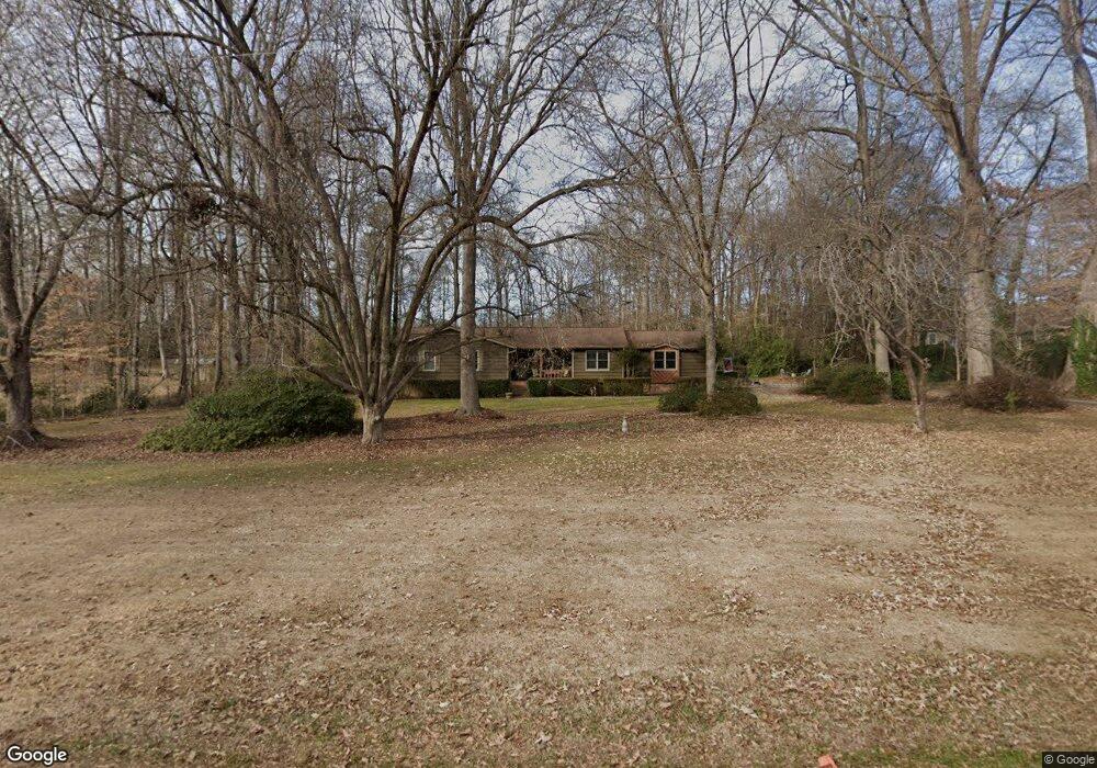
520 Independence Dr Roebuck, SC 29376
Estimated Value: $276,000 - $386,000
3
Beds
2
Baths
2,146
Sq Ft
$152/Sq Ft
Est. Value
About This Home
This home is located at 520 Independence Dr, Roebuck, SC 29376 and is currently estimated at $326,419, approximately $152 per square foot. 520 Independence Dr is a home located in Spartanburg County with nearby schools including Dorman High School Freshman Campus and Dorman High School.
Ownership History
Date
Name
Owned For
Owner Type
Purchase Details
Closed on
Mar 24, 2025
Sold by
Huckeba Patricia S
Bought by
Patricia S Huckeba Revocable Trust and Huckeba
Current Estimated Value
Purchase Details
Closed on
Jun 4, 2007
Sold by
Huckeba Dante L and Huckeba Jeffrey
Bought by
Huckeba Dante L and Huckeba Patricia S
Purchase Details
Closed on
Mar 1, 2004
Sold by
Huckeba Thelma C
Bought by
Huckeba Thelma Christine
Create a Home Valuation Report for This Property
The Home Valuation Report is an in-depth analysis detailing your home's value as well as a comparison with similar homes in the area
Home Values in the Area
Average Home Value in this Area
Purchase History
| Date | Buyer | Sale Price | Title Company |
|---|---|---|---|
| Patricia S Huckeba Revocable Trust | -- | None Listed On Document | |
| Huckeba Dante L | $51,976 | None Available | |
| Huckeba Thelma Christine | -- | -- |
Source: Public Records
Tax History Compared to Growth
Tax History
| Year | Tax Paid | Tax Assessment Tax Assessment Total Assessment is a certain percentage of the fair market value that is determined by local assessors to be the total taxable value of land and additions on the property. | Land | Improvement |
|---|---|---|---|---|
| 2025 | $1,054 | $7,432 | $1,187 | $6,245 |
| 2024 | $1,054 | $7,432 | $1,187 | $6,245 |
| 2023 | $1,054 | $7,432 | $1,187 | $6,245 |
| 2022 | $899 | $6,463 | $1,095 | $5,368 |
| 2021 | $889 | $6,463 | $1,095 | $5,368 |
| 2020 | $866 | $6,463 | $1,095 | $5,368 |
| 2019 | $844 | $6,463 | $1,095 | $5,368 |
| 2018 | $1,201 | $6,463 | $1,095 | $5,368 |
| 2017 | $1,038 | $5,620 | $1,000 | $4,620 |
| 2016 | $1,062 | $5,620 | $1,000 | $4,620 |
| 2015 | $1,039 | $5,620 | $1,000 | $4,620 |
| 2014 | $1,006 | $5,620 | $1,000 | $4,620 |
Source: Public Records
Map
Nearby Homes
- 365 Guernsey Ln
- 0 Independence Ct
- 129 John Lancaster Rd
- 583 Chattooga Rd
- 635 Mcabee Rd
- 707 Tallulah Ct
- 409 Balfour Rd
- 511 Chattooga Rd
- 387 Congaree Rd
- 408 Congaree Rd
- 0 Stone Station Rd
- 118 Myrna Dr
- 120 State Road S-42-9962
- 221 Brookfield Rd
- 310 Templeton Dr
- 0000 U S 221 Hwy N
- 792 Old Canaan Rd
- 260 Eastbrook Terrace
- 375 N Timm Creek Ave
- 5133 U S 221 Hwy N
- 510 Independence Dr
- 530 Independence Dr
- 519 Independence Dr
- 155 State Road S-42-2908
- 155 Guernsey Ln
- 175 Guernsey Ln
- 500 Independence Dr
- 509 Independence Dr
- 540 Independence Dr
- 135 Guernsey Ln
- 205 Guernsey Ln
- 480 Independence Dr
- 565 Independence Dr
- 125 Guernsey Ln
- 550 Independence Dr
- 225 Guernsey Ln
- 170 Freedom Trail
- 470 Independence Dr
- 560 Independence Dr
- 115 Guernsey Ln