Estimated Value: $171,000 - $201,000
2
Beds
2
Baths
1,290
Sq Ft
$144/Sq Ft
Est. Value
About This Home
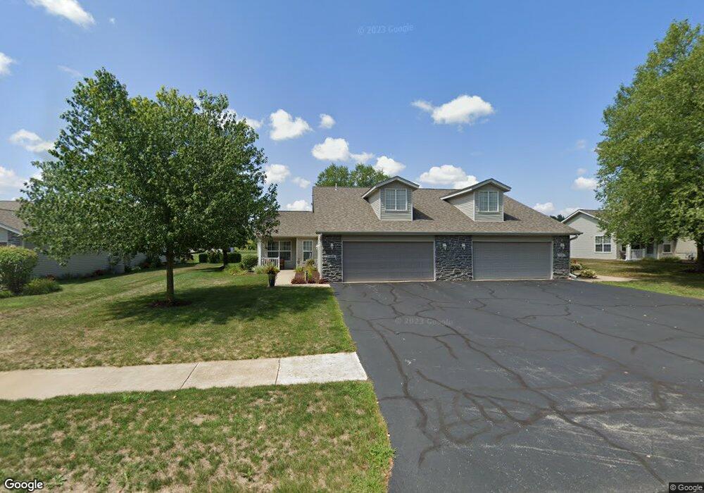
This home is located at 520 Mill Ridge Dr, Byron, IL 61010 and is currently estimated at $185,519, approximately $143 per square foot. 520 Mill Ridge Dr is a home located in Ogle County with nearby schools including Mary Morgan Elementary School, Byron Middle School, and Byron High School.
Ownership History
Date
Name
Owned For
Owner Type
Purchase Details
Closed on
Sep 19, 2012
Sold by
Garnhart Stevia C and Bennett Stevia C
Bought by
Bennett Thomas D and Bennett Stevia C
Current Estimated Value
Purchase Details
Closed on
Aug 29, 2008
Sold by
Robertson Marta J
Bought by
Garnhart Stevia C and Zdeb Barbara Correnti
Home Financials for this Owner
Home Financials are based on the most recent Mortgage that was taken out on this home.
Original Mortgage
$72,000
Outstanding Balance
$48,210
Interest Rate
6.66%
Mortgage Type
New Conventional
Estimated Equity
$137,309
Purchase Details
Closed on
Aug 3, 2006
Sold by
Wilken Terry L and Wilken Troy
Bought by
Robertson Marta J
Home Financials for this Owner
Home Financials are based on the most recent Mortgage that was taken out on this home.
Original Mortgage
$1,100,000
Interest Rate
6.82%
Mortgage Type
New Conventional
Create a Home Valuation Report for This Property
The Home Valuation Report is an in-depth analysis detailing your home's value as well as a comparison with similar homes in the area
Home Values in the Area
Average Home Value in this Area
Purchase History
| Date | Buyer | Sale Price | Title Company |
|---|---|---|---|
| Bennett Thomas D | -- | None Available | |
| Garnhart Stevia C | $125,700 | None Available | |
| Robertson Marta J | $114,000 | None Available |
Source: Public Records
Mortgage History
| Date | Status | Borrower | Loan Amount |
|---|---|---|---|
| Open | Garnhart Stevia C | $72,000 | |
| Previous Owner | Robertson Marta J | $1,100,000 |
Source: Public Records
Tax History Compared to Growth
Tax History
| Year | Tax Paid | Tax Assessment Tax Assessment Total Assessment is a certain percentage of the fair market value that is determined by local assessors to be the total taxable value of land and additions on the property. | Land | Improvement |
|---|---|---|---|---|
| 2024 | $3,264 | $48,994 | $7,058 | $41,936 |
| 2023 | $3,000 | $46,577 | $6,710 | $39,867 |
| 2022 | $2,761 | $43,195 | $6,223 | $36,972 |
| 2021 | $2,680 | $41,350 | $5,957 | $35,393 |
| 2020 | $2,454 | $40,539 | $5,840 | $34,699 |
| 2019 | $2,433 | $39,263 | $5,656 | $33,607 |
| 2018 | $2,409 | $38,249 | $5,510 | $32,739 |
| 2017 | $2,383 | $38,249 | $5,510 | $32,739 |
| 2016 | $2,224 | $37,547 | $5,409 | $32,138 |
| 2015 | $2,090 | $36,347 | $5,236 | $31,111 |
| 2014 | $2,476 | $36,347 | $5,236 | $31,111 |
| 2013 | $2,568 | $36,814 | $5,303 | $31,511 |
Source: Public Records
Map
Nearby Homes
- 309 Creekside Dr
- 265 Creekside Dr
- 247 Creekside Dr
- 153 Perene Ave
- 815 Hampton Dr
- 8752 Rainier Ct
- 2048 Southfield Ln
- 8890 Hales Corner Rd Rd
- 1245 Glacier Dr
- 1257 Glacier Dr
- 211 S Lafayette St
- 3775 E Whippoorwill Ln
- 8638 N Finch Ln
- 1126 Old Hunter Run
- 8692 Glacier Dr
- 225 E 4th St
- 311 E Front St
- 628-630 Allison Cir
- 00 E Ashelford Dr Unit LOT 8
- 00 E Ashelford Dr
- 510 Mill Ridge Dr
- 527 Mill Ridge Dr Unit 74
- 509 Mill Ridge Dr
- 489 Mill Ridge Dr
- 463 Creekside Dr
- 509 Mill Ridge Dr(6l)
- 440 Mill Ridge Dr Unit 7
- 523 Mill Ridge Dr
- 525 Mill Ridge Dr
- 503 Mill Ridge Dr
- 525 Mill Ridge Dr
- 503 Mill Ridge Dr Unit 79
- 523 Mill Ridge Dr
- 500 Mill Ridge Dr
- 460 Mill Ridge Dr
- 463 Mill Ridge Dr
- 525 Mill Ridge Dr
- 467 Creekside Dr
- 443 Creekside Dr
- 407 Mill Ridge Dr