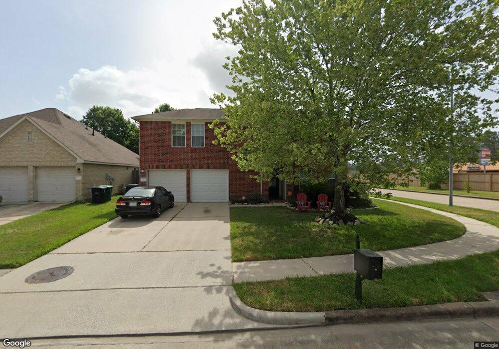
5202 Ubuntu Ct Houston, TX 77091
Acres Homes NeighborhoodEstimated Value: $328,853 - $467,000
3
Beds
3
Baths
2,041
Sq Ft
$194/Sq Ft
Est. Value
About This Home
This home is located at 5202 Ubuntu Ct, Houston, TX 77091 and is currently estimated at $396,713, approximately $194 per square foot. 5202 Ubuntu Ct is a home located in Harris County with nearby schools including Highland Heights Elementary School, Williams Middle, and Booker T Washington Sr High.
Ownership History
Date
Name
Owned For
Owner Type
Purchase Details
Closed on
Jan 9, 2012
Sold by
Powell Ernest
Bought by
Powell Natalie
Current Estimated Value
Purchase Details
Closed on
Jul 30, 2002
Sold by
Mhi Partnership Ltd
Bought by
Powell Ernest W and Powell Natalie
Home Financials for this Owner
Home Financials are based on the most recent Mortgage that was taken out on this home.
Original Mortgage
$135,654
Interest Rate
6.62%
Mortgage Type
FHA
Create a Home Valuation Report for This Property
The Home Valuation Report is an in-depth analysis detailing your home's value as well as a comparison with similar homes in the area
Home Values in the Area
Average Home Value in this Area
Purchase History
| Date | Buyer | Sale Price | Title Company |
|---|---|---|---|
| Powell Natalie | -- | None Available | |
| Powell Ernest W | -- | Millennium Title |
Source: Public Records
Mortgage History
| Date | Status | Borrower | Loan Amount |
|---|---|---|---|
| Previous Owner | Powell Ernest W | $135,654 |
Source: Public Records
Tax History Compared to Growth
Tax History
| Year | Tax Paid | Tax Assessment Tax Assessment Total Assessment is a certain percentage of the fair market value that is determined by local assessors to be the total taxable value of land and additions on the property. | Land | Improvement |
|---|---|---|---|---|
| 2025 | $184 | $321,341 | $86,711 | $234,630 |
| 2024 | $184 | $321,341 | $86,711 | $234,630 |
| 2023 | $184 | $321,341 | $86,711 | $234,630 |
| 2022 | $5,849 | $265,628 | $54,596 | $211,032 |
| 2021 | $6,191 | $265,628 | $54,596 | $211,032 |
| 2020 | $6,395 | $264,095 | $54,596 | $209,499 |
| 2019 | $6,413 | $253,424 | $54,596 | $198,828 |
| 2018 | $1,900 | $253,424 | $54,596 | $198,828 |
| 2017 | $6,408 | $253,424 | $54,596 | $198,828 |
| 2016 | $6,119 | $246,477 | $54,596 | $191,881 |
| 2015 | $1,989 | $231,742 | $38,538 | $193,204 |
| 2014 | $1,989 | $200,000 | $38,538 | $161,462 |
Source: Public Records
Map
Nearby Homes
- 1151 Creekmont Dr
- 1118 Del Norte St
- 1123 Cottage Oak Ln
- 1119 Cottage Oak Ln
- 1161 Eden Park Ln
- 5106 Prosperity Cir
- 5123 Redemption Cir
- 1103 W Donovan St
- 1130 Bethlehem St
- 1119 Marcella St
- 3333 Creekmont Dr
- 1650 Plan B at Commons at Ella Forest
- 2153 Plan C at Commons at Ella Forest
- 1825 Plan A at Commons at Ella Forest
- 1218 Lehman St
- 3807 Pinemont Dr
- 1230 W Donovan St
- 5506B Wheatley St
- 5506D Wheatley St
- 5506E Wheatley St
- 5206 Ubuntu Ct
- 5203 Jericho Ct
- 5210 Ubuntu Ct
- 5207 Jericho Ct
- 5203 Ubuntu Ct
- 5214 Ubuntu Ct
- 5207 Ubuntu Ct
- 5211 Ubuntu Ct
- 5215 Jericho Ct
- 5218 Ubuntu Ct
- 5215 Ubuntu Ct
- 5219 Jericho Ct
- 5202 Four Rivers Ct
- 5202 Jericho Ct
- 5206 Four Rivers Ct
- 5206 Jericho Ct
- 5219 Ubuntu Ct
- 5210 Four Rivers Ct
- 5210 Jericho Ct
- 5214 Four Rivers Ct