Estimated Value: $309,107 - $435,000
3
Beds
3
Baths
2,196
Sq Ft
$159/Sq Ft
Est. Value
About This Home
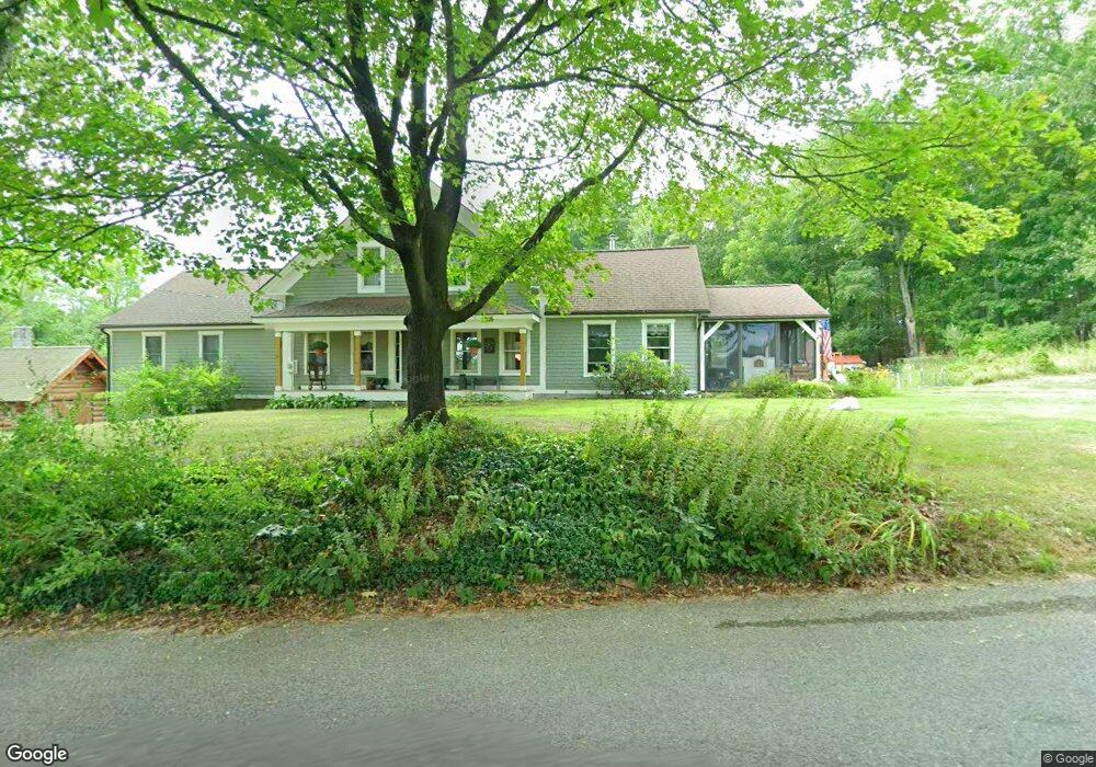
This home is located at 521 Townsend Rd, Mason, NH 03048 and is currently estimated at $350,027, approximately $159 per square foot. 521 Townsend Rd is a home located in Hillsborough County.
Ownership History
Date
Name
Owned For
Owner Type
Purchase Details
Closed on
Jul 10, 2025
Sold by
Broadbent Alfred J Est and Broadbent
Bought by
Garside Philip and Garside Rebecca
Current Estimated Value
Purchase Details
Closed on
Mar 9, 2016
Sold by
Garside Philip M and Garside Rebecca F
Bought by
Garside Ret and Garside
Purchase Details
Closed on
Jul 28, 2014
Sold by
Sheldon Kathleen A
Bought by
Garside Philip M and Garside Rebecca F
Purchase Details
Closed on
Oct 18, 2004
Sold by
Casey Kevin V E and Casey Sally Marydale
Bought by
Sheldon Kathleen A
Home Financials for this Owner
Home Financials are based on the most recent Mortgage that was taken out on this home.
Original Mortgage
$300,000
Interest Rate
5.8%
Mortgage Type
Purchase Money Mortgage
Create a Home Valuation Report for This Property
The Home Valuation Report is an in-depth analysis detailing your home's value as well as a comparison with similar homes in the area
Home Values in the Area
Average Home Value in this Area
Purchase History
| Date | Buyer | Sale Price | Title Company |
|---|---|---|---|
| Garside Philip | $310,000 | -- | |
| Garside Philip | $310,000 | -- | |
| Garside Ret | -- | -- | |
| Garside Ret | -- | -- | |
| Garside Philip M | $319,000 | -- | |
| Garside Philip M | $319,000 | -- | |
| Sheldon Kathleen A | $380,000 | -- | |
| Sheldon Kathleen A | $380,000 | -- |
Source: Public Records
Mortgage History
| Date | Status | Borrower | Loan Amount |
|---|---|---|---|
| Previous Owner | Sheldon Kathleen A | $278,000 | |
| Previous Owner | Sheldon Kathleen A | $300,000 | |
| Closed | Sheldon Kathleen A | $0 |
Source: Public Records
Tax History Compared to Growth
Tax History
| Year | Tax Paid | Tax Assessment Tax Assessment Total Assessment is a certain percentage of the fair market value that is determined by local assessors to be the total taxable value of land and additions on the property. | Land | Improvement |
|---|---|---|---|---|
| 2024 | $9,303 | $364,109 | $102,109 | $262,000 |
| 2023 | $8,448 | $356,149 | $102,449 | $253,700 |
| 2022 | $7,241 | $356,149 | $102,449 | $253,700 |
| 2021 | $7,067 | $356,219 | $102,519 | $253,700 |
| 2020 | $7,673 | $284,075 | $77,675 | $206,400 |
| 2019 | $7,454 | $284,075 | $77,675 | $206,400 |
| 2018 | $7,153 | $284,075 | $77,675 | $206,400 |
| 2017 | $7,146 | $284,127 | $77,727 | $206,400 |
| 2016 | $7,019 | $278,427 | $77,727 | $200,700 |
| 2015 | $5,923 | $249,078 | $78,678 | $170,400 |
| 2014 | $5,931 | $249,078 | $99,078 | $150,000 |
| 2013 | $6,200 | $249,005 | $99,005 | $150,000 |
Source: Public Records
Map
Nearby Homes
- 1275 Valley Rd
- 1235 Townsend Rd
- 137 Cascade Rd
- 75 Merriam Hill Rd
- 183 New Hillcrest Dr
- 9 Winterberry Rd
- 7 Winterberry Rd
- 87 Laurel Dr
- 18 Bridle Path
- 1-65-C Barrett Rd
- 11 Fox Run
- 53 W Meadow Rd
- 0 Davis Rd
- 38 Countryside Dr
- 74 Wright Rd
- 602 Fitchburg Rd Unit lot 19
- 104 N Mason Rd
- 0 Brookline St
- 15 N End Rd
- 364 Townsend Hill Rd
- 516 Townsend Rd
- 499 Townsend Rd
- 560 Townsend Rd
- 475 Townsend Rd
- 466 Townsend Rd
- 442 Townsend Rd
- 587 Townsend Rd
- L-37-1 Townsend Rd
- 575 Jackson Rd
- 623 Townsend Rd
- 78 Briggs Rd
- 576 Jackson Rd
- 497 Jackson Rd
- 61 Briggs Rd
- 106 Briggs Rd
- 504 Jackson Rd
- 647 Townsend Rd
- 103 Briggs Rd
- 126 Briggs Rd
- 437 Jackson Rd