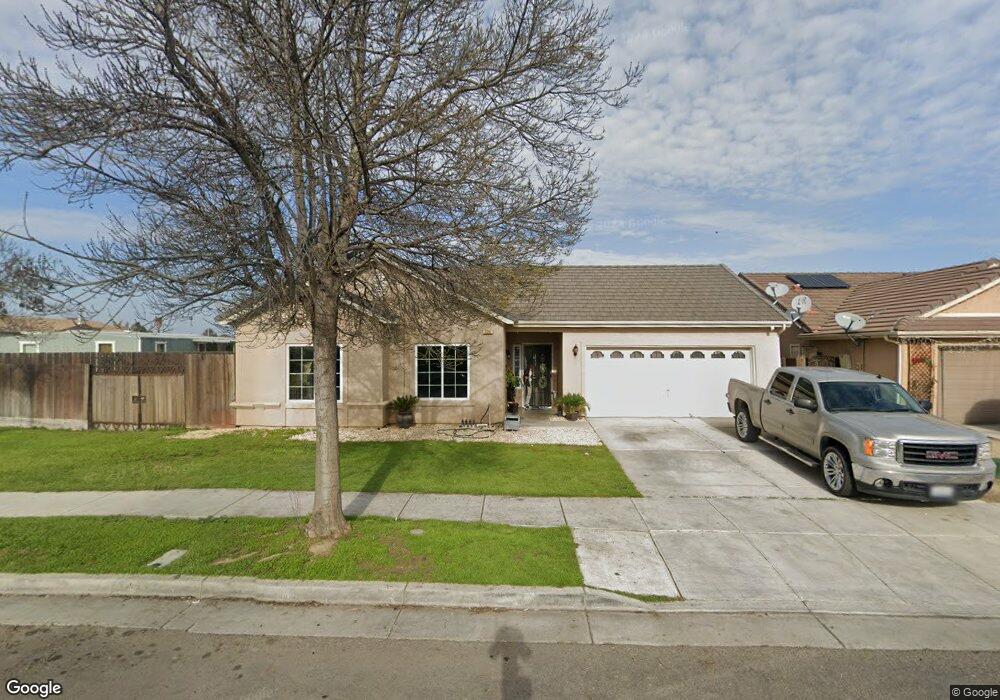
522 Rockport Dr Los Banos, CA 93635
Estimated Value: $343,000 - $392,000
3
Beds
2
Baths
1,070
Sq Ft
$344/Sq Ft
Est. Value
About This Home
This home is located at 522 Rockport Dr, Los Banos, CA 93635 and is currently estimated at $368,193, approximately $344 per square foot. 522 Rockport Dr is a home located in Merced County with nearby schools including R.M. Miano Elementary School, Los Banos Junior High School, and Pacheco High School.
Ownership History
Date
Name
Owned For
Owner Type
Purchase Details
Closed on
Jun 3, 2013
Sold by
Huang Jinsong
Bought by
The Huang Family Trust
Current Estimated Value
Purchase Details
Closed on
Sep 11, 2009
Sold by
Zaragoza Jose A and Zaragoza Martha R
Bought by
Huang Jinsong
Purchase Details
Closed on
Dec 27, 2005
Sold by
Regency Park Estates 1-4 Llc
Bought by
Zaragoza Jose A and Zaragoza Martha F
Home Financials for this Owner
Home Financials are based on the most recent Mortgage that was taken out on this home.
Original Mortgage
$247,100
Interest Rate
7%
Mortgage Type
Fannie Mae Freddie Mac
Create a Home Valuation Report for This Property
The Home Valuation Report is an in-depth analysis detailing your home's value as well as a comparison with similar homes in the area
Home Values in the Area
Average Home Value in this Area
Purchase History
| Date | Buyer | Sale Price | Title Company |
|---|---|---|---|
| The Huang Family Trust | -- | None Available | |
| Huang Jinsong | $80,000 | Transcounty Title Company | |
| Zaragoza Jose A | $309,000 | Fidelity Title Company |
Source: Public Records
Mortgage History
| Date | Status | Borrower | Loan Amount |
|---|---|---|---|
| Previous Owner | Zaragoza Jose A | $247,100 |
Source: Public Records
Tax History Compared to Growth
Tax History
| Year | Tax Paid | Tax Assessment Tax Assessment Total Assessment is a certain percentage of the fair market value that is determined by local assessors to be the total taxable value of land and additions on the property. | Land | Improvement |
|---|---|---|---|---|
| 2025 | $2,038 | $103,249 | $32,263 | $70,986 |
| 2024 | $2,038 | $101,226 | $31,631 | $69,595 |
| 2023 | $1,926 | $99,242 | $31,011 | $68,231 |
| 2022 | $1,865 | $97,297 | $30,403 | $66,894 |
| 2021 | $1,808 | $95,390 | $29,807 | $65,583 |
| 2020 | $1,759 | $94,413 | $29,502 | $64,911 |
| 2019 | $1,716 | $92,563 | $28,924 | $63,639 |
| 2018 | $1,661 | $90,749 | $28,357 | $62,392 |
| 2017 | $1,610 | $88,970 | $27,801 | $61,169 |
| 2016 | $1,587 | $87,226 | $27,256 | $59,970 |
| 2015 | $1,535 | $85,917 | $26,847 | $59,070 |
| 2014 | $1,479 | $84,235 | $26,322 | $57,913 |
Source: Public Records
Map
Nearby Homes
- 436 N Mercey Springs Rd Unit 69
- 436 N Mercey Springs Rd Unit 16
- 436 N Mercey Springs Rd Unit 93
- 436 N Mercey Springs Rd Unit 154
- 418 Rockport Dr
- 1447 Nottingham Cir
- 510 Stonehaven Dr
- 343 San Bernardino St
- 448 Barrett Ln
- 432 Barrett Ln
- The Argent Plan at Southpointe
- The Florencia Plan at Southpointe
- The Stella Plan at Southpointe
- The Santa Cruz Plan at Southpointe
- The Monterey Plan at Southpointe
- The Fasano Plan at Southpointe
- The Caledonia Plan at Southpointe
- The Ashington Plan at Southpointe
- 2054 Casey Ln
- 424 Barrett Ln
- 526 Rockport Dr
- 530 Rockport Dr
- 523 Rockport Dr
- 534 Rockport Dr
- 448 Rockport Dr
- 1404 San Diego St
- 442 Rockport Dr
- 509 Lexington Ave
- 1408 San Diego St
- 429 San Fernando St
- 1429 Wimbledon Ct
- 538 Rockport Dr
- 511 Lexington Ave
- 1425 Wimbledon Ct
- 444 Somerset Ave
- 1412 San Diego St
- 425 San Fernando St
- 513 Lexington Ave
- 439 Somerset Ave
- 438 Somerset Ave