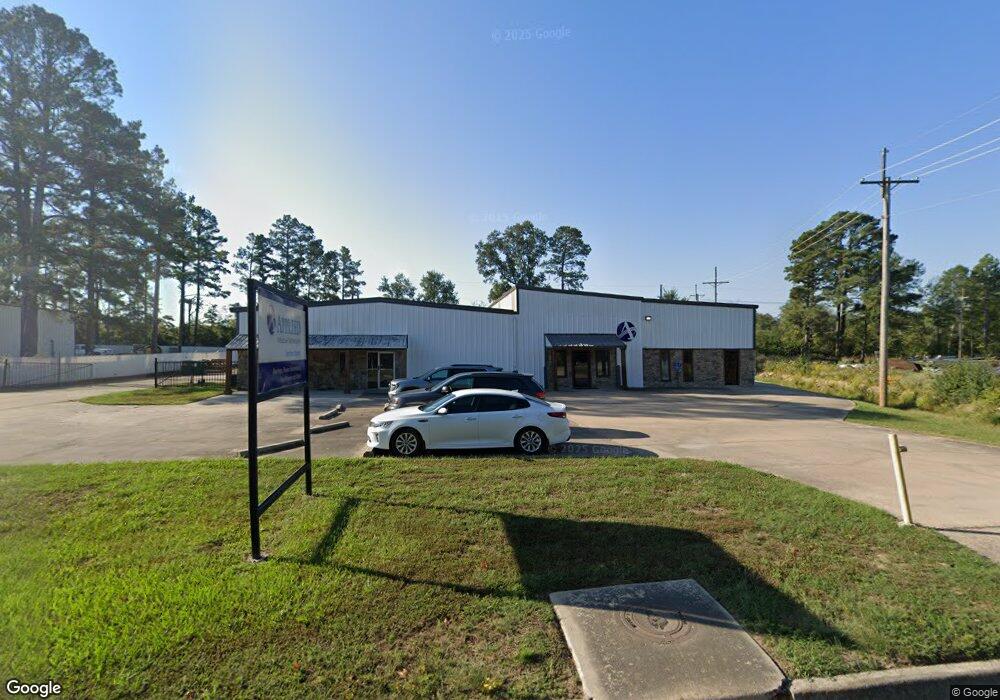
5220 Industrial Dr S White Hall, AR 71602
--
Bed
--
Bath
11,890
Sq Ft
1
Acres
About This Home
This home is located at 5220 Industrial Dr S, White Hall, AR 71602. 5220 Industrial Dr S is a home located in Jefferson County with nearby schools including Matthews Elementary School, Robert F. Morehead Middle School, and Dollarway High School.
Ownership History
Date
Name
Owned For
Owner Type
Purchase Details
Closed on
Sep 14, 2022
Bought by
Sorrells Jimmy Randall
Purchase Details
Closed on
Nov 18, 2003
Bought by
Smith Larry W Trustee
Purchase Details
Closed on
Aug 26, 1997
Bought by
Smith Larry and 5220 Industrial Dr South
Purchase Details
Closed on
Jun 8, 1992
Bought by
Smith Larry
Purchase Details
Closed on
Sep 27, 1978
Bought by
Gammell Don C
Create a Home Valuation Report for This Property
The Home Valuation Report is an in-depth analysis detailing your home's value as well as a comparison with similar homes in the area
Home Values in the Area
Average Home Value in this Area
Purchase History
| Date | Buyer | Sale Price | Title Company |
|---|---|---|---|
| Sorrells Jimmy Randall | $270,000 | -- | |
| Smith Larry W Trustee | -- | -- | |
| Smith Larry | -- | -- | |
| Smith Larry | -- | -- | |
| Gammell Don C | -- | -- |
Source: Public Records
Mortgage History
| Date | Status | Borrower | Loan Amount |
|---|---|---|---|
| Previous Owner | Gammell Don C | $0 |
Source: Public Records
Tax History Compared to Growth
Tax History
| Year | Tax Paid | Tax Assessment Tax Assessment Total Assessment is a certain percentage of the fair market value that is determined by local assessors to be the total taxable value of land and additions on the property. | Land | Improvement |
|---|---|---|---|---|
| 2025 | $2,644 | $39,290 | $7,840 | $31,450 |
| 2024 | $2,644 | $39,290 | $7,840 | $31,450 |
| 2023 | $2,644 | $39,290 | $7,840 | $31,450 |
| 2022 | $1,390 | $23,010 | $8,710 | $14,300 |
| 2021 | $1,390 | $23,010 | $8,710 | $14,300 |
| 2020 | $1,390 | $23,010 | $8,710 | $14,300 |
| 2019 | $1,390 | $23,010 | $8,710 | $14,300 |
| 2018 | $1,390 | $23,010 | $8,710 | $14,300 |
| 2017 | $1,856 | $30,730 | $4,360 | $26,370 |
| 2016 | $1,018 | $17,320 | $4,360 | $12,960 |
| 2015 | $966 | $17,320 | $4,360 | $12,960 |
| 2014 | -- | $17,320 | $4,360 | $12,960 |
Source: Public Records
Map
Nearby Homes
- 5515 Kennedy Ave
- 6102 Dollarway Rd
- 6204 Dollarway Rd
- 2500 N Phillips
- 5501 W Mosley St
- 0000 Jefferson Pkwy
- 1300 N Haley St
- 2305 Betty St
- 5812 Windham Ave
- 00 Sturgis Rd
- 6013 Windham Ave
- 6328 Sheridan Rd
- 5801 W Jones St
- 5811 W Jones St
- 00 Sidney Flipper
- 5301 W Malcomb St Unit 5303
- 6106 W Jones St
- 204 Wildwood Dr
- 1 Westchester Dr
- 6905 White Oak Cove
- 2800 N Hutchinson St
- N Hutchinson St
- 2720 N Hutchinson St
- 2601 N Hutchinson St
- 5401 Smart Ave
- 5413 Smart Ave
- 2705 N Pryce St
- 2618 N Hutchinson St
- 2618 N Hutchinson St Unit 5408 Smart St.
- 5419 Smart Ave
- 5404 Smart Ave
- 5421 Smart Ave
- 0 Smart
- 5408 Smart Ave
- 2600 N Hutchinson St
- 5412 Smart Ave
- 2510 N Hutchinson St
- 5418 Smart Ave
- 5617 Smart Ave
- 2504 N Hutchinson St