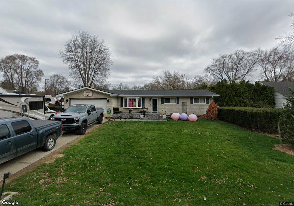
5225 Auburndale Shelby Township, MI 48317
Estimated Value: $273,000 - $346,000
3
Beds
2
Baths
1,550
Sq Ft
$204/Sq Ft
Est. Value
About This Home
This home is located at 5225 Auburndale, Shelby Township, MI 48317 and is currently estimated at $316,719, approximately $204 per square foot. 5225 Auburndale is a home located in Macomb County with nearby schools including Roberts Elementary School, Eppler Junior High School, and Utica High School.
Ownership History
Date
Name
Owned For
Owner Type
Purchase Details
Closed on
Mar 19, 2009
Sold by
Scoggins Steven R and Scoggins Mary Lou
Bought by
Locke Jason S
Current Estimated Value
Home Financials for this Owner
Home Financials are based on the most recent Mortgage that was taken out on this home.
Original Mortgage
$140,719
Interest Rate
4.08%
Mortgage Type
FHA
Purchase Details
Closed on
Mar 17, 2009
Sold by
Scoggins Steven R and Scoggins Mary Lou
Bought by
Locke Jason S
Home Financials for this Owner
Home Financials are based on the most recent Mortgage that was taken out on this home.
Original Mortgage
$140,719
Interest Rate
4.08%
Mortgage Type
FHA
Create a Home Valuation Report for This Property
The Home Valuation Report is an in-depth analysis detailing your home's value as well as a comparison with similar homes in the area
Home Values in the Area
Average Home Value in this Area
Purchase History
| Date | Buyer | Sale Price | Title Company |
|---|---|---|---|
| Locke Jason S | $159,000 | Complete Title Svcs Of South | |
| Locke Jason S | -- | Greater Macomb Title Agency |
Source: Public Records
Mortgage History
| Date | Status | Borrower | Loan Amount |
|---|---|---|---|
| Previous Owner | Locke Jason S | $140,719 |
Source: Public Records
Tax History Compared to Growth
Tax History
| Year | Tax Paid | Tax Assessment Tax Assessment Total Assessment is a certain percentage of the fair market value that is determined by local assessors to be the total taxable value of land and additions on the property. | Land | Improvement |
|---|---|---|---|---|
| 2025 | $2,626 | $175,600 | $0 | $0 |
| 2024 | $1,554 | $152,100 | $0 | $0 |
| 2023 | $1,472 | $141,200 | $0 | $0 |
| 2022 | $2,375 | $130,800 | $0 | $0 |
| 2021 | $2,537 | $126,000 | $0 | $0 |
| 2020 | $1,355 | $122,500 | $0 | $0 |
| 2019 | $2,219 | $106,600 | $0 | $0 |
| 2018 | $2,423 | $105,700 | $0 | $0 |
| 2017 | $2,377 | $96,300 | $22,700 | $73,600 |
| 2016 | $2,652 | $96,300 | $0 | $0 |
| 2015 | $2,240 | $84,450 | $0 | $0 |
| 2012 | -- | $0 | $0 | $0 |
Source: Public Records
Map
Nearby Homes
- 47103 Ladd Ave
- 47414 Winthrop St
- 47425 Jeffry
- 47341 Kennesaw Ridge
- 47565 Frederick Rd
- 6525 Little Turkey Run
- 47595 Frederick Rd
- 5720 Hearst Rd
- 47141 Greenview Rd
- 46955 Shiloh Way
- 48342 Lake Valley Dr
- 47840 Greenview Rd
- 45300 Manor Dr
- 47760 Shelby Rd
- 4899 Green Ct Unit 22
- 4907 Green Ct
- 6936 Ryburn St
- 45277 Universal Ct
- 3733 Christie Ln
- 48212 Cardinal St
- 5205 Auburndale
- 5245 Auburndale
- 0 Auburndale Unit 883918
- 5224 Howe St
- 5204 Howe St
- 5267 Auburndale
- 5185 Auburndale
- 5250 Howe St
- 5224 Auburndale
- 5190 Howe St
- 5260 Howe St
- 5204 Auburndale
- 5244 Auburndale
- 5155 Auburndale
- 5170 Howe St
- 5266 Auburndale
- 5155 Auburndale St
- 5180 Auburndale
- 5296 Howe St
- 5160 Howe St