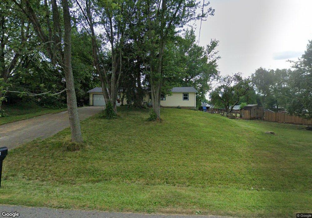
5230 Lesh St Louisville, OH 44641
Estimated Value: $159,301 - $215,000
3
Beds
1
Bath
1,008
Sq Ft
$181/Sq Ft
Est. Value
About This Home
This home is located at 5230 Lesh St, Louisville, OH 44641 and is currently estimated at $182,075, approximately $180 per square foot. 5230 Lesh St is a home located in Stark County with nearby schools including Louisville High School, East Branch Preparatory Academy Wright Preparatory Academy, and Canton Harbor High School.
Ownership History
Date
Name
Owned For
Owner Type
Purchase Details
Closed on
Oct 22, 2014
Sold by
Bray Elaine M and Koehler Elaine M
Bought by
Bray Edward P and Bray Elaine M
Current Estimated Value
Purchase Details
Closed on
Oct 3, 2007
Sold by
Estate Of Anna Lee Koehler
Bought by
Koehler Luther F
Purchase Details
Closed on
Sep 22, 2003
Sold by
Koeler Albert F and Koehler Luther F
Bought by
Koehler Anna L
Create a Home Valuation Report for This Property
The Home Valuation Report is an in-depth analysis detailing your home's value as well as a comparison with similar homes in the area
Home Values in the Area
Average Home Value in this Area
Purchase History
| Date | Buyer | Sale Price | Title Company |
|---|---|---|---|
| Bray Edward P | -- | None Available | |
| Koehler Luther F | -- | Attorney | |
| Koehler Anna L | -- | -- |
Source: Public Records
Tax History Compared to Growth
Tax History
| Year | Tax Paid | Tax Assessment Tax Assessment Total Assessment is a certain percentage of the fair market value that is determined by local assessors to be the total taxable value of land and additions on the property. | Land | Improvement |
|---|---|---|---|---|
| 2025 | -- | $40,150 | $17,500 | $22,650 |
| 2024 | -- | $40,150 | $17,500 | $22,650 |
| 2023 | $1,738 | $35,740 | $14,210 | $21,530 |
| 2022 | $1,744 | $35,740 | $14,210 | $21,530 |
| 2021 | $1,749 | $35,740 | $14,210 | $21,530 |
| 2020 | $1,500 | $32,380 | $12,780 | $19,600 |
| 2019 | $1,506 | $32,380 | $12,780 | $19,600 |
| 2018 | $1,501 | $32,380 | $12,780 | $19,600 |
| 2017 | $1,332 | $27,410 | $9,380 | $18,030 |
| 2016 | $1,302 | $27,410 | $9,380 | $18,030 |
| 2015 | $1,343 | $27,410 | $9,380 | $18,030 |
| 2014 | $1,313 | $25,520 | $8,750 | $16,770 |
| 2013 | $660 | $25,520 | $8,750 | $16,770 |
Source: Public Records
Map
Nearby Homes
- 4465 Eastland Ave NE
- 4481 Broadway Ave NE
- 2975 Mcintosh Dr NE
- 2981 Mcintosh Dr NE
- 2980 Mcintosh Dr NE
- 424 Honeycrisp Dr NE
- 2969 Mcintosh Dr NE
- 2974 Mcintosh Dr NE
- 420 Honeycrisp Dr NE
- Forsythia Plan at Orchard Park - Aspire Single Family Collection
- Goldenrod Plan at Orchard Park - Aspire Single Family Collection
- Water Lily Plan at Orchard Park - Aspire Single Family Collection
- Oleander Plan at Orchard Park - Aspire Single Family Collection
- Beckfield Plan at Orchard Park - Aspire Townhome Collection
- 3894 Tulane Ave
- 414 Honeycrisp Dr NE
- 5208 Oakridge Dr
- 6083 Apple St
- 3951 Glenoak Dr NE
- 4060 Hambleton Ave NE
- 5126 Lesh St
- 5262 Lesh St
- 5262 Lesh St
- 4290 Homeland Ave
- 5274 Lesh St
- 5229 Lesh St
- 4274 Homeland Ave
- 4305 Homeland Ave
- 5292 Lesh St
- 5271 Lesh St
- VL Homeland Ave NE
- 5285 Lesh St
- 5301 Lesh St
- 4285 Homeland Ave
- 5308 Lesh St
- 4256 Homeland Ave
- 5225 Clay St
- 4267 Homeland Ave
- 5251 Clay St
- 99999 Eastland Ave