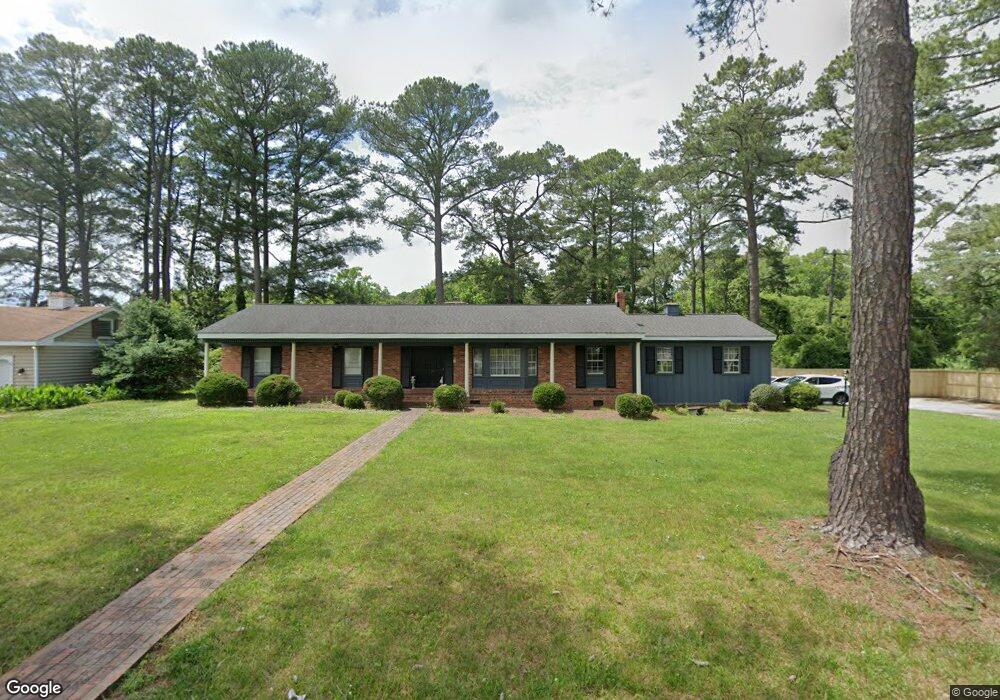
5233 Amherst Dr Portsmouth, VA 23703
Churchland NeighborhoodEstimated Value: $385,000 - $428,000
3
Beds
2
Baths
1,992
Sq Ft
$202/Sq Ft
Est. Value
About This Home
This home is located at 5233 Amherst Dr, Portsmouth, VA 23703 and is currently estimated at $402,111, approximately $201 per square foot. 5233 Amherst Dr is a home located in Portsmouth City with nearby schools including Churchland Elementary School, Churchland Academy Elementary School, and Churchland Middle School.
Ownership History
Date
Name
Owned For
Owner Type
Purchase Details
Closed on
Aug 29, 2024
Sold by
Batista Alexi and Batista Alex
Bought by
Jacobs Morgan Michelle and Aviles Johnny Gil
Current Estimated Value
Home Financials for this Owner
Home Financials are based on the most recent Mortgage that was taken out on this home.
Original Mortgage
$395,491
Outstanding Balance
$390,938
Interest Rate
6.78%
Mortgage Type
VA
Estimated Equity
$11,173
Purchase Details
Closed on
Oct 22, 2020
Sold by
Olsen Richard J
Bought by
Batista Alex
Create a Home Valuation Report for This Property
The Home Valuation Report is an in-depth analysis detailing your home's value as well as a comparison with similar homes in the area
Home Values in the Area
Average Home Value in this Area
Purchase History
| Date | Buyer | Sale Price | Title Company |
|---|---|---|---|
| Jacobs Morgan Michelle | $385,000 | Fortis Title | |
| Batista Alex | $195,000 | Attorney |
Source: Public Records
Mortgage History
| Date | Status | Borrower | Loan Amount |
|---|---|---|---|
| Open | Jacobs Morgan Michelle | $395,491 |
Source: Public Records
Tax History Compared to Growth
Tax History
| Year | Tax Paid | Tax Assessment Tax Assessment Total Assessment is a certain percentage of the fair market value that is determined by local assessors to be the total taxable value of land and additions on the property. | Land | Improvement |
|---|---|---|---|---|
| 2025 | $3,864 | $302,000 | $94,800 | $207,200 |
| 2024 | $3,864 | $300,260 | $94,800 | $205,460 |
| 2023 | $3,903 | $298,520 | $94,800 | $203,720 |
| 2022 | $3,768 | $289,820 | $94,800 | $195,020 |
| 2021 | $2,905 | $223,460 | $45,830 | $177,630 |
| 2020 | $2,718 | $209,100 | $43,650 | $165,450 |
| 2019 | $2,831 | $217,800 | $43,650 | $174,150 |
| 2018 | $2,831 | $217,800 | $43,650 | $174,150 |
| 2017 | $2,831 | $217,800 | $43,650 | $174,150 |
| 2016 | $2,831 | $217,800 | $43,650 | $174,150 |
| 2015 | $2,831 | $217,790 | $43,650 | $174,140 |
| 2014 | $2,766 | $217,790 | $43,650 | $174,140 |
Source: Public Records
Map
Nearby Homes
- 5302 High St W
- 5221 High St W
- 5304 High St W
- 3101 Laurel Ln
- 3205 Clover Hill Dr
- 5220 Clover Hill Dr
- 3233 Clover Hill Dr
- 3432 Carter Rd
- 5111 Sweetbriar Cir
- 3000 Ferguson Dr
- 4011 Reese Dr S
- 3110 Sterling Way Unit 62
- 5006 High St W
- 3425 Cedar Ln
- 3509 Spence Rd
- 3200 Westwood Crescent
- 1047 Christiana Cir Unit 40
- 3315 Camellia Dr
- 3405 Canterbury Dr
- 5516 Bingham Dr
- 5229 Amherst Dr
- 5229 High St W
- 5228 Amherst Dr
- 5225 Amherst Dr
- 5319 High St W
- 5225 High St W
- 5300 High St W
- 5224 Amherst Dr
- 5221 Amherst Dr
- 3200 Clover Hill Dr
- 5217 Amherst Dr
- 3202 Clover Hill Dr
- 3204 Clover Hill Dr
- 3107 Honeysuckle Ln
- 3206 Clover Hill Dr
- 5315 High St W
- 3208 Clover Hill Dr
- 5217 High St W
- 5308 High St W
- 3210 Clover Hill Dr