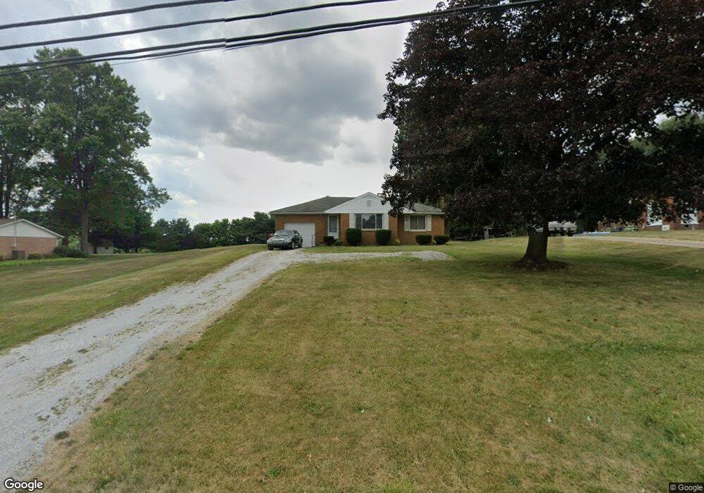
5241 Meese Rd Louisville, OH 44641
Estimated Value: $127,000 - $189,000
2
Beds
1
Bath
974
Sq Ft
$161/Sq Ft
Est. Value
About This Home
This home is located at 5241 Meese Rd, Louisville, OH 44641 and is currently estimated at $156,488, approximately $160 per square foot. 5241 Meese Rd is a home located in Stark County with nearby schools including Louisville High School and St. Thomas Aquinas High School & Middle School.
Ownership History
Date
Name
Owned For
Owner Type
Purchase Details
Closed on
Dec 11, 2023
Sold by
Benson Cynthia I
Bought by
Wheeler Dylan
Current Estimated Value
Home Financials for this Owner
Home Financials are based on the most recent Mortgage that was taken out on this home.
Original Mortgage
$117,170
Outstanding Balance
$115,043
Interest Rate
7.03%
Mortgage Type
New Conventional
Estimated Equity
$41,445
Purchase Details
Closed on
Aug 12, 1994
Sold by
Benson Jack L
Bought by
Lewis Robert J
Create a Home Valuation Report for This Property
The Home Valuation Report is an in-depth analysis detailing your home's value as well as a comparison with similar homes in the area
Home Values in the Area
Average Home Value in this Area
Purchase History
| Date | Buyer | Sale Price | Title Company |
|---|---|---|---|
| Wheeler Dylan | $120,000 | None Listed On Document | |
| Lewis Robert J | $6,500 | -- |
Source: Public Records
Mortgage History
| Date | Status | Borrower | Loan Amount |
|---|---|---|---|
| Open | Wheeler Dylan | $117,170 |
Source: Public Records
Tax History Compared to Growth
Tax History
| Year | Tax Paid | Tax Assessment Tax Assessment Total Assessment is a certain percentage of the fair market value that is determined by local assessors to be the total taxable value of land and additions on the property. | Land | Improvement |
|---|---|---|---|---|
| 2025 | -- | $35,950 | $13,510 | $22,440 |
| 2024 | -- | $35,950 | $13,510 | $22,440 |
| 2023 | $1,107 | $31,930 | $9,560 | $22,370 |
| 2022 | $1,133 | $31,930 | $9,560 | $22,370 |
| 2021 | $1,136 | $31,930 | $9,560 | $22,370 |
| 2020 | $929 | $28,770 | $8,610 | $20,160 |
| 2019 | $933 | $28,770 | $8,610 | $20,160 |
| 2018 | $930 | $28,770 | $8,610 | $20,160 |
| 2017 | $856 | $26,320 | $8,050 | $18,270 |
| 2016 | $837 | $26,320 | $8,050 | $18,270 |
| 2015 | $839 | $26,320 | $8,050 | $18,270 |
| 2014 | $735 | $22,970 | $7,040 | $15,930 |
| 2013 | $371 | $22,970 | $7,040 | $15,930 |
Source: Public Records
Map
Nearby Homes
- 5495 Meese Rd NE
- 2015 E Main St
- 203 Brookfield St
- 6052 N Nickelplate St
- 0 Michigan Blvd
- 1170 Winding Ridge Ave
- 910 Crosswyck Cir
- 1812 E Broad St
- 1715 High St
- 316 E Reno Dr
- 308 Superior St
- 5474 Ravenna Ave
- 325 Lincoln Ave
- 5765 Maplegrove St
- 428 Honeycrisp Dr NE
- 3047 Mcintosh Dr NE
- 432 Honeycrisp Dr NE
- 2962 Mcintosh Dr NE
- 2963 Mcintosh Dr NE
- 430 Honeycrisp Dr NE
- 5261 Meese Rd
- 5199 Meese Rd NE
- 5191 Meese Rd NE
- 5295 Meese Rd
- 5202 Meese Rd
- 5265 Meese Rd NE
- 5270 Meese Rd
- 5190 Meese Rd
- 5345 Meese Rd
- 5340 Meese Rd
- 5432 Meese Rd NE
- 5065 Meese Rd NE
- 5065 Meese Rd NE
- 5056 Meese Rd NE
- 5056 Meese Rd
- 5047 Meese Rd
- 5034 Meese Rd NE
- 5034 Meese Rd
- 5023 Meese Rd
- 8701 Scott St