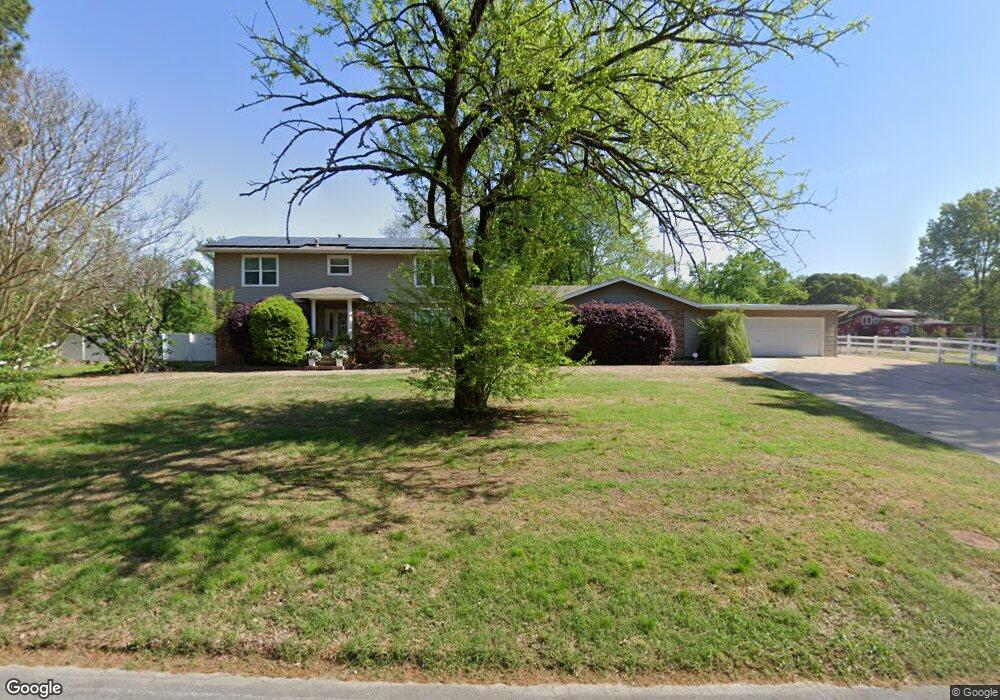
525 E Lee Ave Sherwood, AR 72120
Estimated Value: $281,000 - $508,655
--
Bed
3
Baths
3,396
Sq Ft
$106/Sq Ft
Est. Value
About This Home
This home is located at 525 E Lee Ave, Sherwood, AR 72120 and is currently estimated at $359,218, approximately $105 per square foot. 525 E Lee Ave is a home located in Pulaski County with nearby schools including Sherwood Elementary School, Sylvan Hills Middle School, and Sylvan Hills High School.
Ownership History
Date
Name
Owned For
Owner Type
Purchase Details
Closed on
Nov 30, 2011
Sold by
Osborne Kelly Lynn
Bought by
Osborne Mark Gordon
Current Estimated Value
Purchase Details
Closed on
Nov 8, 2007
Sold by
Osborne Bobby J and Osborne Laurie
Bought by
Osborne Mark G and Osborne Kelley
Purchase Details
Closed on
Jul 31, 2006
Sold by
Osborne Bobby J and Osborne Laurie
Bought by
Osborne Mark G and Osborne Kelly L
Home Financials for this Owner
Home Financials are based on the most recent Mortgage that was taken out on this home.
Original Mortgage
$60,000
Interest Rate
6%
Mortgage Type
Seller Take Back
Create a Home Valuation Report for This Property
The Home Valuation Report is an in-depth analysis detailing your home's value as well as a comparison with similar homes in the area
Home Values in the Area
Average Home Value in this Area
Purchase History
| Date | Buyer | Sale Price | Title Company |
|---|---|---|---|
| Osborne Mark Gordon | -- | None Available | |
| Osborne Mark Gordon | -- | None Available | |
| Osborne Mark Gordon | -- | None Available | |
| Osborne Mark Gordon | -- | None Available | |
| Osborne Mark G | -- | Fidelity Title Services Inc | |
| Osborne Mark G | $160,000 | Fidelity Title Services Inc |
Source: Public Records
Mortgage History
| Date | Status | Borrower | Loan Amount |
|---|---|---|---|
| Previous Owner | Osborne Mark G | $60,000 |
Source: Public Records
Tax History Compared to Growth
Tax History
| Year | Tax Paid | Tax Assessment Tax Assessment Total Assessment is a certain percentage of the fair market value that is determined by local assessors to be the total taxable value of land and additions on the property. | Land | Improvement |
|---|---|---|---|---|
| 2025 | $4,234 | $100,868 | $34,776 | $66,092 |
| 2024 | $3,881 | $100,868 | $34,776 | $66,092 |
| 2023 | $3,881 | $100,868 | $34,776 | $66,092 |
| 2022 | $4,080 | $100,868 | $34,776 | $66,092 |
| 2021 | $3,864 | $70,850 | $20,000 | $50,850 |
| 2020 | $3,348 | $70,850 | $20,000 | $50,850 |
| 2019 | $3,207 | $70,850 | $20,000 | $50,850 |
| 2018 | $3,090 | $70,850 | $20,000 | $50,850 |
| 2017 | $2,949 | $84,870 | $34,020 | $50,850 |
| 2016 | $2,808 | $73,400 | $24,010 | $49,390 |
| 2015 | $3,222 | $63,434 | $24,010 | $39,424 |
| 2014 | $3,222 | $59,094 | $24,010 | $35,084 |
Source: Public Records
Map
Nearby Homes
- 701 Club Rd
- 208 E Kiehl Ave Unit out parcel
- 8320 Holiday Dr
- 135 W Lee Ave
- 00 E Kiehl Ave
- 125 Almond Cove
- 7625 Highway 107
- 8602 Patricia Lynn Ln
- 4636 Brandywine Cove
- 8109 Oak Ridge Rd
- 1109 Brice Rd
- 4690 Hollyridge Cove
- 59 Wesley Dr
- 9125 Woodbine St
- 8000 Pinto Trail
- 11 Daniel Dr
- 2410 Crown Ct
- 9016 Wilhite Ln
- 7605 Toltec Dr
- 6 Ridgewell Ct