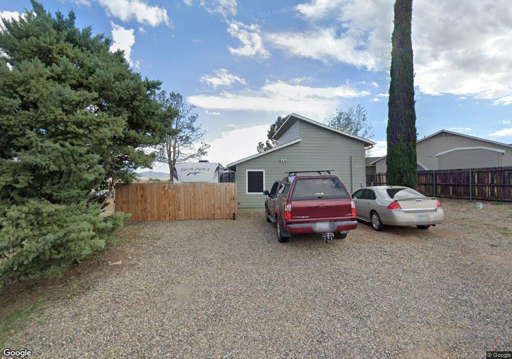
5251 N Lone Dr Prescott Valley, AZ 86314
Estimated Value: $382,507 - $419,000
2
Beds
3
Baths
1,552
Sq Ft
$258/Sq Ft
Est. Value
About This Home
This home is located at 5251 N Lone Dr, Prescott Valley, AZ 86314 and is currently estimated at $400,877, approximately $258 per square foot. 5251 N Lone Dr is a home located in Yavapai County with nearby schools including Coyote Springs Elementary School, Glassford Hill Middle School, and Bradshaw Mountain High School.
Ownership History
Date
Name
Owned For
Owner Type
Purchase Details
Closed on
May 25, 2017
Sold by
Lawrence Lois Fay
Bought by
Strong Susan Kay Lawrence
Current Estimated Value
Purchase Details
Closed on
Oct 11, 2010
Sold by
Fay Lawrence Kenneth L and Fay Lawrence Lois
Bought by
Fay Lawrence Kenneth L and Fay Lawrence Lois
Home Financials for this Owner
Home Financials are based on the most recent Mortgage that was taken out on this home.
Original Mortgage
$60,800
Interest Rate
4.26%
Mortgage Type
New Conventional
Purchase Details
Closed on
Aug 27, 2010
Sold by
The Bank Of New York Mellon
Bought by
Fay Lawrence Kenneth L and Fay Lawrence Lois
Home Financials for this Owner
Home Financials are based on the most recent Mortgage that was taken out on this home.
Original Mortgage
$60,800
Interest Rate
4.26%
Mortgage Type
New Conventional
Purchase Details
Closed on
Dec 17, 2009
Sold by
Vandegrift Neil and Ramos Angeles
Bought by
The Bank Of New York Mellon and The Bank Of New York
Purchase Details
Closed on
Jul 12, 2007
Sold by
Vandegrift Neil and Vandegrift Christena
Bought by
Vandegrift Neil and Vandegrift Christena
Home Financials for this Owner
Home Financials are based on the most recent Mortgage that was taken out on this home.
Original Mortgage
$43,000
Interest Rate
6.62%
Mortgage Type
Stand Alone Second
Purchase Details
Closed on
Jan 6, 2004
Sold by
Vandegrift Neil and Ramos Angeles
Bought by
Vandegrift Neil and Ramos Angeles
Purchase Details
Closed on
Jun 20, 2002
Sold by
Nelson James
Bought by
Vandegrift Neil and Vandegrift Angeles
Home Financials for this Owner
Home Financials are based on the most recent Mortgage that was taken out on this home.
Original Mortgage
$74,700
Interest Rate
7.99%
Purchase Details
Closed on
Dec 23, 1997
Sold by
Kropf Paul and Kropf Crystal
Bought by
Nelson James F
Home Financials for this Owner
Home Financials are based on the most recent Mortgage that was taken out on this home.
Original Mortgage
$70,650
Interest Rate
7.14%
Mortgage Type
Seller Take Back
Create a Home Valuation Report for This Property
The Home Valuation Report is an in-depth analysis detailing your home's value as well as a comparison with similar homes in the area
Home Values in the Area
Average Home Value in this Area
Purchase History
| Date | Buyer | Sale Price | Title Company |
|---|---|---|---|
| Strong Susan Kay Lawrence | -- | None Available | |
| Fay Lawrence Kenneth L | -- | First American Title Prescot | |
| Fay Lawrence Kenneth L | $76,000 | First American Title Prescot | |
| The Bank Of New York Mellon | $68,850 | First American Title Ins | |
| Vandegrift Neil | -- | First American Title Ins Co | |
| Vandegrift Neil | -- | -- | |
| Vandegrift Neil | -- | Capital Title Agency Inc | |
| Nelson James F | $81,000 | Capital Title Agency |
Source: Public Records
Mortgage History
| Date | Status | Borrower | Loan Amount |
|---|---|---|---|
| Previous Owner | Fay Lawrence Kenneth L | $60,800 | |
| Previous Owner | Vandegrift Neil | $43,000 | |
| Previous Owner | Vandegrift Neil | $74,700 | |
| Previous Owner | Nelson James F | $70,650 | |
| Closed | Vandegrift Neil | $18,700 |
Source: Public Records
Tax History Compared to Growth
Tax History
| Year | Tax Paid | Tax Assessment Tax Assessment Total Assessment is a certain percentage of the fair market value that is determined by local assessors to be the total taxable value of land and additions on the property. | Land | Improvement |
|---|---|---|---|---|
| 2026 | $1,266 | $32,011 | -- | -- |
| 2024 | $1,161 | $33,247 | -- | -- |
| 2023 | $1,161 | $27,419 | $0 | $0 |
| 2022 | $1,142 | $22,177 | $2,776 | $19,401 |
| 2021 | $1,193 | $20,495 | $2,745 | $17,750 |
| 2020 | $1,147 | $0 | $0 | $0 |
| 2019 | $1,132 | $0 | $0 | $0 |
| 2018 | $1,077 | $0 | $0 | $0 |
| 2017 | $1,056 | $0 | $0 | $0 |
| 2016 | $1,020 | $0 | $0 | $0 |
| 2015 | -- | $0 | $0 | $0 |
| 2014 | -- | $0 | $0 | $0 |
Source: Public Records
Map
Nearby Homes
- 8790 E Totem Cir
- 5080 N Ranger Rd
- 5344 N Cord Dr
- 5575 E Magpie Dr
- 9101 E Manley Dr
- 5244 N Pinto Dr
- 4767 N Stallion Dr
- 8428 E Manley Dr
- 4870 N Meixner Rd Unit 4
- 5681 N Hondo Dr
- 8800 E Westward Way
- 5290 N Robert Rd
- 4700 N Socorro Dr
- 5088 N Desert Ln
- 4661 N Carla Vista Dr
- 5601 N Robert Rd
- 4895 N Arnold Dr
- 4691 N Glenrosa Cir
- 5035 N Robert Rd
- 4581 N Ranger Rd
- 5241 N Lone Dr
- 5250 N Hondo Dr
- 6040 N Lone Dr
- 6047 N Lone Dr
- 6041 N Lone Dr
- 5476 N Lone Dr
- 5250 N Lone Dr Unit 9
- 5266 N Hondo Cir
- 5250 N Lone Dr
- 5231 N Lone Dr Unit 9
- 5240 N Lone Dr
- 5240 N Lone Dr Unit 9
- 5255 N Hondo Dr Unit 9
- 5240 N Hondo Dr Unit 9
- 5240 N Hondo Dr
- 5261 N Hondo Dr
- 5251 N Hondo Dr
- 5230 N Lone Dr Unit X
- 5230 N Lone Dr
- 5283 N Hondo Cir