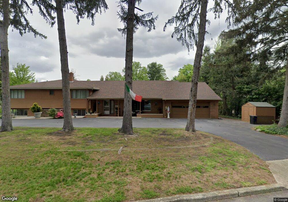
526 E Rugby Place Woodbury, NJ 08096
Estimated Value: $561,000 - $634,000
4
Beds
4
Baths
3,753
Sq Ft
$156/Sq Ft
Est. Value
About This Home
This home is located at 526 E Rugby Place, Woodbury, NJ 08096 and is currently estimated at $584,297, approximately $155 per square foot. 526 E Rugby Place is a home located in Gloucester County with nearby schools including Woodbury Junior/Senior High School and Holy Angels Catholic School.
Ownership History
Date
Name
Owned For
Owner Type
Purchase Details
Closed on
Jun 30, 2011
Sold by
Rauso Gennaro
Bought by
Rugby Estate Llc
Current Estimated Value
Home Financials for this Owner
Home Financials are based on the most recent Mortgage that was taken out on this home.
Original Mortgage
$231,920
Interest Rate
4.81%
Mortgage Type
New Conventional
Purchase Details
Closed on
May 27, 2011
Sold by
Wolfson Benjamin
Bought by
Rauso Gennaro
Home Financials for this Owner
Home Financials are based on the most recent Mortgage that was taken out on this home.
Original Mortgage
$231,920
Interest Rate
4.81%
Mortgage Type
New Conventional
Purchase Details
Closed on
Jan 14, 2000
Sold by
Ozburn Robert N and Ozburn Susan S
Bought by
Wolfson Benjamin and Wolfson Antoinette R
Purchase Details
Closed on
Apr 19, 1996
Sold by
Green Jack B and Green Gloria Lou
Bought by
Ozburn Robert N and Ozburn Susan S
Create a Home Valuation Report for This Property
The Home Valuation Report is an in-depth analysis detailing your home's value as well as a comparison with similar homes in the area
Home Values in the Area
Average Home Value in this Area
Purchase History
| Date | Buyer | Sale Price | Title Company |
|---|---|---|---|
| Rugby Estate Llc | -- | None Available | |
| Rauso Gennaro | $289,900 | Foundation Title Llc | |
| Wolfson Benjamin | $228,000 | Congress Title | |
| Ozburn Robert N | -- | -- |
Source: Public Records
Mortgage History
| Date | Status | Borrower | Loan Amount |
|---|---|---|---|
| Previous Owner | Rauso Gennaro | $231,920 |
Source: Public Records
Tax History Compared to Growth
Tax History
| Year | Tax Paid | Tax Assessment Tax Assessment Total Assessment is a certain percentage of the fair market value that is determined by local assessors to be the total taxable value of land and additions on the property. | Land | Improvement |
|---|---|---|---|---|
| 2025 | $14,933 | $310,400 | $73,400 | $237,000 |
| 2024 | $14,403 | $310,400 | $73,400 | $237,000 |
| 2023 | $14,403 | $310,400 | $73,400 | $237,000 |
| 2022 | $14,148 | $310,400 | $73,400 | $237,000 |
| 2021 | $13,962 | $310,400 | $73,400 | $237,000 |
| 2020 | $14,044 | $284,400 | $85,700 | $198,700 |
| 2019 | $13,572 | $284,400 | $85,700 | $198,700 |
| 2018 | $13,270 | $284,400 | $85,700 | $198,700 |
| 2017 | $13,045 | $284,400 | $85,700 | $198,700 |
| 2016 | $12,863 | $284,400 | $85,700 | $198,700 |
| 2015 | $12,653 | $284,400 | $85,700 | $198,700 |
| 2014 | $12,454 | $284,400 | $85,700 | $198,700 |
Source: Public Records
Map
Nearby Homes
- 31 S Bayard Ave
- 25 N Evergreen Ave
- 10 Lake Dr
- 161 Riggins Blvd
- 38 Pinecrest Dr
- 437 E Barber Ave
- 16 N Maple St Unit A5
- 470 E Barber Ave
- 204 Hunter St
- 433 Trowbridge Ave
- 54 Knollwood Dr
- 53 Knollwood Dr
- 71 Cooper St
- 226 S Maple St
- 82 Hopkins St
- 78 Hopkins St
- 118 Caribou Ct
- 43 Curtis Ave
- 338 E Red Bank Ave
- 89 E Barber Ave