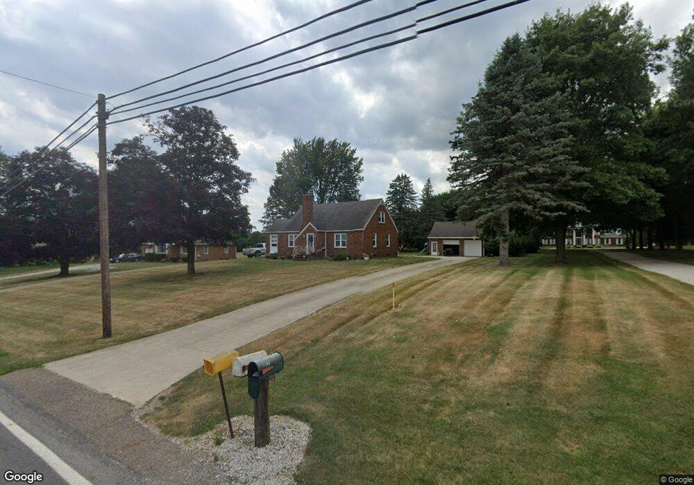
5261 Meese Rd Louisville, OH 44641
Estimated Value: $203,000 - $229,544
3
Beds
1
Bath
1,554
Sq Ft
$139/Sq Ft
Est. Value
About This Home
This home is located at 5261 Meese Rd, Louisville, OH 44641 and is currently estimated at $216,136, approximately $139 per square foot. 5261 Meese Rd is a home located in Stark County with nearby schools including Louisville High School and St. Thomas Aquinas High School & Middle School.
Ownership History
Date
Name
Owned For
Owner Type
Purchase Details
Closed on
Aug 31, 2018
Sold by
Mcdonald Sean M
Bought by
Fitz Raymond R and Fitz Ashlee
Current Estimated Value
Home Financials for this Owner
Home Financials are based on the most recent Mortgage that was taken out on this home.
Original Mortgage
$142,000
Outstanding Balance
$123,577
Interest Rate
4.5%
Mortgage Type
VA
Estimated Equity
$92,559
Purchase Details
Closed on
May 3, 2017
Sold by
Heppner David J and Brien Karen H O
Bought by
Mcdonald Sean M
Home Financials for this Owner
Home Financials are based on the most recent Mortgage that was taken out on this home.
Original Mortgage
$130,202
Interest Rate
4.23%
Mortgage Type
New Conventional
Create a Home Valuation Report for This Property
The Home Valuation Report is an in-depth analysis detailing your home's value as well as a comparison with similar homes in the area
Home Values in the Area
Average Home Value in this Area
Purchase History
| Date | Buyer | Sale Price | Title Company |
|---|---|---|---|
| Fitz Raymond R | $137,500 | None Available | |
| Mcdonald Sean M | $128,900 | None Available |
Source: Public Records
Mortgage History
| Date | Status | Borrower | Loan Amount |
|---|---|---|---|
| Open | Fitz Raymond R | $142,000 | |
| Previous Owner | Mcdonald Sean M | $130,202 |
Source: Public Records
Tax History Compared to Growth
Tax History
| Year | Tax Paid | Tax Assessment Tax Assessment Total Assessment is a certain percentage of the fair market value that is determined by local assessors to be the total taxable value of land and additions on the property. | Land | Improvement |
|---|---|---|---|---|
| 2025 | -- | $69,440 | $16,800 | $52,640 |
| 2024 | -- | $69,440 | $16,800 | $52,640 |
| 2023 | $2,214 | $45,540 | $11,900 | $33,640 |
| 2022 | $1,108 | $45,470 | $11,900 | $33,570 |
| 2021 | $2,223 | $45,470 | $11,900 | $33,570 |
| 2020 | $1,888 | $40,810 | $10,710 | $30,100 |
| 2019 | $1,896 | $40,810 | $10,710 | $30,100 |
| 2018 | $1,890 | $40,810 | $10,710 | $30,100 |
| 2017 | $1,408 | $37,740 | $10,050 | $27,690 |
| 2016 | $1,208 | $34,170 | $6,480 | $27,690 |
| 2015 | $1,211 | $34,170 | $6,480 | $27,690 |
| 2014 | $1,086 | $29,830 | $5,640 | $24,190 |
| 2013 | $546 | $29,830 | $5,640 | $24,190 |
Source: Public Records
Map
Nearby Homes
- 5495 Meese Rd NE
- 2015 E Main St
- 203 Brookfield St
- 6052 N Nickelplate St
- 0 Michigan Blvd
- 1170 Winding Ridge Ave
- 910 Crosswyck Cir
- 1812 E Broad St
- 1715 High St
- 316 E Reno Dr
- 308 Superior St
- 5474 Ravenna Ave
- 325 Lincoln Ave
- 5765 Maplegrove St
- 428 Honeycrisp Dr NE
- 3047 Mcintosh Dr NE
- 432 Honeycrisp Dr NE
- 2962 Mcintosh Dr NE
- 2963 Mcintosh Dr NE
- 430 Honeycrisp Dr NE
- 5241 Meese Rd
- 5295 Meese Rd
- 5199 Meese Rd NE
- 5202 Meese Rd
- 5270 Meese Rd
- 5345 Meese Rd
- 5265 Meese Rd NE
- 5191 Meese Rd NE
- 5340 Meese Rd
- 5190 Meese Rd
- 5432 Meese Rd NE
- 5065 Meese Rd NE
- 5065 Meese Rd NE
- 5056 Meese Rd NE
- 5056 Meese Rd
- 5047 Meese Rd
- 5552 N Nickelplate St
- 5034 Meese Rd NE
- 5440 Meese Rd
- 5034 Meese Rd