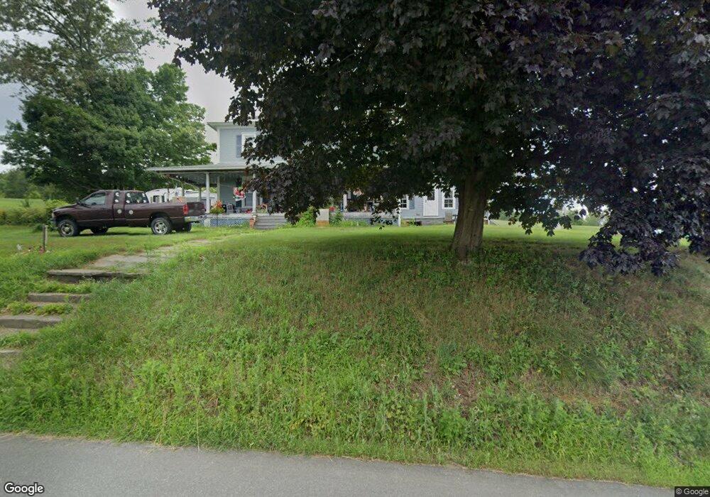
53 Coombs Hill Rd Colrain, MA 01340
Colrain NeighborhoodEstimated Value: $257,579 - $405,000
4
Beds
2
Baths
3,000
Sq Ft
$102/Sq Ft
Est. Value
About This Home
This home is located at 53 Coombs Hill Rd, Colrain, MA 01340 and is currently estimated at $307,395, approximately $102 per square foot. 53 Coombs Hill Rd is a home located in Franklin County with nearby schools including Mohawk Trail Regional High School.
Ownership History
Date
Name
Owned For
Owner Type
Purchase Details
Closed on
Aug 20, 2019
Sold by
Coombs Russell E
Bought by
Coombs Russell E and Coombs Sandra D
Current Estimated Value
Purchase Details
Closed on
Jun 28, 2002
Sold by
Coombs Russell E and Coombs Sandra D
Bought by
Sweeney George M
Home Financials for this Owner
Home Financials are based on the most recent Mortgage that was taken out on this home.
Original Mortgage
$85,000
Interest Rate
6.92%
Mortgage Type
Purchase Money Mortgage
Create a Home Valuation Report for This Property
The Home Valuation Report is an in-depth analysis detailing your home's value as well as a comparison with similar homes in the area
Home Values in the Area
Average Home Value in this Area
Purchase History
| Date | Buyer | Sale Price | Title Company |
|---|---|---|---|
| Coombs Russell E | -- | -- | |
| Sweeney George M | $175,000 | -- |
Source: Public Records
Mortgage History
| Date | Status | Borrower | Loan Amount |
|---|---|---|---|
| Previous Owner | Sweeney George M | $85,000 | |
| Previous Owner | Sweeney George M | $20,000 |
Source: Public Records
Tax History Compared to Growth
Tax History
| Year | Tax Paid | Tax Assessment Tax Assessment Total Assessment is a certain percentage of the fair market value that is determined by local assessors to be the total taxable value of land and additions on the property. | Land | Improvement |
|---|---|---|---|---|
| 2025 | $3,212 | $175,900 | $33,300 | $142,600 |
| 2024 | $3,339 | $175,900 | $33,300 | $142,600 |
| 2023 | $3,453 | $175,900 | $33,300 | $142,600 |
| 2022 | $3,521 | $171,900 | $29,300 | $142,600 |
| 2021 | $3,637 | $171,900 | $29,300 | $142,600 |
| 2020 | $3,428 | $172,000 | $29,300 | $142,700 |
| 2019 | $3,437 | $167,100 | $29,300 | $137,800 |
| 2018 | $3,382 | $167,100 | $29,300 | $137,800 |
| 2017 | $3,284 | $166,700 | $28,900 | $137,800 |
| 2016 | $2,935 | $157,100 | $28,900 | $128,200 |
| 2015 | $2,842 | $157,100 | $28,900 | $128,200 |
Source: Public Records
Map
Nearby Homes
- 0 Fiske Mill Rd
- 3+5 Church St
- 151 Smead Hill Rd
- 27 Lunt Dr
- 336 Plain Rd
- 187 Plain Rd
- 218 Greenfield Rd
- 319 Greenfield Rd
- 105 - 107 Bridge St
- 33 Williams St
- 104 Leyden Rd
- 10 Deerfield Ave Unit 5
- 10 Deerfield Ave Unit 2
- 0 Pickett Ln
- 4 Pickett Ln
- 22 Princeton Terrace Unit 22
- 2155 Massachusetts 2
- 2151 Route 2
- 414 Mohawk Trail
- 66 Reil Ln
- 45 Coombs Hill Rd
- 198 Prolovich Rd
- 705 Little Mohawk Rd
- 188 Prolovich Rd
- 705 Little Mohawk Rd
- 21 Coombs Hill Rd
- 20 Coombs Hill Rd
- 17 Coombs Hill Rd
- 686 Little Mohawk Rd
- 680 Little Mohawk Rd
- 153 Prolovich Rd
- 669 Little Mohawk Rd
- 2 Coombs Hill Rd
- 694 Little Mohawk Rd
- 324 Greenfield Rd
- 650 Little Mohawk Rd
- 320 Greenfield Rd
- 455 Colrain Shelburne Rd
- 452 Colrain Shelburne Rd
- 318 Greenfield Rd