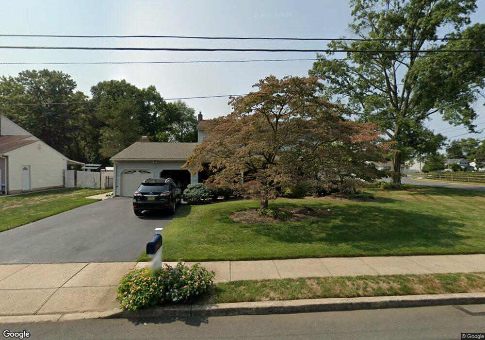
53 Elkton Ave Trenton, NJ 08619
Estimated Value: $467,000 - $577,000
--
Bed
--
Bath
2,032
Sq Ft
$249/Sq Ft
Est. Value
About This Home
This home is located at 53 Elkton Ave, Trenton, NJ 08619 and is currently estimated at $505,904, approximately $248 per square foot. 53 Elkton Ave is a home located in Mercer County with nearby schools including Kuser Elementary School, Emily C. Reynolds Middle School, and Steinert - Hamilton High East.
Ownership History
Date
Name
Owned For
Owner Type
Purchase Details
Closed on
Mar 20, 2017
Sold by
Lavern M Reid
Bought by
Abdel-Gleil Ahmed
Current Estimated Value
Home Financials for this Owner
Home Financials are based on the most recent Mortgage that was taken out on this home.
Original Mortgage
$185,948
Outstanding Balance
$154,752
Interest Rate
4.3%
Estimated Equity
$351,152
Purchase Details
Closed on
Nov 23, 1987
Bought by
Constantine James A and Constantine Anita L
Create a Home Valuation Report for This Property
The Home Valuation Report is an in-depth analysis detailing your home's value as well as a comparison with similar homes in the area
Home Values in the Area
Average Home Value in this Area
Purchase History
| Date | Buyer | Sale Price | Title Company |
|---|---|---|---|
| Abdel-Gleil Ahmed | -- | -- | |
| Constantine James A | -- | -- |
Source: Public Records
Mortgage History
| Date | Status | Borrower | Loan Amount |
|---|---|---|---|
| Open | Abdel-Gleil Ahmed | $185,948 | |
| Closed | Abdel-Gleil Ahmed | -- |
Source: Public Records
Tax History Compared to Growth
Tax History
| Year | Tax Paid | Tax Assessment Tax Assessment Total Assessment is a certain percentage of the fair market value that is determined by local assessors to be the total taxable value of land and additions on the property. | Land | Improvement |
|---|---|---|---|---|
| 2025 | $10,184 | $289,000 | $87,100 | $201,900 |
| 2024 | $9,546 | $289,000 | $87,100 | $201,900 |
| 2023 | $9,546 | $289,000 | $87,100 | $201,900 |
| 2022 | $9,395 | $289,000 | $87,100 | $201,900 |
| 2021 | $10,788 | $289,000 | $87,100 | $201,900 |
| 2020 | $9,498 | $289,000 | $87,100 | $201,900 |
| 2019 | $9,494 | $289,000 | $87,100 | $201,900 |
| 2018 | $9,387 | $289,000 | $87,100 | $201,900 |
| 2017 | $8,907 | $289,000 | $87,100 | $201,900 |
| 2016 | $7,815 | $289,000 | $87,100 | $201,900 |
| 2015 | $8,632 | $182,800 | $55,800 | $127,000 |
| 2014 | $8,490 | $182,800 | $55,800 | $127,000 |
Source: Public Records
Map
Nearby Homes
- 14 Chester Ave
- 176 Pope Ave
- 319 Cypress Ln
- L:25 Mandl St
- 61 Leuckel Ave
- 25 Brook Ln
- 20 Leuckel Ave
- 16 Merovan Ave
- 90 Sundance Dr
- 125 Sundance Dr
- 1523 Cornell Ave
- 226 Saybrook Ave
- 121 Dickinson Ave
- 235 Darcy Ave
- 1427 Hamilton Ave
- 144 Beal St
- 448 Lynwood Ave
- 51 Charlotte Ave
- 20 Charlotte Ave
- 618 Atlantic Ave