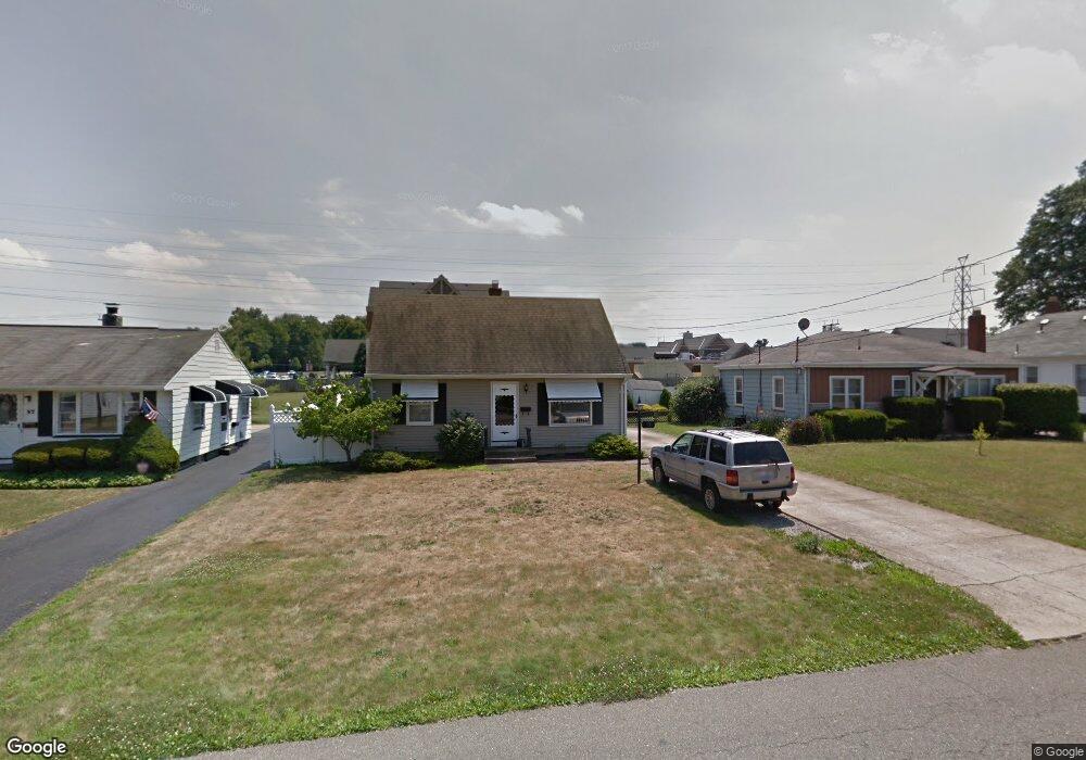
53 Romaine Ave Youngstown, OH 44512
Estimated Value: $124,000 - $148,000
2
Beds
1
Bath
1,152
Sq Ft
$116/Sq Ft
Est. Value
About This Home
This home is located at 53 Romaine Ave, Youngstown, OH 44512 and is currently estimated at $133,153, approximately $115 per square foot. 53 Romaine Ave is a home located in Mahoning County with nearby schools including Boardman Glenwood Junior High School, Boardman High School, and Youngstown Christian School.
Ownership History
Date
Name
Owned For
Owner Type
Purchase Details
Closed on
Apr 20, 2015
Sold by
Anthony Gail R and Dundon Gail R
Bought by
Tokarsky Michael J
Current Estimated Value
Home Financials for this Owner
Home Financials are based on the most recent Mortgage that was taken out on this home.
Original Mortgage
$66,768
Outstanding Balance
$51,174
Interest Rate
3.62%
Mortgage Type
FHA
Estimated Equity
$81,979
Purchase Details
Closed on
Jun 21, 1991
Bought by
Dundon Gail R
Create a Home Valuation Report for This Property
The Home Valuation Report is an in-depth analysis detailing your home's value as well as a comparison with similar homes in the area
Home Values in the Area
Average Home Value in this Area
Purchase History
| Date | Buyer | Sale Price | Title Company |
|---|---|---|---|
| Tokarsky Michael J | $68,000 | Attorney | |
| Dundon Gail R | -- | -- |
Source: Public Records
Mortgage History
| Date | Status | Borrower | Loan Amount |
|---|---|---|---|
| Open | Tokarsky Michael J | $66,768 |
Source: Public Records
Tax History Compared to Growth
Tax History
| Year | Tax Paid | Tax Assessment Tax Assessment Total Assessment is a certain percentage of the fair market value that is determined by local assessors to be the total taxable value of land and additions on the property. | Land | Improvement |
|---|---|---|---|---|
| 2024 | $1,697 | $33,150 | $3,500 | $29,650 |
| 2023 | $1,674 | $33,150 | $3,500 | $29,650 |
| 2022 | $1,544 | $23,340 | $3,500 | $19,840 |
| 2021 | $1,545 | $23,340 | $3,500 | $19,840 |
| 2020 | $1,552 | $23,340 | $3,500 | $19,840 |
| 2019 | $1,544 | $20,480 | $3,070 | $17,410 |
| 2018 | $1,301 | $20,480 | $3,070 | $17,410 |
| 2017 | $1,298 | $20,480 | $3,070 | $17,410 |
| 2016 | $1,217 | $19,010 | $3,330 | $15,680 |
| 2015 | $1,192 | $19,010 | $3,330 | $15,680 |
| 2014 | $1,196 | $19,010 | $3,330 | $15,680 |
| 2013 | $1,181 | $19,010 | $3,330 | $15,680 |
Source: Public Records
Map
Nearby Homes
- 26 Marlindale Ave
- 103 Wildwood Dr
- 197 Mathews Rd Unit B
- 6511 Pembrooke Place
- 44 Gertrude Ave
- 96 Aylesboro Ave
- 6726 Glendale Ave
- 6001 Applecrest Dr
- 242 Oakley Ave
- 149 Argyle Ave
- 169 Wolcott Dr
- 642 Oakridge Dr
- 0 Mathews Rd Unit 5038026
- 33 Crestline Place
- 6785 Tanglewood Dr
- 7110 Amherst Ave
- 235 Wolcott Dr
- 167 Afton Ave
- 7005 Paxton Rd
- 81 Melrose Ave