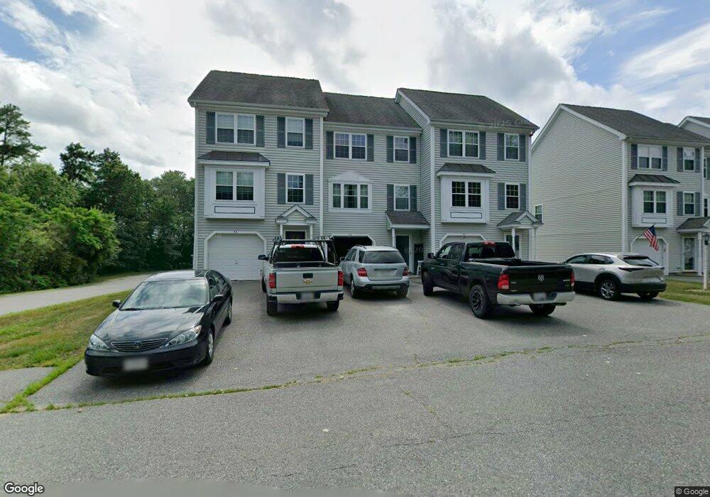
53 Roosevelt Ave Unit 17 Dracut, MA 01826
Estimated Value: $292,665 - $379,000
2
Beds
2
Baths
1,224
Sq Ft
$282/Sq Ft
Est. Value
About This Home
This home is located at 53 Roosevelt Ave Unit 17, Dracut, MA 01826 and is currently estimated at $344,666, approximately $281 per square foot. 53 Roosevelt Ave Unit 17 is a home located in Middlesex County with nearby schools including Joseph A. Campbell Elementary School, Richardson Middle School, and Dracut Senior High School.
Ownership History
Date
Name
Owned For
Owner Type
Purchase Details
Closed on
Dec 29, 2011
Sold by
Apostolakes Jay and Buckland Tannya M
Bought by
Apostolakes Jay
Current Estimated Value
Purchase Details
Closed on
Jan 14, 2010
Sold by
Apostolakes Jay
Bought by
Apostolakes Jay and Buckland Tannya Michele
Home Financials for this Owner
Home Financials are based on the most recent Mortgage that was taken out on this home.
Original Mortgage
$163,003
Interest Rate
4.71%
Mortgage Type
FHA
Purchase Details
Closed on
Jun 17, 2005
Sold by
Riverside Afford Hsng
Bought by
Parker Debbie and Apostalakes Jay
Home Financials for this Owner
Home Financials are based on the most recent Mortgage that was taken out on this home.
Original Mortgage
$146,000
Interest Rate
5.78%
Mortgage Type
Purchase Money Mortgage
Create a Home Valuation Report for This Property
The Home Valuation Report is an in-depth analysis detailing your home's value as well as a comparison with similar homes in the area
Home Values in the Area
Average Home Value in this Area
Purchase History
| Date | Buyer | Sale Price | Title Company |
|---|---|---|---|
| Apostolakes Jay | -- | -- | |
| Apostolakes Jay | -- | -- | |
| Apostolakes Jay | -- | -- | |
| Parker Debbie | $166,000 | -- |
Source: Public Records
Mortgage History
| Date | Status | Borrower | Loan Amount |
|---|---|---|---|
| Previous Owner | Apostolakes Jay | $163,003 | |
| Previous Owner | Parker Debbie | $146,000 |
Source: Public Records
Tax History Compared to Growth
Tax History
| Year | Tax Paid | Tax Assessment Tax Assessment Total Assessment is a certain percentage of the fair market value that is determined by local assessors to be the total taxable value of land and additions on the property. | Land | Improvement |
|---|---|---|---|---|
| 2025 | $2,214 | $218,768 | $0 | $218,768 |
| 2024 | $2,078 | $198,880 | $0 | $198,880 |
| 2023 | $2,094 | $180,800 | $0 | $180,800 |
| 2022 | $2,222 | $180,800 | $0 | $180,800 |
| 2021 | $2,352 | $180,800 | $0 | $180,800 |
| 2020 | $2,414 | $180,800 | $0 | $180,800 |
| 2019 | $2,486 | $180,800 | $0 | $180,800 |
| 2018 | $2,557 | $180,800 | $0 | $180,800 |
| 2017 | $2,622 | $180,800 | $0 | $180,800 |
| 2016 | $2,683 | $180,800 | $0 | $180,800 |
| 2015 | $2,699 | $180,800 | $0 | $180,800 |
| 2014 | $2,620 | $180,800 | $0 | $180,800 |
Source: Public Records
Map
Nearby Homes
- 173 Merrimack Meadows Ln Unit 162
- 820 Methuen St Unit 820
- 16 Winding Ln
- 173 Brook St
- 100 Merrimack Ave Unit 50
- 100 Merrimack Ave Unit 91
- 100 Merrimack Ave Unit 124
- 15 Sharyn Cir
- 78 Merrimack Meadows Ln Unit 78
- 931 Methuen St Unit 6
- 11 Merrimack Meadows Ln Unit 17
- 11 View St
- 16 Wetherbee Ave
- 4 Hazelwood Ave Unit 12
- 7 Wildwood St Unit A24
- 45 Clark Rd
- 284 Beacon St
- 650 Robbins Ave Unit 33
- 26 Luce St
- 139 Beech St
- 51 Roosevelt Ave Unit 16
- 45 Roosevelt Ave Unit 15
- 45 Roosevelt Ave Unit 14
- 45 Roosevelt Ave Unit 45
- 55 Roosevelt Ave Unit 18
- 43 Roosevelt Ave Unit 14
- 41 Roosevelt Ave Unit 13
- 41 Roosevelt Ave Unit 41
- 54 Joseph Ave Unit 12
- 52 Joseph Ave Unit 11
- 44 Joseph Ave Unit 9
- 50 Joseph Ave Unit 10
- 42 Joseph Ave Unit 8
- 40 Joseph Ave Unit 7
- 39 Roosevelt Ave
- 38 Joseph Ave
- 25 Perot Dr
- 53 Joseph Ave Unit 5
- 51 Joseph Ave Unit 4
- 43 Reagan Rd