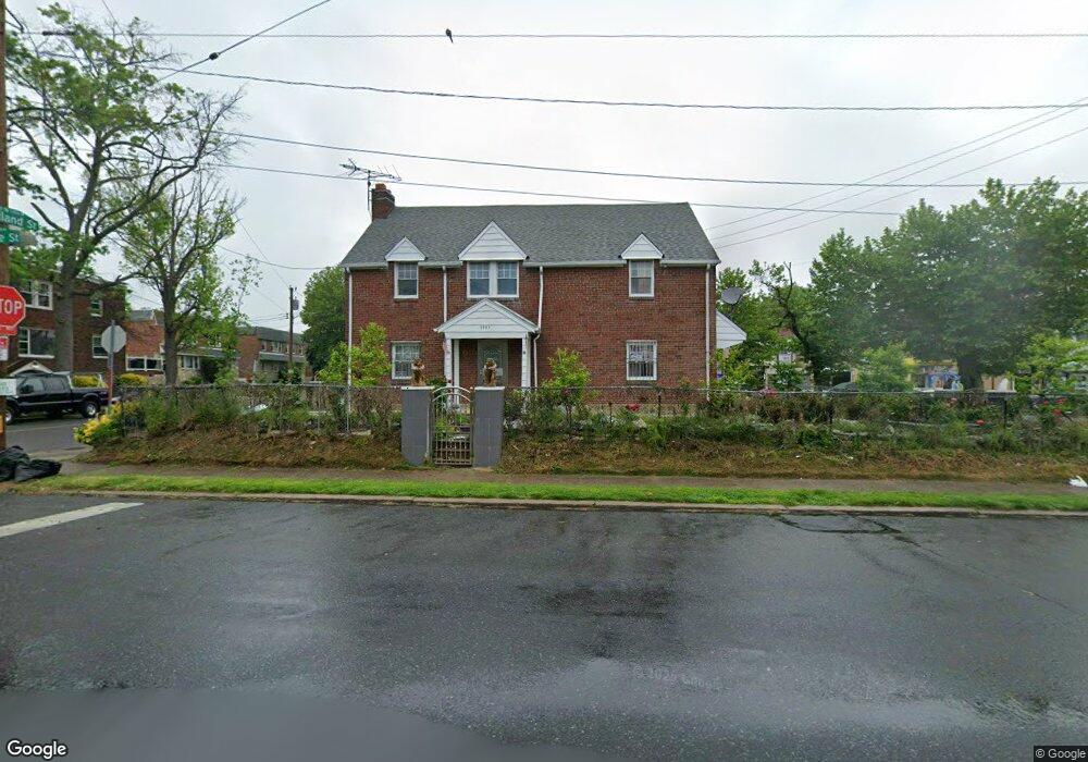
5304 Oxford Ave Philadelphia, PA 19124
Frankford NeighborhoodEstimated Value: $225,000 - $293,346
3
Beds
3
Baths
2,264
Sq Ft
$117/Sq Ft
Est. Value
About This Home
This home is located at 5304 Oxford Ave, Philadelphia, PA 19124 and is currently estimated at $263,837, approximately $116 per square foot. 5304 Oxford Ave is a home located in Philadelphia County with nearby schools including Frankford High School, The Philadelphia Charter School for the Arts & Sciences, and Northwood Academy Charter School.
Ownership History
Date
Name
Owned For
Owner Type
Purchase Details
Closed on
Oct 15, 2024
Sold by
Thach Dung and In Sovannary
Bought by
Thach Dung N
Current Estimated Value
Purchase Details
Closed on
Aug 31, 2021
Sold by
Hoang Toan and Zhao Ping
Bought by
Thach Dung and In Sovannary
Create a Home Valuation Report for This Property
The Home Valuation Report is an in-depth analysis detailing your home's value as well as a comparison with similar homes in the area
Home Values in the Area
Average Home Value in this Area
Purchase History
| Date | Buyer | Sale Price | Title Company |
|---|---|---|---|
| Thach Dung N | -- | None Listed On Document | |
| Thach Dung | $190,000 | North Penn Abstract Co Inc |
Source: Public Records
Tax History Compared to Growth
Tax History
| Year | Tax Paid | Tax Assessment Tax Assessment Total Assessment is a certain percentage of the fair market value that is determined by local assessors to be the total taxable value of land and additions on the property. | Land | Improvement |
|---|---|---|---|---|
| 2026 | $2,920 | $267,300 | $53,460 | $213,840 |
| 2025 | $2,920 | $267,300 | $53,460 | $213,840 |
| 2024 | $2,920 | $267,300 | $53,460 | $213,840 |
| 2023 | $2,920 | $208,600 | $41,720 | $166,880 |
| 2022 | $2,290 | $163,600 | $41,720 | $121,880 |
| 2021 | $2,160 | $0 | $0 | $0 |
| 2020 | $2,160 | $0 | $0 | $0 |
| 2019 | $2,154 | $0 | $0 | $0 |
| 2018 | $2,151 | $0 | $0 | $0 |
| 2017 | $2,151 | $0 | $0 | $0 |
| 2016 | $2,151 | $0 | $0 | $0 |
| 2015 | $2,060 | $0 | $0 | $0 |
| 2014 | -- | $153,700 | $19,950 | $133,750 |
| 2012 | -- | $26,528 | $8,246 | $18,282 |
Source: Public Records
Map
Nearby Homes
- 1048 Bridge St
- 5659 Miriam Rd
- 5661 Miriam Rd
- 1137 Bridge St
- 5640 Miriam Rd
- 996 Anchor St
- 991 Carver St
- 972 Bridge St
- 1204 Pratt St
- 5505 Loretto Ave
- 1218 Pratt St
- 1431 Rosalie St
- 5347 Sylvester St
- 1220 Pratt St
- 934 Brill St
- 1244 E Sanger St
- 934 E Sanger St
- 1225 E Cheltenham Ave
- 1211 E Cheltenham Ave
- 5902 E Roosevelt Blvd
- 1029 Bridge St
- 1027 Bridge St
- 1025 Bridge St
- 5313 Oxford Ave
- 1052 Bridge St
- 1050 Bridge St
- 1023 Bridge St
- 5309 Oxford Ave
- 5315 Oxford Ave
- 5308 Rutland St
- 5321 Oxford Ave
- 5321 Oxford Ave Unit 2ND FLOOR
- 5260 Oxford Ave
- 5323 Oxford Ave
- 5307 Oxford Ave
- 1040 Bridge St
- 1021 Bridge St
- 5325 Oxford Ave
- 5301 Oxford Ave
- 5312 Rutland St