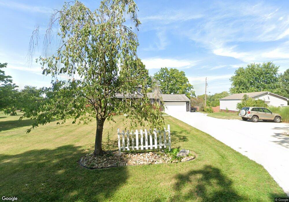
5305 Brook Rd NW Lancaster, OH 43130
Estimated Value: $265,000 - $374,000
3
Beds
2
Baths
1,262
Sq Ft
$247/Sq Ft
Est. Value
About This Home
This home is located at 5305 Brook Rd NW, Lancaster, OH 43130 and is currently estimated at $312,243, approximately $247 per square foot. 5305 Brook Rd NW is a home located in Fairfield County with nearby schools including Bloom Carroll Primary School, Bloom Carroll Intermediate School, and Bloom-Carroll Middle School.
Ownership History
Date
Name
Owned For
Owner Type
Purchase Details
Closed on
Feb 9, 2005
Sold by
Robberts Paul E and Robberts Betsy B
Bought by
Loy Donald J and Loy Karen S
Current Estimated Value
Home Financials for this Owner
Home Financials are based on the most recent Mortgage that was taken out on this home.
Original Mortgage
$112,500
Outstanding Balance
$57,295
Interest Rate
5.78%
Mortgage Type
Purchase Money Mortgage
Estimated Equity
$254,948
Purchase Details
Closed on
Nov 24, 1997
Sold by
Johnson Raymond T
Bought by
Robberts Paul E and Robberts Betsy B
Home Financials for this Owner
Home Financials are based on the most recent Mortgage that was taken out on this home.
Original Mortgage
$88,150
Interest Rate
7.38%
Mortgage Type
New Conventional
Purchase Details
Closed on
Sep 1, 1990
Purchase Details
Closed on
Jun 1, 1986
Create a Home Valuation Report for This Property
The Home Valuation Report is an in-depth analysis detailing your home's value as well as a comparison with similar homes in the area
Home Values in the Area
Average Home Value in this Area
Purchase History
| Date | Buyer | Sale Price | Title Company |
|---|---|---|---|
| Loy Donald J | $112,500 | -- | |
| Robberts Paul E | $86,500 | -- | |
| -- | $43,000 | -- | |
| -- | $36,500 | -- |
Source: Public Records
Mortgage History
| Date | Status | Borrower | Loan Amount |
|---|---|---|---|
| Open | Loy Donald J | $112,500 | |
| Previous Owner | Robberts Paul E | $88,150 |
Source: Public Records
Tax History Compared to Growth
Tax History
| Year | Tax Paid | Tax Assessment Tax Assessment Total Assessment is a certain percentage of the fair market value that is determined by local assessors to be the total taxable value of land and additions on the property. | Land | Improvement |
|---|---|---|---|---|
| 2024 | $5,675 | $70,320 | $21,000 | $49,320 |
| 2023 | $2,882 | $66,050 | $21,000 | $45,050 |
| 2022 | $2,903 | $66,050 | $21,000 | $45,050 |
| 2021 | $2,264 | $50,540 | $17,500 | $33,040 |
| 2020 | $2,291 | $50,540 | $17,500 | $33,040 |
| 2019 | $2,301 | $50,540 | $17,500 | $33,040 |
| 2018 | $1,711 | $35,300 | $14,000 | $21,300 |
| 2017 | $1,605 | $38,600 | $14,000 | $24,600 |
| 2016 | $1,557 | $38,600 | $14,000 | $24,600 |
| 2015 | $1,507 | $36,380 | $14,000 | $22,380 |
| 2014 | $1,440 | $36,380 | $14,000 | $22,380 |
| 2013 | $1,440 | $36,380 | $14,000 | $22,380 |
Source: Public Records
Map
Nearby Homes
- 0 Brook Rd NW
- 5870 Brook Rd NW
- 2831 Sterling Dr NW
- 5095 Lancaster Kirkersville Rd NW
- 4345 Lancaster Kirkersville Rd NW
- 1705 Ginder Rd NW
- 1502 Leonard Rd NW
- 3515 Election House Rd NW
- 1350 Leonard Rd NW
- 6990 Bader Rd NW
- 4656 Meadow Grove Dr NW
- 1080 Coonpath Rd NW
- 133 N Creekview Ct
- 0 S Company St Unit Lot 2 225029545
- 0 S Company St Unit Lot 1 225029543
- 3340 Stringtown Rd NE
- 0 Fremar Rd NE Unit Lot1 225007256
- 111 N High St
- 101 Circle Dr
- 0 Coonpath Rd NW Unit Tract 4 224028093
- 5315 Brook Rd NW
- 5300 Brook Rd NW
- 5320 Brook Rd NW
- 5275 Brook Rd NW
- 5253 Brook Rd NW
- 5336 Brook Rd NW
- 5227 Brook Rd NW
- 5350 Brook Rd NW
- 5210 Brook Rd NW
- 5213 Brook Rd NW
- 5177 Brook Rd NW
- 5400 Brook Rd NW
- 5270 Brook Rd NW
- 5150 Brook Rd NW
- 5440 Brook Rd NW
- 5145 Brook Rd NW
- 5470 Brook Rd NW
- 5500 Brook Rd NW
- 5113 Brook Rd NW
- 5090 Brook Rd NW