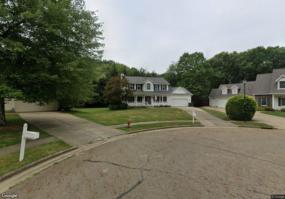
531 Brookfield Cir Louisville, OH 44641
Estimated Value: $311,000 - $359,000
3
Beds
3
Baths
2,308
Sq Ft
$145/Sq Ft
Est. Value
About This Home
This home is located at 531 Brookfield Cir, Louisville, OH 44641 and is currently estimated at $333,819, approximately $144 per square foot. 531 Brookfield Cir is a home located in Stark County with nearby schools including Louisville High School and St. Thomas Aquinas High School & Middle School.
Ownership History
Date
Name
Owned For
Owner Type
Purchase Details
Closed on
Oct 16, 2008
Sold by
Michael Carl W and Michael Patricia A
Bought by
Michael Carl W and Michael Patricia A
Current Estimated Value
Purchase Details
Closed on
Oct 17, 2003
Sold by
Simone Joseph A and Simone Jill C
Bought by
Michael Carl W and Thomas Patricia A
Home Financials for this Owner
Home Financials are based on the most recent Mortgage that was taken out on this home.
Original Mortgage
$172,000
Outstanding Balance
$81,804
Interest Rate
6.49%
Mortgage Type
Purchase Money Mortgage
Estimated Equity
$252,015
Purchase Details
Closed on
Sep 12, 1995
Sold by
Rich Michael J
Bought by
Simone Joseph A and Simone Jill
Purchase Details
Closed on
Oct 31, 1994
Sold by
Rich Michael J
Bought by
Lingenhoel Arden R
Create a Home Valuation Report for This Property
The Home Valuation Report is an in-depth analysis detailing your home's value as well as a comparison with similar homes in the area
Home Values in the Area
Average Home Value in this Area
Purchase History
| Date | Buyer | Sale Price | Title Company |
|---|---|---|---|
| Michael Carl W | -- | Attorney | |
| Michael Carl W | $215,000 | -- | |
| Simone Joseph A | $22,500 | -- | |
| Lingenhoel Arden R | $25,500 | -- |
Source: Public Records
Mortgage History
| Date | Status | Borrower | Loan Amount |
|---|---|---|---|
| Open | Michael Carl W | $172,000 |
Source: Public Records
Tax History Compared to Growth
Tax History
| Year | Tax Paid | Tax Assessment Tax Assessment Total Assessment is a certain percentage of the fair market value that is determined by local assessors to be the total taxable value of land and additions on the property. | Land | Improvement |
|---|---|---|---|---|
| 2025 | -- | $109,590 | $18,060 | $91,530 |
| 2024 | -- | $109,590 | $18,060 | $91,530 |
| 2023 | $3,192 | $83,450 | $17,050 | $66,400 |
| 2022 | $3,216 | $83,450 | $17,050 | $66,400 |
| 2021 | $3,225 | $83,450 | $17,050 | $66,400 |
| 2020 | $2,644 | $75,260 | $15,370 | $59,890 |
| 2019 | $2,655 | $75,260 | $15,370 | $59,890 |
| 2018 | $2,645 | $75,260 | $15,370 | $59,890 |
| 2017 | $2,407 | $67,170 | $13,510 | $53,660 |
| 2016 | $2,457 | $67,170 | $13,510 | $53,660 |
| 2015 | $2,464 | $67,170 | $13,510 | $53,660 |
| 2014 | $236 | $58,040 | $11,660 | $46,380 |
| 2013 | $1,122 | $58,040 | $11,660 | $46,380 |
Source: Public Records
Map
Nearby Homes
- 1812 E Broad St
- 1715 High St
- 2110 Edmar St
- 2015 E Main St
- 641 S Nickelplate St
- 0 Michigan Blvd
- 308 Superior St
- 520 S Silver St
- 3390 Meese Rd NE
- 728 E Broad St
- 908 Sand Lot Cir
- 510 S Bauman Ct
- 204 E Broad St
- 1170 Winding Ridge Ave
- 325 Lincoln Ave
- 107 E Broad St
- 910 Crosswyck Cir
- 8225 Georgetown St
- 5495 Meese Rd NE
- 1702 View Pointe Ave
- 527 Brookfield Cir
- 532 Brookfield Cir
- 523 Brookfield Cir
- 528 Brookfield Cir
- 524 Brookfield Cir
- 513 Brookfield St
- 2015 Briarwood St
- 510 Brookfield St
- 2114 Ashbrook Ave
- 2020 Ashbrook Ave
- 2134 Ashbrook Ave
- 2105 Briarwood St
- 2005 Briarwood St
- 2002 Ashbrook Ave
- 2125 Briarwood St
- 2000 Ashbrook Ave
- 1925 Briarwood St
- 2133 Briarwood St
- 4201 Meese Rd
- 4221 Meese Rd NE