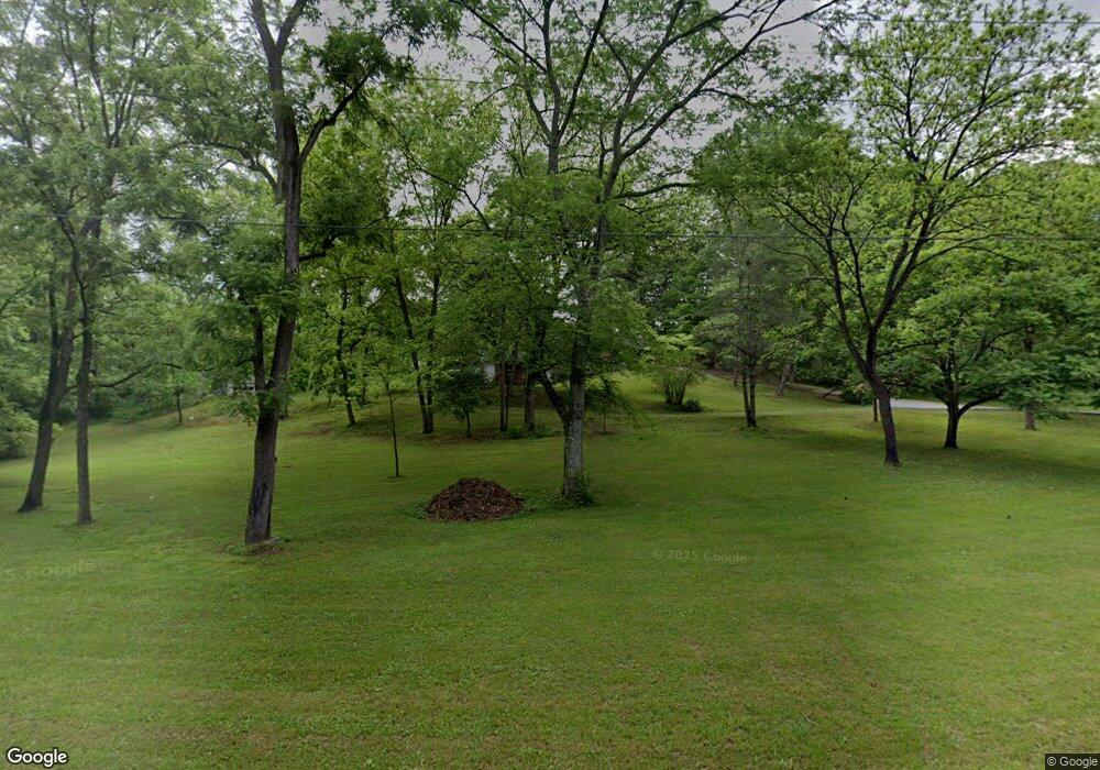
537 Carroll Rd Morristown, TN 37813
Estimated Value: $248,251 - $342,000
--
Bed
1
Bath
1,722
Sq Ft
$174/Sq Ft
Est. Value
About This Home
This home is located at 537 Carroll Rd, Morristown, TN 37813 and is currently estimated at $299,563, approximately $173 per square foot. 537 Carroll Rd is a home located in Hamblen County with nearby schools including John Hay Elementary School, Meadowview Middle School, and Morristown East High School.
Ownership History
Date
Name
Owned For
Owner Type
Purchase Details
Closed on
Sep 19, 2005
Sold by
Crouche Linda F
Bought by
Crouche Jerry W
Current Estimated Value
Purchase Details
Closed on
Feb 10, 1998
Sold by
Crouche Linda F
Bought by
Sims Ronald
Purchase Details
Closed on
Mar 5, 1997
Sold by
Kinsler Vada L and Kinsler E
Bought by
Tony Southerland
Purchase Details
Closed on
Aug 26, 1996
Sold by
Crouche Linda F
Bought by
Horner Lee
Purchase Details
Closed on
Jun 13, 1990
Bought by
Crouche Linda F
Purchase Details
Closed on
Jul 24, 1968
Bought by
Crouche Jerry W and Crouche Linda F
Create a Home Valuation Report for This Property
The Home Valuation Report is an in-depth analysis detailing your home's value as well as a comparison with similar homes in the area
Home Values in the Area
Average Home Value in this Area
Purchase History
| Date | Buyer | Sale Price | Title Company |
|---|---|---|---|
| Crouche Jerry W | -- | -- | |
| Sims Ronald | $19,000 | -- | |
| Tony Southerland | $9,500 | -- | |
| Horner Lee | $7,500 | -- | |
| Crouche Linda F | -- | -- | |
| Crouche Jerry W | -- | -- |
Source: Public Records
Tax History Compared to Growth
Tax History
| Year | Tax Paid | Tax Assessment Tax Assessment Total Assessment is a certain percentage of the fair market value that is determined by local assessors to be the total taxable value of land and additions on the property. | Land | Improvement |
|---|---|---|---|---|
| 2024 | $821 | $41,675 | $5,450 | $36,225 |
| 2023 | $821 | $41,675 | $0 | $0 |
| 2022 | $821 | $41,675 | $5,450 | $36,225 |
| 2021 | $821 | $41,675 | $5,450 | $36,225 |
| 2020 | $821 | $41,675 | $5,450 | $36,225 |
| 2019 | $829 | $38,900 | $5,450 | $33,450 |
| 2018 | $829 | $38,900 | $5,450 | $33,450 |
| 2017 | $829 | $38,900 | $5,450 | $33,450 |
| 2016 | $774 | $38,900 | $5,450 | $33,450 |
| 2015 | $720 | $38,900 | $5,450 | $33,450 |
| 2014 | -- | $38,900 | $5,450 | $33,450 |
| 2013 | -- | $43,375 | $0 | $0 |
Source: Public Records
Map
Nearby Homes
- 3661 Halifax Cir
- 1689 Carroll Rd
- 4270 Brockland Dr
- 358 Dover Rd
- Lot 1 E Andrew Johnson Hwy
- 3115 Eloise Dr
- 1148 George Byrd Rd
- 3003 Eloise Dr
- 1575 Thompson Creek Rd
- 542 Cliff St
- 0 Thompson Creek Rd
- 4458 Brockland Dr
- 512 Cliff St
- 517 Cliff St
- 3113 Berna Way
- 288 Fuller Estate Cir
- 1744 Carroll Rd
- 4581 Lockley Ct
- 4907 Barton Springs Dr
- 4705 E Hampton Blvd
- 587 Carroll Rd
- 520 Carroll Rd
- 497 Carroll Rd
- 3656 Halifax Cir
- 493 Carroll Rd
- 3650 Halifax Cir
- 481 Carroll Rd
- 3646 Halifax Cir
- 473 Carroll Rd
- 3666 Halifax Cir
- 3642 Halifax Cir
- 464 Carroll Rd
- 3638 Halifax Cir
- 3653 Halifax Cir
- 460 Carroll Rd
- 3634 Halifax Cir
- 3660 Mike Dr
- 3670 Halifax Cir
- 3654 Mike Dr
- 3630 Halifax Cir
