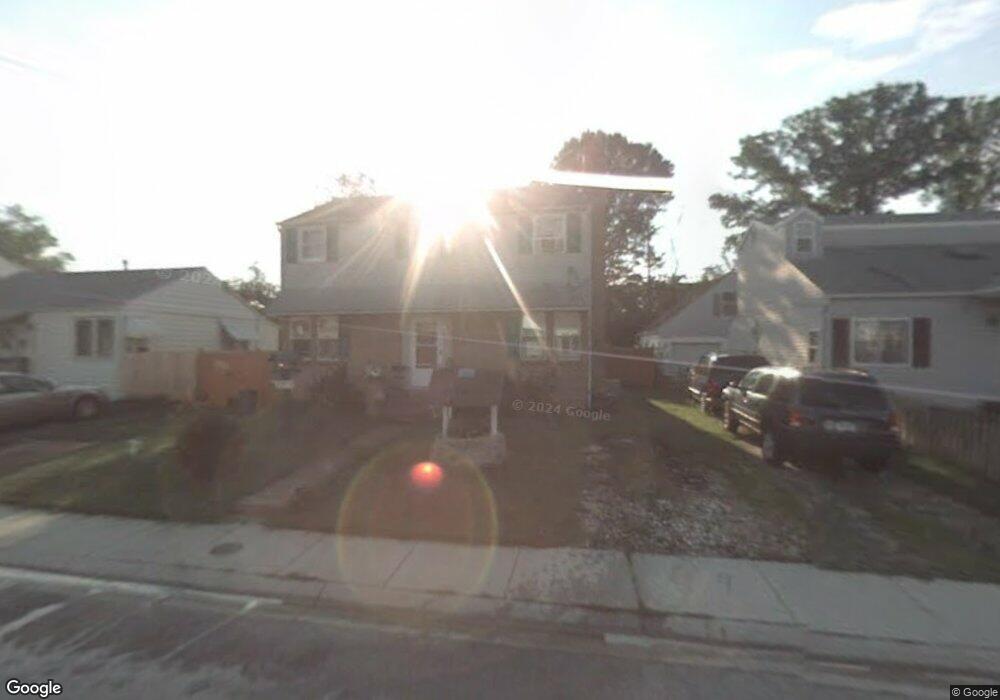
539 Munroe Cir Glen Burnie, MD 21061
Estimated Value: $323,000 - $377,000
--
Bed
1
Bath
1,584
Sq Ft
$226/Sq Ft
Est. Value
About This Home
This home is located at 539 Munroe Cir, Glen Burnie, MD 21061 and is currently estimated at $358,002, approximately $226 per square foot. 539 Munroe Cir is a home located in Anne Arundel County with nearby schools including Richard Henry Lee Elementary School, Corkran Middle School, and Glen Burnie High School.
Ownership History
Date
Name
Owned For
Owner Type
Purchase Details
Closed on
Feb 10, 2003
Sold by
Ruff Frank A
Bought by
Siebert William E and Siebert Lisa A
Current Estimated Value
Purchase Details
Closed on
Dec 31, 2002
Sold by
Reed Rodney J
Bought by
Ruff Frank A
Purchase Details
Closed on
Feb 14, 1996
Sold by
Federal Home Loan Mortgage Corporation
Bought by
Reed Rodney J and Reed Beverly A
Purchase Details
Closed on
Sep 19, 1995
Sold by
Friedman Alvin E
Bought by
Federal Home Loan Mortgage Corporation
Create a Home Valuation Report for This Property
The Home Valuation Report is an in-depth analysis detailing your home's value as well as a comparison with similar homes in the area
Home Values in the Area
Average Home Value in this Area
Purchase History
| Date | Buyer | Sale Price | Title Company |
|---|---|---|---|
| Siebert William E | $136,000 | -- | |
| Ruff Frank A | $103,400 | -- | |
| Reed Rodney J | $75,000 | -- | |
| Federal Home Loan Mortgage Corporation | $84,300 | -- |
Source: Public Records
Mortgage History
| Date | Status | Borrower | Loan Amount |
|---|---|---|---|
| Closed | Siebert William E | -- |
Source: Public Records
Tax History Compared to Growth
Tax History
| Year | Tax Paid | Tax Assessment Tax Assessment Total Assessment is a certain percentage of the fair market value that is determined by local assessors to be the total taxable value of land and additions on the property. | Land | Improvement |
|---|---|---|---|---|
| 2025 | $2,347 | $260,600 | $142,800 | $117,800 |
| 2024 | $2,347 | $247,533 | $0 | $0 |
| 2023 | $2,268 | $234,467 | $0 | $0 |
| 2022 | $2,108 | $221,400 | $127,800 | $93,600 |
| 2021 | $4,154 | $218,833 | $0 | $0 |
| 2020 | $2,005 | $216,267 | $0 | $0 |
| 2019 | $1,977 | $213,700 | $122,800 | $90,900 |
| 2018 | $2,057 | $202,833 | $0 | $0 |
| 2017 | $1,857 | $191,967 | $0 | $0 |
| 2016 | -- | $181,100 | $0 | $0 |
| 2015 | -- | $172,867 | $0 | $0 |
| 2014 | -- | $164,633 | $0 | $0 |
Source: Public Records
Map
Nearby Homes
- 304 9th Ave SE
- 912 Oakwood Rd
- 530 Delmar Ave
- 112 Main Ave SE
- 118 Heather Stone Way Unit 80
- 203 Buckingham Dr
- 500 Manor Rd
- 307 Oxford Dr
- 0 Irene Dr
- 103 4th Ave SE
- 1003 Lee Rd
- 106 3rd Ave SE
- 713 Cotter Rd
- 7530 Baltimore Annapolis Blvd
- 267 Truck Farm Dr
- 1316 Ray Ln
- 303 A St SW
- 1423 Braden Loop
- 405 Morningside Dr
- 301 Whitman Ct
- 541 Munroe Cir
- 537 Munroe Cir
- 614 Stephanie Ct
- 543 Munroe Cir
- 302 Nicole Ln
- 535 Munroe Cir
- 300 Nicole Ln
- 533 Munroe Cir
- 612 Stephanie Ct
- 545 Munroe Cir
- 536 Munroe Cir
- 304 Nicole Ln
- 538 Munroe Cir
- 534 Munroe Cir
- 540 Munroe Cir
- 532 Munroe Cir
- 531 Munroe Cir
- 547 Munroe Cir
- 610 Stephanie Ct
- 542 Munroe Cir