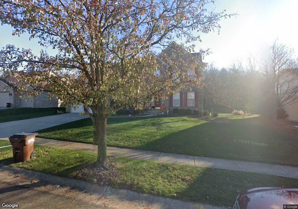
539 Saint Thomas Ct Fairfield, OH 45014
Estimated Value: $447,704 - $518,000
4
Beds
3
Baths
3,029
Sq Ft
$164/Sq Ft
Est. Value
About This Home
This home is located at 539 Saint Thomas Ct, Fairfield, OH 45014 and is currently estimated at $495,676, approximately $163 per square foot. 539 Saint Thomas Ct is a home located in Butler County with nearby schools including Fairfield West Elementary School, Creekside Middle School, and Fairfield Senior High School.
Ownership History
Date
Name
Owned For
Owner Type
Purchase Details
Closed on
May 8, 1997
Sold by
Zaring Homes Inc
Bought by
Oravec Brian M and Oravec Lisa
Current Estimated Value
Home Financials for this Owner
Home Financials are based on the most recent Mortgage that was taken out on this home.
Original Mortgage
$183,850
Outstanding Balance
$24,920
Interest Rate
7.88%
Mortgage Type
New Conventional
Estimated Equity
$470,756
Purchase Details
Closed on
Dec 20, 1995
Sold by
Welsh Dev Co Inc
Bought by
Zaring Homes Inc
Create a Home Valuation Report for This Property
The Home Valuation Report is an in-depth analysis detailing your home's value as well as a comparison with similar homes in the area
Home Values in the Area
Average Home Value in this Area
Purchase History
| Date | Buyer | Sale Price | Title Company |
|---|---|---|---|
| Oravec Brian M | $216,315 | -- | |
| Zaring Homes Inc | $86,000 | -- |
Source: Public Records
Mortgage History
| Date | Status | Borrower | Loan Amount |
|---|---|---|---|
| Open | Oravec Brian M | $183,850 |
Source: Public Records
Tax History Compared to Growth
Tax History
| Year | Tax Paid | Tax Assessment Tax Assessment Total Assessment is a certain percentage of the fair market value that is determined by local assessors to be the total taxable value of land and additions on the property. | Land | Improvement |
|---|---|---|---|---|
| 2024 | $4,719 | $128,110 | $15,090 | $113,020 |
| 2023 | $4,696 | $128,820 | $15,090 | $113,730 |
| 2022 | $4,352 | $91,060 | $15,090 | $75,970 |
| 2021 | $3,756 | $89,570 | $15,090 | $74,480 |
| 2020 | $3,907 | $89,570 | $15,090 | $74,480 |
| 2019 | $6,471 | $74,950 | $16,030 | $58,920 |
| 2018 | $3,714 | $74,950 | $16,030 | $58,920 |
| 2017 | $3,751 | $74,950 | $16,030 | $58,920 |
| 2016 | $3,584 | $68,170 | $16,030 | $52,140 |
| 2015 | $3,412 | $68,170 | $16,030 | $52,140 |
| 2014 | $3,768 | $68,170 | $16,030 | $52,140 |
| 2013 | $3,768 | $79,000 | $19,370 | $59,630 |
Source: Public Records
Map
Nearby Homes
- 12190 Kilbride Dr
- 1235 Bruton Parish Way
- 3169 John Gray Rd
- 5604 Chateau Way
- 5380 Stonetrace Dr
- 1 Stone Mill Rd
- 0 Stone Mill Rd Unit 1846428
- 11881 Stone Mill Rd
- 5476 Lakeside Dr
- 11916 Abbeytown Dr
- 6367 Jamesfield Ct
- 11955 Merrion Ct
- 1370 Hunter Ct
- 5360 Burgundy Place
- 1523 Hunter Rd
- 11992 Pippin Rd
- 12003 Westerly Dr
- 5826 High Point Ct
- 1605 W Augusta Blvd
- 5729 Red Oak Dr
- 531 Saint Thomas Ct
- 547 Saint Thomas Ct
- 523 Saint Thomas Ct
- 555 Saint Thomas Ct
- 544 Saint Thomas Ct
- 536 Saint Thomas Ct
- 528 St Thomas Ct
- 552 Saint Thomas Ct
- 835 Abbot Dr
- 528 Saint Thomas Ct
- 815 Abbot Dr
- 515 Saint Thomas Ct
- 845 Abbot Dr
- 563 Saint Thomas Ct
- 560 Saint Thomas Ct
- 520 Saint Thomas Ct
- 855 Abbot Dr
- 575 Saint Thomas Ct
- 512 Saint Thomas Ct
- 840 Abbot Dr