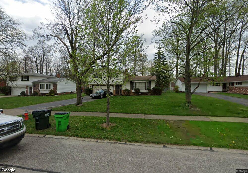
5395 Holly Rd Bedford, OH 44146
Estimated Value: $166,000 - $221,000
3
Beds
1
Bath
1,403
Sq Ft
$140/Sq Ft
Est. Value
About This Home
This home is located at 5395 Holly Rd, Bedford, OH 44146 and is currently estimated at $196,020, approximately $139 per square foot. 5395 Holly Rd is a home located in Cuyahoga County with nearby schools including Heskett Middle School, Bedford High School, and Ohio College Preparatory School.
Ownership History
Date
Name
Owned For
Owner Type
Purchase Details
Closed on
May 10, 2005
Sold by
Solly Thomas R and Solly Dorothy
Bought by
Lanier Michelle N
Current Estimated Value
Home Financials for this Owner
Home Financials are based on the most recent Mortgage that was taken out on this home.
Original Mortgage
$139,000
Outstanding Balance
$73,821
Interest Rate
6.13%
Mortgage Type
Fannie Mae Freddie Mac
Estimated Equity
$122,199
Purchase Details
Closed on
Jan 1, 1975
Bought by
Solly Dorothy R
Create a Home Valuation Report for This Property
The Home Valuation Report is an in-depth analysis detailing your home's value as well as a comparison with similar homes in the area
Home Values in the Area
Average Home Value in this Area
Purchase History
| Date | Buyer | Sale Price | Title Company |
|---|---|---|---|
| Lanier Michelle N | $139,000 | Heights Title Agency | |
| Solly Dorothy R | -- | -- |
Source: Public Records
Mortgage History
| Date | Status | Borrower | Loan Amount |
|---|---|---|---|
| Open | Lanier Michelle N | $139,000 |
Source: Public Records
Tax History Compared to Growth
Tax History
| Year | Tax Paid | Tax Assessment Tax Assessment Total Assessment is a certain percentage of the fair market value that is determined by local assessors to be the total taxable value of land and additions on the property. | Land | Improvement |
|---|---|---|---|---|
| 2024 | $4,599 | $64,540 | $11,900 | $52,640 |
| 2023 | $4,145 | $50,330 | $8,960 | $41,370 |
| 2022 | $3,623 | $50,330 | $8,960 | $41,370 |
| 2021 | $3,585 | $50,330 | $8,960 | $41,370 |
| 2020 | $3,268 | $41,270 | $7,350 | $33,920 |
| 2019 | $3,172 | $117,900 | $21,000 | $96,900 |
| 2018 | $3,154 | $41,270 | $7,350 | $33,920 |
| 2017 | $3,299 | $40,780 | $9,280 | $31,500 |
| 2016 | $3,273 | $40,780 | $9,280 | $31,500 |
| 2015 | $3,268 | $40,780 | $9,280 | $31,500 |
| 2014 | $3,268 | $40,780 | $9,280 | $31,500 |
Source: Public Records
Map
Nearby Homes
- 5301 Mardale Ave
- 5285 Mardale Ave
- 20750 Bowling Green Rd
- 20732 Applegate Rd
- 20739 Donny Brook Rd
- 5385 Bartlett Rd
- 21416 Gardenview Dr
- 179 Willard Ave
- 20814 Kenyon Dr
- 20625 Centuryway Rd
- 20701 Kenyon Dr
- 21207 Franklin Rd
- 63 Willard Ave
- 20510 Mountville Dr
- 54 Willard Ave
- 21102 Raymond St
- 61 Hubbell Way
- 66 Hubbell Way
- 58 Hubbell Way
- 62 Hubbell Way
- 5387 Holly Rd
- 5403 Holly Rd
- 5379 Holly Rd
- 5411 Holly Rd
- 5396 Mardale Ave
- 5388 Mardale Ave
- 5404 Mardale Ave
- 5371 Holly Rd
- 5419 Holly Rd
- 5380 Mardale Ave
- 5412 Mardale Ave
- 5396 Holly Rd
- 5404 Holly Rd
- 5380 Holly Rd
- 5412 Holly Rd
- 5372 Mardale Ave
- 5427 Holly Rd
- 5363 Holly Rd
- 5420 Mardale Ave
- 5420 Holly Rd