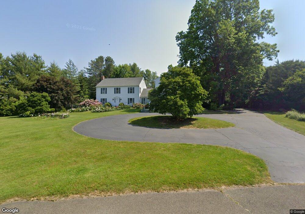
54 Butternut Ln Southport, CT 06890
Estimated Value: $1,869,000 - $2,576,000
6
Beds
5
Baths
4,414
Sq Ft
$483/Sq Ft
Est. Value
About This Home
This home is located at 54 Butternut Ln, Southport, CT 06890 and is currently estimated at $2,132,995, approximately $483 per square foot. 54 Butternut Ln is a home located in Fairfield County with nearby schools including Dwight Elementary School, Roger Ludlowe Middle School, and Fairfield Ludlowe High School.
Ownership History
Date
Name
Owned For
Owner Type
Purchase Details
Closed on
May 15, 1992
Sold by
Hoffman Andrea K
Bought by
Lee Clarence V and Lee Evelyn B
Current Estimated Value
Home Financials for this Owner
Home Financials are based on the most recent Mortgage that was taken out on this home.
Original Mortgage
$330,000
Interest Rate
6.5%
Mortgage Type
Purchase Money Mortgage
Create a Home Valuation Report for This Property
The Home Valuation Report is an in-depth analysis detailing your home's value as well as a comparison with similar homes in the area
Home Values in the Area
Average Home Value in this Area
Purchase History
| Date | Buyer | Sale Price | Title Company |
|---|---|---|---|
| Lee Clarence V | $460,000 | -- |
Source: Public Records
Mortgage History
| Date | Status | Borrower | Loan Amount |
|---|---|---|---|
| Closed | Lee Clarence V | $330,000 |
Source: Public Records
Tax History Compared to Growth
Tax History
| Year | Tax Paid | Tax Assessment Tax Assessment Total Assessment is a certain percentage of the fair market value that is determined by local assessors to be the total taxable value of land and additions on the property. | Land | Improvement |
|---|---|---|---|---|
| 2025 | $25,370 | $893,620 | $411,740 | $481,880 |
| 2024 | $20,413 | $731,640 | $411,740 | $319,900 |
| 2023 | $20,127 | $731,640 | $411,740 | $319,900 |
| 2022 | $19,930 | $731,640 | $411,740 | $319,900 |
| 2021 | $18,287 | $677,800 | $357,900 | $319,900 |
| 2020 | $19,654 | $733,620 | $353,940 | $379,680 |
| 2019 | $19,654 | $733,620 | $353,940 | $379,680 |
| 2018 | $19,338 | $733,620 | $353,940 | $379,680 |
| 2017 | $18,942 | $733,620 | $353,940 | $379,680 |
| 2016 | $18,671 | $733,620 | $353,940 | $379,680 |
| 2015 | $20,059 | $809,140 | $380,600 | $428,540 |
| 2014 | $19,743 | $809,140 | $380,600 | $428,540 |
Source: Public Records
Map
Nearby Homes
- 1213 Cedar Rd
- 1001 Hulls Farm Rd
- 688 Hulls Farm Rd
- 1 Sturges Hwy Unit Lot 1
- 1 Sturges Hwy Unit 2
- 10 Debra Ln
- 125 Old Rd
- 107 Old Rd
- 1 Coastal Ct
- 1135 Mill Hill Rd
- 844 Mill Hill Terrace
- 21 Sturges Commons
- 40 Maple Ave N
- 153 Pease Ave
- 646 Mill Hill Terrace
- 21 Queens Grant Dr
- 476 Mill Hill Terrace
- 6 Bayberry Common
- 220 Lansdowne
- 7 High Gate Rd
- 41 Butternut Ln
- 90 Butternut Ln
- 1076 Hulls Hwy
- 91 Butternut Ln
- 162 Butternut Ln
- 117 Butternut Ln
- 100 Grist Mill Ln
- 1023 Hulls Hwy Unit LANE
- 1023 Hulls Hwy
- 1061 Cedar Rd
- 1090 Hulls Hwy
- 1120 Hulls Hwy
- 165 Butternut Ln
- 165 Butternut Ln Unit A
- 165 Butternut Ln Unit Lot A
- 165 Butternut Ln Unit Lot B
- 135 Butternut Ln
- 20 Sasco River Ln
- 176 Butternut Ln
- 940 Hulls Hwy