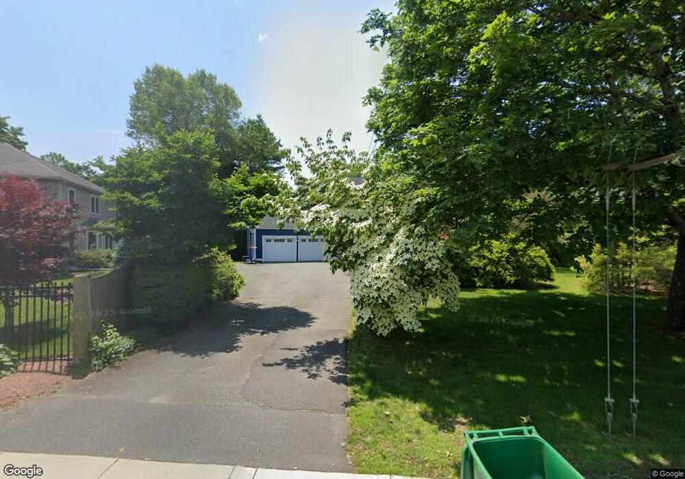
54 High Rock St Westwood, MA 02090
Estimated Value: $1,389,000 - $1,520,000
4
Beds
3
Baths
3,500
Sq Ft
$418/Sq Ft
Est. Value
About This Home
This home is located at 54 High Rock St, Westwood, MA 02090 and is currently estimated at $1,464,582, approximately $418 per square foot. 54 High Rock St is a home located in Norfolk County with nearby schools including Westwood High School, St Catherine Of Siena School, and Xaverian Brothers High School.
Ownership History
Date
Name
Owned For
Owner Type
Purchase Details
Closed on
Jul 17, 2009
Sold by
Shaffer Karen E and Shaffer Hugh D
Bought by
Bril Igor and Kostopulos Helen
Current Estimated Value
Purchase Details
Closed on
Apr 8, 2005
Sold by
Morris Mark J and Morris Marlene E
Bought by
Shaffer Karen E
Purchase Details
Closed on
Nov 6, 1997
Sold by
Scibilia Jeffrey P
Bought by
Morris Mark J and Morris Marlene E
Purchase Details
Closed on
Mar 1, 1995
Sold by
Ja Stivaletta Jr Const
Bought by
Scibilia Jeffrey P
Purchase Details
Closed on
Jun 17, 1993
Sold by
Deviney Edgar P and Deviney Eleanor
Bought by
J A Stivaletta Constr
Create a Home Valuation Report for This Property
The Home Valuation Report is an in-depth analysis detailing your home's value as well as a comparison with similar homes in the area
Home Values in the Area
Average Home Value in this Area
Purchase History
| Date | Buyer | Sale Price | Title Company |
|---|---|---|---|
| Bril Igor | $657,000 | -- | |
| Shaffer Karen E | $775,000 | -- | |
| Morris Mark J | $408,000 | -- | |
| Scibilia Jeffrey P | $358,000 | -- | |
| J A Stivaletta Constr | $242,500 | -- |
Source: Public Records
Mortgage History
| Date | Status | Borrower | Loan Amount |
|---|---|---|---|
| Open | J A Stivaletta Constr | $308,000 | |
| Closed | J A Stivaletta Constr | $310,000 | |
| Closed | J A Stivaletta Constr | $365,000 |
Source: Public Records
Tax History Compared to Growth
Tax History
| Year | Tax Paid | Tax Assessment Tax Assessment Total Assessment is a certain percentage of the fair market value that is determined by local assessors to be the total taxable value of land and additions on the property. | Land | Improvement |
|---|---|---|---|---|
| 2025 | $15,119 | $1,181,200 | $597,200 | $584,000 |
| 2024 | $14,833 | $1,157,900 | $568,800 | $589,100 |
| 2023 | $13,107 | $916,600 | $474,000 | $442,600 |
| 2022 | $12,444 | $839,100 | $419,200 | $419,900 |
| 2021 | $12,572 | $850,600 | $399,200 | $451,400 |
| 2020 | $12,170 | $838,700 | $399,200 | $439,500 |
| 2019 | $11,626 | $793,550 | $380,000 | $413,550 |
| 2018 | $11,527 | $763,900 | $380,000 | $383,900 |
| 2017 | $11,011 | $755,750 | $380,000 | $375,750 |
| 2016 | $10,771 | $734,750 | $380,000 | $354,750 |
| 2015 | $10,321 | $677,250 | $380,000 | $297,250 |
Source: Public Records
Map
Nearby Homes
- 197 Hartford St
- 207 Hartford St
- 60 Warwick Dr
- 49 Fisher St
- 4 Shoestring Ln
- 39 Bayley St
- 36 Kingswood Rd
- 132 Thatcher St
- 401 Sandy Valley Rd
- 20 Longmeadow Dr
- 95 Arcadia Rd
- 618 Nahatan St
- 17 Royal Ct
- 140 Burgess Ave
- 66 Crestwood Cir
- 26 Longmeadow Dr
- 151 Arcadia Rd
- 14 Ruel Dr
- 470 Nahatan St
- 90 Blueberry Ln
- 48 High Rock St
- 48 High Rock St Unit 1
- 106 Hartford St
- 40 High Rock St
- 55 High Rock St
- 34 High Rock St
- 107 Hartford St
- 35 High Rock St
- 91 Hartford St
- 27 High Rock St
- 85 Hartford St Unit 87
- 20 High Rock St
- 19 High Rock St
- 76 Hartford St
- 92 High Rock St
- 168 Hartford St
- 145 Hartford St
- 85-87 Hartford St Unit 85
- 85-87 Hartford St Unit 87
- 71 Hartford St