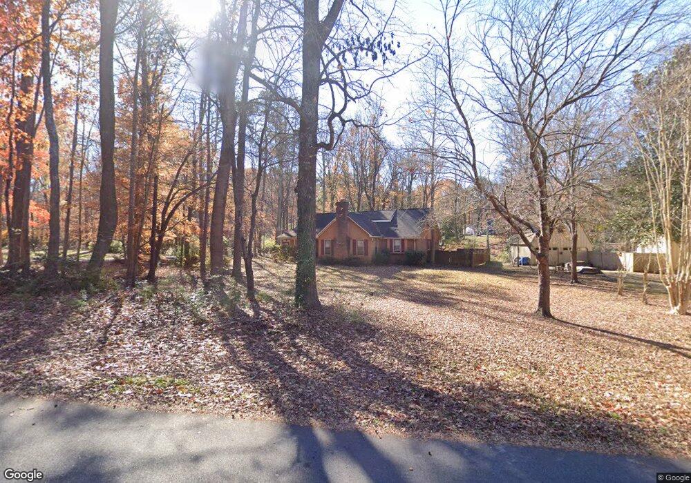
5401 Beaver Dam Ln Mint Hill, NC 28227
Estimated Value: $467,000 - $502,000
3
Beds
2
Baths
2,412
Sq Ft
$201/Sq Ft
Est. Value
About This Home
This home is located at 5401 Beaver Dam Ln, Mint Hill, NC 28227 and is currently estimated at $485,589, approximately $201 per square foot. 5401 Beaver Dam Ln is a home located in Mecklenburg County with nearby schools including Bain Elementary, Mint Hill Middle School, and Independence High.
Ownership History
Date
Name
Owned For
Owner Type
Purchase Details
Closed on
Nov 15, 2002
Sold by
Gillespie Ronald W and Gillespie Linda
Bought by
Brewer John Edward and Brewer Kathy S
Current Estimated Value
Home Financials for this Owner
Home Financials are based on the most recent Mortgage that was taken out on this home.
Original Mortgage
$193,800
Outstanding Balance
$82,547
Interest Rate
6.25%
Mortgage Type
VA
Estimated Equity
$403,042
Create a Home Valuation Report for This Property
The Home Valuation Report is an in-depth analysis detailing your home's value as well as a comparison with similar homes in the area
Home Values in the Area
Average Home Value in this Area
Purchase History
| Date | Buyer | Sale Price | Title Company |
|---|---|---|---|
| Brewer John Edward | $190,000 | -- |
Source: Public Records
Mortgage History
| Date | Status | Borrower | Loan Amount |
|---|---|---|---|
| Open | Brewer John Edward | $193,800 |
Source: Public Records
Tax History Compared to Growth
Tax History
| Year | Tax Paid | Tax Assessment Tax Assessment Total Assessment is a certain percentage of the fair market value that is determined by local assessors to be the total taxable value of land and additions on the property. | Land | Improvement |
|---|---|---|---|---|
| 2025 | $1,481 | $384,900 | $99,000 | $285,900 |
| 2024 | $1,481 | $384,900 | $99,000 | $285,900 |
| 2023 | $1,388 | $384,900 | $99,000 | $285,900 |
| 2022 | $1,126 | $249,300 | $66,000 | $183,300 |
| 2021 | $1,126 | $249,300 | $66,000 | $183,300 |
| 2020 | $1,126 | $249,300 | $66,000 | $183,300 |
| 2019 | $1,120 | $249,300 | $66,000 | $183,300 |
| 2018 | $1,052 | $187,400 | $36,000 | $151,400 |
| 2017 | $1,041 | $187,400 | $36,000 | $151,400 |
| 2016 | $2,055 | $187,400 | $36,000 | $151,400 |
| 2015 | $2,052 | $187,400 | $36,000 | $151,400 |
| 2014 | $2,050 | $187,400 | $36,000 | $151,400 |
Source: Public Records
Map
Nearby Homes
- 6525 Robin Hollow Dr
- 5918 Foxcrest Dr
- 7301 Timber Ridge Dr
- 5900 Oakwielde Ct
- 4401 Quail Ridge Dr
- 5900 Lebanon Rd
- 6545 Old Magnolia Ln
- 8245 Franklin Trail St
- 8237 Franklin Trail St
- 8233 Franklin Trail St
- 5420 Saddlewood Ln
- 8234 Franklin Trail St
- 5344 Saddlewood Ln
- 7410 Canterway Dr
- 4123 Roe Creek Dr
- Banks Plan at Alton Creek
- Woodwright Plan at Alton Creek
- Henderson Plan at Alton Creek
- Allen Plan at Alton Creek
- Maxwell Plan at Alton Creek
- 5409 Beaver Dam Ln
- 5421 Beaver Dam Ln
- 5400 Foxcrest Dr
- 5210 Quail Ridge Dr
- 5412 Foxcrest Dr
- 5200 Quail Ridge Dr
- 5220 Quail Ridge Dr
- 5305 Quail Ridge Dr
- 5424 Foxcrest Dr
- 5122 Quail Ridge Dr
- 5429 Beaver Dam Ln
- 5300 Quail Ridge Dr
- 5500 Foxcrest Dr
- 5420 Beaver Dam Ln
- 5310 Quail Ridge Dr
- 4800 Shea Ln
- 5108 Quail Ridge Dr
- 5051 Quail Ridge Dr
- 5441 Beaver Dam Ln
- 5430 Beaver Dam Ln