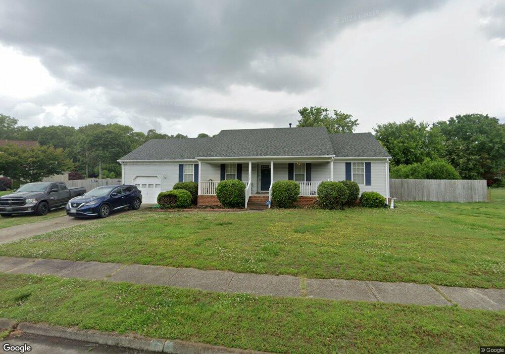
5412 Larkspur Rd Portsmouth, VA 23703
Churchland NeighborhoodEstimated Value: $344,173 - $385,000
4
Beds
2
Baths
1,750
Sq Ft
$210/Sq Ft
Est. Value
About This Home
This home is located at 5412 Larkspur Rd, Portsmouth, VA 23703 and is currently estimated at $367,043, approximately $209 per square foot. 5412 Larkspur Rd is a home located in Portsmouth City with nearby schools including Churchland Elementary School, Churchland Academy Elementary School, and Churchland Middle School.
Ownership History
Date
Name
Owned For
Owner Type
Purchase Details
Closed on
May 30, 2018
Sold by
Payne Lelia S
Bought by
Batchelor Tiffany S and Reed Timothy
Current Estimated Value
Home Financials for this Owner
Home Financials are based on the most recent Mortgage that was taken out on this home.
Original Mortgage
$205,000
Outstanding Balance
$176,917
Interest Rate
4.5%
Mortgage Type
VA
Estimated Equity
$190,126
Create a Home Valuation Report for This Property
The Home Valuation Report is an in-depth analysis detailing your home's value as well as a comparison with similar homes in the area
Home Values in the Area
Average Home Value in this Area
Purchase History
| Date | Buyer | Sale Price | Title Company |
|---|---|---|---|
| Batchelor Tiffany S | $205,000 | Landmark Title Llc |
Source: Public Records
Mortgage History
| Date | Status | Borrower | Loan Amount |
|---|---|---|---|
| Open | Batchelor Tiffany S | $205,000 |
Source: Public Records
Tax History Compared to Growth
Tax History
| Year | Tax Paid | Tax Assessment Tax Assessment Total Assessment is a certain percentage of the fair market value that is determined by local assessors to be the total taxable value of land and additions on the property. | Land | Improvement |
|---|---|---|---|---|
| 2025 | $3,571 | $284,620 | $88,500 | $196,120 |
| 2024 | $3,571 | $276,450 | $88,500 | $187,950 |
| 2023 | $3,149 | $251,930 | $88,500 | $163,430 |
| 2022 | $3,402 | $261,700 | $73,750 | $187,950 |
| 2021 | $3,170 | $243,860 | $60,820 | $183,040 |
| 2020 | $2,963 | $227,890 | $57,920 | $169,970 |
| 2019 | $2,708 | $208,280 | $57,920 | $150,360 |
| 2018 | $2,769 | $213,010 | $57,920 | $155,090 |
| 2017 | $2,769 | $213,010 | $57,920 | $155,090 |
| 2016 | $2,769 | $213,010 | $57,920 | $155,090 |
| 2015 | $2,725 | $209,640 | $57,920 | $151,720 |
| 2014 | $2,662 | $209,640 | $57,920 | $151,720 |
Source: Public Records
Map
Nearby Homes
- 3604 Lilac Dr
- 3315 Camellia Dr
- 5516 Bingham Dr
- 5300 Larkspur Rd
- 10AC Cedar Ln
- 5806 Fawkes St
- 4959 Briarwood Ln
- 4955 Briarwood Ln
- 4008 Oakhurst Rd
- 5911 Dunkirk St
- 3432 Carter Rd
- 3616 Bowden St
- 3509 Spence Rd
- 6002 Campbell St
- 6015 Arthur Ave
- 3433 Willow Breeze Dr
- 6205 Dunkirk St
- 5304 High St W
- 5302 High St W
- 3110 Sterling Way Unit 62
- 3605 Hosiers Oaks Dr
- 5408 Larkspur Rd
- 3601 Hosiers Oaks Dr
- 3609 Hosiers Oaks Dr
- 1 Eaver Ct
- 5405 Larkspur Rd
- 3613 Hosiers Oaks Dr
- 5404 Larkspur Rd
- 2 Eaver Ct
- 3 Eaver Ct
- 3604 Hosiers Oaks Dr
- 3617 Hosiers Oaks Dr
- 3663 Hosiers Oaks Dr
- 3600 Hosiers Oaks Dr
- 3633 Hosiers Oaks Dr
- 3629 Hosiers Oaks Dr
- 3509 Hosiers Oaks Dr
- 3641 Hosiers Oaks Dr
- 3608 Hosiers Oaks Dr
- 3637 Hosiers Oaks Dr