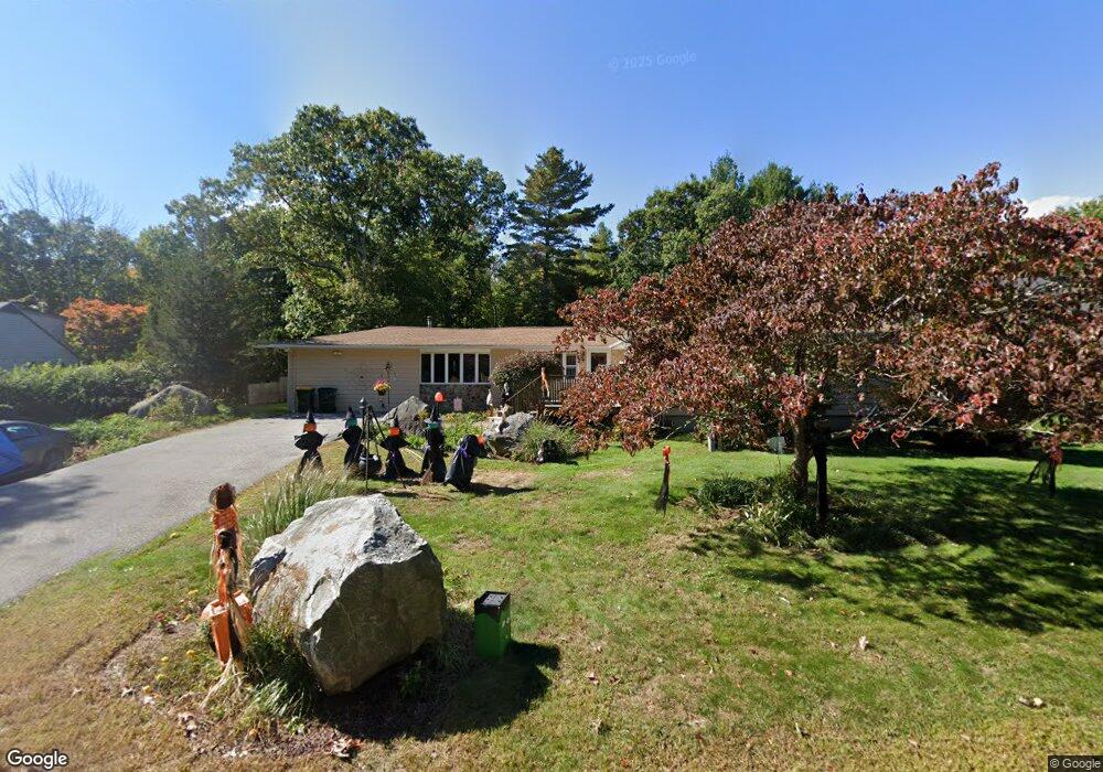
543 Steere Farm Rd Harrisville, RI 02830
Burrillville NeighborhoodEstimated Value: $536,000 - $749,000
4
Beds
2
Baths
1,759
Sq Ft
$340/Sq Ft
Est. Value
About This Home
This home is located at 543 Steere Farm Rd, Harrisville, RI 02830 and is currently estimated at $598,745, approximately $340 per square foot. 543 Steere Farm Rd is a home located in Providence County with nearby schools including Austin T. Levy School, Burrillville Middle School, and Burrillville High School.
Ownership History
Date
Name
Owned For
Owner Type
Purchase Details
Closed on
Oct 25, 2010
Sold by
Parker Kenneth
Bought by
Mitsmenn Timothy G and Richards Patricia A
Current Estimated Value
Home Financials for this Owner
Home Financials are based on the most recent Mortgage that was taken out on this home.
Original Mortgage
$148,467
Interest Rate
4.37%
Mortgage Type
Purchase Money Mortgage
Purchase Details
Closed on
Jan 29, 2004
Sold by
Cline Pamela and Cline Michael
Bought by
Parker Kenneth
Purchase Details
Closed on
Apr 30, 1998
Sold by
Barrett Carolyn R
Bought by
Cline Pamela J
Purchase Details
Closed on
Jun 19, 1992
Sold by
Stokes Alfred R
Bought by
Stokes Carolyn R
Create a Home Valuation Report for This Property
The Home Valuation Report is an in-depth analysis detailing your home's value as well as a comparison with similar homes in the area
Home Values in the Area
Average Home Value in this Area
Purchase History
| Date | Buyer | Sale Price | Title Company |
|---|---|---|---|
| Mitsmenn Timothy G | $193,600 | -- | |
| Parker Kenneth | $258,000 | -- | |
| Cline Pamela J | $120,000 | -- | |
| Stokes Carolyn R | $35,500 | -- |
Source: Public Records
Mortgage History
| Date | Status | Borrower | Loan Amount |
|---|---|---|---|
| Open | Stokes Carolyn R | $175,000 | |
| Closed | Stokes Carolyn R | $148,467 | |
| Previous Owner | Stokes Carolyn R | $240,000 |
Source: Public Records
Tax History Compared to Growth
Tax History
| Year | Tax Paid | Tax Assessment Tax Assessment Total Assessment is a certain percentage of the fair market value that is determined by local assessors to be the total taxable value of land and additions on the property. | Land | Improvement |
|---|---|---|---|---|
| 2025 | $6,080 | $510,900 | $95,200 | $415,700 |
| 2024 | $5,731 | $382,600 | $76,200 | $306,400 |
| 2023 | $5,506 | $382,600 | $76,200 | $306,400 |
| 2022 | $5,322 | $382,600 | $76,200 | $306,400 |
| 2021 | $5,992 | $364,900 | $78,300 | $286,600 |
| 2020 | $5,842 | $364,900 | $78,300 | $286,600 |
| 2019 | $5,838 | $364,900 | $78,300 | $286,600 |
| 2018 | $4,685 | $257,400 | $70,300 | $187,100 |
| 2017 | $4,520 | $257,400 | $70,300 | $187,100 |
| 2016 | $4,476 | $257,400 | $70,300 | $187,100 |
| 2015 | $4,869 | $257,900 | $71,000 | $186,900 |
| 2014 | $4,869 | $257,900 | $71,000 | $186,900 |
Source: Public Records
Map
Nearby Homes
- 0 Steere Farm Rd
- 654 Steere Farm Rd
- 0 Broncos Hwy
- 42 Steere Farm Rd
- 0 Mowry St
- 11 Central St
- 660 Victory Hwy
- 825 Victory Hwy
- 40 Overlook Ln
- 44 Overlook Ln
- 464 Chapel St
- 448 Chapel St
- 211 Whipple Ave
- 0 Griffin St Unit 1387114
- 311 Chapel St
- 33 Slavin Path
- 427 Gazza Rd
- 40 Remington Ave Unit 42
- 459 Gazza Rd
- 361 Chapel St
- 533 Steere Farm Rd
- 555 Steere Farm Rd
- 525 Steere Farm Rd
- 534 Steere Farm Rd
- 520 Steere Farm Rd
- 574 Steere Farm Rd
- 515 Steere Farm Rd
- 504 Steere Farm Rd
- 492 Steere Farm Rd
- 501 Steere Farm Rd
- 483 Steere Farm Rd
- 474 Steere Farm Rd
- 620 Steere Farm Rd
- 467 Steere Farm Rd
- 462 Steere Farm Rd
- 444 Steere Farm Rd
- 575 Steere Farm Rd
- 505 Steere Farm Rd
- 435 Steere Farm Rd
- 421 Steere Farm Rd