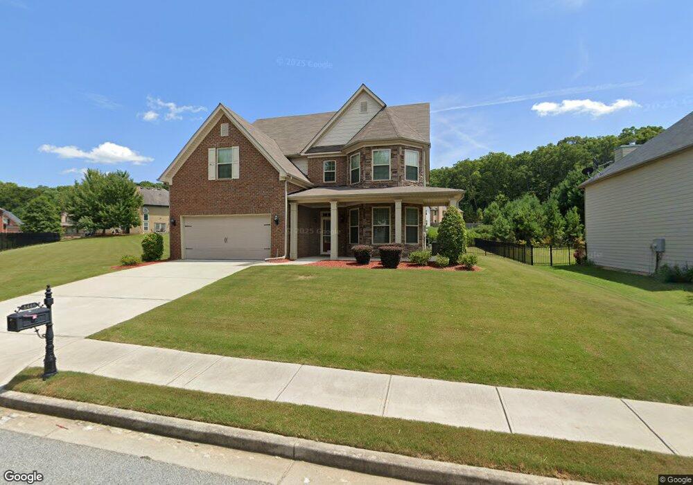
5448 Jamerson Dr Unit 219 Atlanta, GA 30349
Estimated Value: $450,618 - $517,000
5
Beds
3
Baths
3,094
Sq Ft
$156/Sq Ft
Est. Value
About This Home
This home is located at 5448 Jamerson Dr Unit 219, Atlanta, GA 30349 and is currently estimated at $481,905, approximately $155 per square foot. 5448 Jamerson Dr Unit 219 is a home located in Fulton County with nearby schools including Wolf Creek Elementary, Sandtown Middle School, and Langston Hughes High School.
Ownership History
Date
Name
Owned For
Owner Type
Purchase Details
Closed on
Dec 29, 2014
Sold by
Swmbd Llc
Bought by
Williams Nakesha
Current Estimated Value
Home Financials for this Owner
Home Financials are based on the most recent Mortgage that was taken out on this home.
Original Mortgage
$240,458
Outstanding Balance
$184,384
Interest Rate
3.87%
Mortgage Type
FHA
Estimated Equity
$297,521
Purchase Details
Closed on
Jun 16, 2014
Sold by
Ryland Grp Inc
Bought by
Swmbd Llc
Create a Home Valuation Report for This Property
The Home Valuation Report is an in-depth analysis detailing your home's value as well as a comparison with similar homes in the area
Home Values in the Area
Average Home Value in this Area
Purchase History
| Date | Buyer | Sale Price | Title Company |
|---|---|---|---|
| Williams Nakesha | $244,895 | -- | |
| Swmbd Llc | $178,500 | -- |
Source: Public Records
Mortgage History
| Date | Status | Borrower | Loan Amount |
|---|---|---|---|
| Open | Williams Nakesha | $240,458 |
Source: Public Records
Tax History Compared to Growth
Tax History
| Year | Tax Paid | Tax Assessment Tax Assessment Total Assessment is a certain percentage of the fair market value that is determined by local assessors to be the total taxable value of land and additions on the property. | Land | Improvement |
|---|---|---|---|---|
| 2025 | $3,223 | $194,240 | $47,400 | $146,840 |
| 2023 | $4,444 | $157,440 | $29,680 | $127,760 |
| 2022 | $3,039 | $127,720 | $36,440 | $91,280 |
| 2021 | $2,991 | $114,080 | $24,320 | $89,760 |
| 2020 | $2,994 | $111,400 | $19,080 | $92,320 |
| 2019 | $3,014 | $101,480 | $14,960 | $86,520 |
| 2018 | $3,152 | $99,080 | $14,600 | $84,480 |
| 2017 | $2,807 | $85,960 | $12,400 | $73,560 |
| 2016 | $2,806 | $85,960 | $12,400 | $73,560 |
| 2015 | $2,815 | $85,960 | $12,400 | $73,560 |
| 2014 | $430 | $11,720 | $11,720 | $0 |
Source: Public Records
Map
Nearby Homes
- 932 Brookmere Ct
- 4419 Bellwood Cir
- 4482 Hazeltine Dr
- 4480 Old Fairburn Rd
- 4304 Bellwood Cir
- 4320 Union Rd SW
- 4220 Union Rd SW
- 3295 Stonewall Tell Rd
- 4387 Old Fairburn Rd
- 5688 Baffin Rd
- 546100 Stonewall Tell Rd
- 4765 Stonewall Tell Rd
- 4395 Stonewall Tell Rd
- 5611 Rosehall Place
- 5611 Rosehall Place Unit 181
- 5615 Rosehall Place
- 5615 Rosehall Place Unit LOT 182
- 5105 Highland Lake Dr
- 4132 Thronbud Rd
- 4132 Thronbud Rd Unit LOT 124
- 5448 Jamerson Dr
- 949 Brookmere Ct
- 5452 Jamerson Dr
- 5452 Jamerson Dr Unit 218
- 5456 Jamerson Dr
- 5456 Jamerson Dr Unit 217
- 5451 Jamerson Dr
- 5447 Jamerson Dr
- 953 Brookmere Ct
- 5457 Jamerson Dr
- 5443 Jamerson Dr
- 957 Brookmere Ct
- 945 Brookmere Ct
- 961 Brookmere Ct
- 5439 Jamerson Dr
- 965 Brookmere Ct
- 5435 Jamerson Dr
- 952 Brookmere Ct
- 5464 Jamerson Dr
- 5464 Jamerson Dr Unit 216