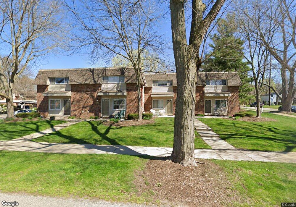
545 Longshore Dr Unit A Ann Arbor, MI 48105
Northern Ann Arbor NeighborhoodEstimated Value: $269,000 - $279,000
2
Beds
1
Bath
800
Sq Ft
$344/Sq Ft
Est. Value
About This Home
This home is located at 545 Longshore Dr Unit A, Ann Arbor, MI 48105 and is currently estimated at $274,933, approximately $343 per square foot. 545 Longshore Dr Unit A is a home located in Washtenaw County with nearby schools including Ann Arbor STEAM at Northside, Clague Middle School, and Skyline High School.
Ownership History
Date
Name
Owned For
Owner Type
Purchase Details
Closed on
Oct 16, 2023
Sold by
Moreno Isabel
Bought by
Irunia Llc
Current Estimated Value
Purchase Details
Closed on
Nov 8, 2010
Sold by
Fischer Markus and Moreno Isabel
Bought by
Moreno Isabel and Isabel Moreno Revocable Trust
Purchase Details
Closed on
Jul 31, 2001
Sold by
Lyons Timothy David
Bought by
Fischer Markus
Create a Home Valuation Report for This Property
The Home Valuation Report is an in-depth analysis detailing your home's value as well as a comparison with similar homes in the area
Home Values in the Area
Average Home Value in this Area
Purchase History
| Date | Buyer | Sale Price | Title Company |
|---|---|---|---|
| Irunia Llc | -- | None Listed On Document | |
| Moreno Isabel | -- | None Listed On Document | |
| Moreno Isabel | -- | None Available | |
| Fischer Markus | $115,000 | -- |
Source: Public Records
Tax History Compared to Growth
Tax History
| Year | Tax Paid | Tax Assessment Tax Assessment Total Assessment is a certain percentage of the fair market value that is determined by local assessors to be the total taxable value of land and additions on the property. | Land | Improvement |
|---|---|---|---|---|
| 2025 | $3,898 | $109,300 | $0 | $0 |
| 2024 | $3,275 | $107,300 | $0 | $0 |
| 2023 | $3,024 | $102,400 | $0 | $0 |
| 2022 | $3,660 | $97,600 | $0 | $0 |
| 2021 | $3,557 | $93,200 | $0 | $0 |
| 2020 | $3,445 | $91,300 | $0 | $0 |
| 2019 | $3,286 | $81,300 | $81,300 | $0 |
| 2018 | $3,224 | $76,200 | $0 | $0 |
| 2017 | $3,110 | $65,100 | $0 | $0 |
| 2016 | $3,030 | $48,979 | $0 | $0 |
| 2015 | $2,906 | $48,833 | $0 | $0 |
| 2014 | $2,906 | $47,308 | $0 | $0 |
| 2013 | -- | $47,308 | $0 | $0 |
Source: Public Records
Map
Nearby Homes
- 519 Longshore Dr Unit A
- 1136 Longshore Dr Unit 1
- 1128 Longshore Dr Unit 1
- 1128 Longshore Dr Unit 2
- 539 Longshore Dr Unit 46
- 408 Longshore Dr Unit C
- 408 Longshore Dr Unit A
- 117 E Summit St
- 207 Sunset Rd
- 209 Sunset Rd
- 1183 Freesia Ct Unit 52
- 651 N 5th Ave
- 530 N Division St Unit B
- 530 N Division St Unit A
- 530 N Division St Unit D
- 530 N Division St Unit C
- 118 W Summit St
- 610 N 5th Ave
- 1050 Wall St Unit 5A
- 1050 Wall St Unit 4A
- 545 Longshore Dr Unit B
- 545 Longshore Dr
- 541b Longshore Dr Unit 5
- 0 Longshore Drive #B Unit 3259001
- 541 Longshore Dr Unit B DR
- 541 Longshore Dr Unit B
- 541 Longshore Dr Unit A
- 541 Longshore Dr Unit : B
- 541 Longshore Dr
- 547 Longshore Dr Unit B
- 547 Longshore Dr Unit B
- 547 Longshore Dr Unit A
- 547 Longshore Dr
- 547 Longshore Dr Unit 6
- 543 Longshore Dr Unit A
- 543 Longshore Dr Unit B
- 543 Longshore Dr Unit : B
- 543 Longshore Dr
- 547 Longshore Dr Apt A Dr
- 541 Longshore Unit B Dr