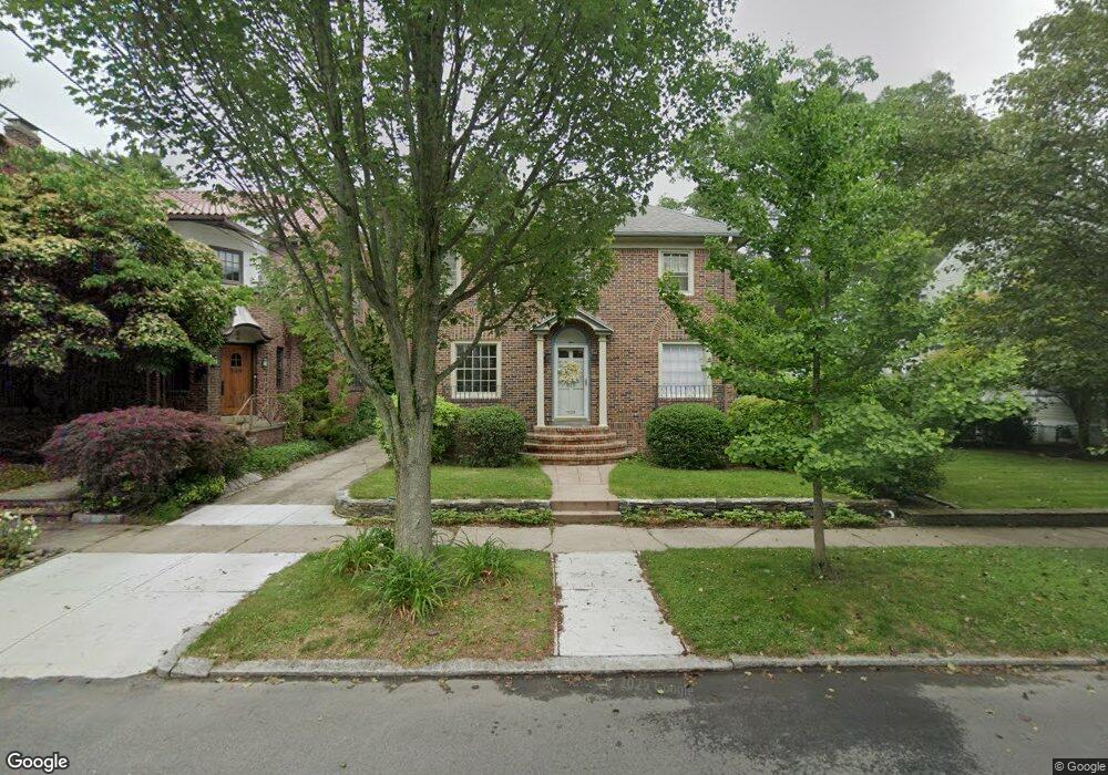
545 Wayland Ave Providence, RI 02906
Blackstone NeighborhoodEstimated Value: $911,000 - $1,144,000
4
Beds
3
Baths
2,201
Sq Ft
$457/Sq Ft
Est. Value
About This Home
This home is located at 545 Wayland Ave, Providence, RI 02906 and is currently estimated at $1,006,157, approximately $457 per square foot. 545 Wayland Ave is a home located in Providence County with nearby schools including Asa Messer Elementary School, Charles N. Fortes Elementary School, and Veazie Street Elementary School.
Ownership History
Date
Name
Owned For
Owner Type
Purchase Details
Closed on
Jul 15, 2005
Sold by
Deluca Paul M and Deluca Kerry G
Bought by
Martinez Robert E and Castiglione Caroline F
Current Estimated Value
Purchase Details
Closed on
Nov 3, 2000
Sold by
Jessell Jack A
Bought by
Deluca Paul M and Deluca Kerry G
Create a Home Valuation Report for This Property
The Home Valuation Report is an in-depth analysis detailing your home's value as well as a comparison with similar homes in the area
Home Values in the Area
Average Home Value in this Area
Purchase History
| Date | Buyer | Sale Price | Title Company |
|---|---|---|---|
| Martinez Robert E | $488,000 | -- | |
| Deluca Paul M | $281,000 | -- |
Source: Public Records
Mortgage History
| Date | Status | Borrower | Loan Amount |
|---|---|---|---|
| Open | Deluca Paul M | $55,000 | |
| Open | Deluca Paul M | $406,700 |
Source: Public Records
Tax History Compared to Growth
Tax History
| Year | Tax Paid | Tax Assessment Tax Assessment Total Assessment is a certain percentage of the fair market value that is determined by local assessors to be the total taxable value of land and additions on the property. | Land | Improvement |
|---|---|---|---|---|
| 2025 | $13,267 | $908,700 | $484,500 | $424,200 |
| 2024 | $13,080 | $712,800 | $306,800 | $406,000 |
| 2023 | $13,080 | $712,800 | $306,800 | $406,000 |
| 2022 | $12,688 | $712,800 | $306,800 | $406,000 |
| 2021 | $12,292 | $500,500 | $231,700 | $268,800 |
| 2020 | $12,292 | $500,500 | $231,700 | $268,800 |
| 2019 | $12,292 | $500,500 | $231,700 | $268,800 |
| 2018 | $14,487 | $453,300 | $216,400 | $236,900 |
| 2017 | $14,487 | $453,300 | $216,400 | $236,900 |
| 2016 | $14,487 | $453,300 | $216,400 | $236,900 |
| 2015 | $14,097 | $425,900 | $202,000 | $223,900 |
| 2014 | $14,374 | $425,900 | $202,000 | $223,900 |
| 2013 | $14,374 | $425,900 | $202,000 | $223,900 |
Source: Public Records
Map
Nearby Homes
- 140 Freeman Pkwy
- 294 Cole Ave
- 296 Cole Ave
- 360 Taber Ave
- 41 Stadium Rd
- 189 Laurel Ave Unit 189
- 160 Slater Ave
- 188 Blackstone Blvd
- 80 Clarendon Ave
- 15 Taft Ave
- 201 Arlington Ave
- 234 President Ave Unit 16
- 22 Miles Ave Unit 1
- 94 Larch St
- 125 Taber Ave
- 134 Irving Ave
- 428 Hope St
- 184 Irving Ave Unit 1
- 436 Blackstone Blvd
- 31 Mount Hope Ave
- 549 Wayland Ave
- 535 Wayland Ave
- 46 Alton Rd
- 553 Wayland Ave
- 56 Alton Rd
- 531 Wayland Ave
- 546 Wayland Ave
- 550 Wayland Ave
- 36 Alton Rd
- 536 Wayland Ave
- 554 Wayland Ave
- 563 Wayland Ave Unit 2
- 563 Wayland Ave
- 563 Wayland Ave Unit 1
- 523 Wayland Ave
- 560 Wayland Ave
- 66 Alton Rd
- 160 Emeline St
- 567 Wayland Ave
- 173 Sessions St