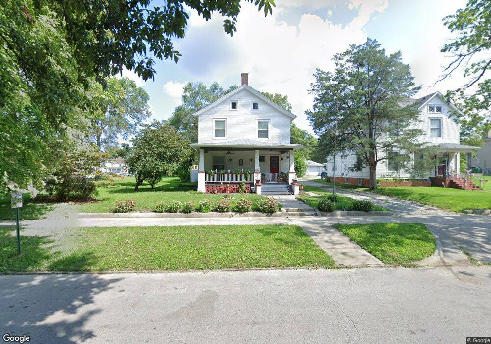
546 W William St Decatur, IL 62522
Millikin Home NeighborhoodEstimated Value: $81,000 - $103,985
4
Beds
2
Baths
3,360
Sq Ft
$27/Sq Ft
Est. Value
About This Home
This home is located at 546 W William St, Decatur, IL 62522 and is currently estimated at $91,496, approximately $27 per square foot. 546 W William St is a home located in Macon County with nearby schools including Dennis Lab School, St. Patrick School, and Teen Challenge-Home For Girls.
Ownership History
Date
Name
Owned For
Owner Type
Purchase Details
Closed on
Sep 1, 2005
Sold by
Hood Jason
Bought by
Tinker Brandon Z and Tinker Elizabeth M
Current Estimated Value
Home Financials for this Owner
Home Financials are based on the most recent Mortgage that was taken out on this home.
Original Mortgage
$107,257
Outstanding Balance
$57,491
Interest Rate
5.88%
Mortgage Type
VA
Estimated Equity
$34,005
Purchase Details
Closed on
Aug 9, 2005
Sold by
Potter P Duane and Potter Lynn H
Bought by
Hod Jason
Home Financials for this Owner
Home Financials are based on the most recent Mortgage that was taken out on this home.
Original Mortgage
$107,257
Outstanding Balance
$57,491
Interest Rate
5.88%
Mortgage Type
VA
Estimated Equity
$34,005
Purchase Details
Closed on
Jul 1, 2002
Create a Home Valuation Report for This Property
The Home Valuation Report is an in-depth analysis detailing your home's value as well as a comparison with similar homes in the area
Home Values in the Area
Average Home Value in this Area
Purchase History
| Date | Buyer | Sale Price | Title Company |
|---|---|---|---|
| Tinker Brandon Z | $105,000 | None Available | |
| Hod Jason | $100,000 | None Available | |
| -- | $18,500 | -- |
Source: Public Records
Mortgage History
| Date | Status | Borrower | Loan Amount |
|---|---|---|---|
| Open | Tinker Brandon Z | $107,257 | |
| Previous Owner | Hod Jason | $107,257 |
Source: Public Records
Tax History Compared to Growth
Tax History
| Year | Tax Paid | Tax Assessment Tax Assessment Total Assessment is a certain percentage of the fair market value that is determined by local assessors to be the total taxable value of land and additions on the property. | Land | Improvement |
|---|---|---|---|---|
| 2024 | $2,431 | $31,108 | $2,807 | $28,301 |
| 2023 | $2,389 | $30,007 | $2,708 | $27,299 |
| 2022 | $2,178 | $27,298 | $2,037 | $25,261 |
| 2021 | $2,006 | $25,493 | $1,902 | $23,591 |
| 2020 | $1,947 | $24,310 | $1,814 | $22,496 |
| 2019 | $1,947 | $24,310 | $1,814 | $22,496 |
| 2018 | $1,932 | $24,390 | $1,820 | $22,570 |
| 2017 | $1,994 | $25,041 | $1,869 | $23,172 |
| 2016 | $2,039 | $25,296 | $1,888 | $23,408 |
| 2015 | $1,927 | $24,849 | $1,855 | $22,994 |
| 2014 | $1,783 | $24,603 | $1,837 | $22,766 |
| 2013 | $1,864 | $25,527 | $1,906 | $23,621 |
Source: Public Records
Map
Nearby Homes
- 422 W William St
- 609 W William St
- 452 W Prairie Ave
- 442 W Prairie Ave
- 233 N Edward St
- 330 W William St
- 366 W Prairie Ave
- 254 N Pine St
- 717 W Prairie Ave Unit 2
- 875 N Monroe St
- 281 W Prairie Ave
- 320 W Main St
- 415 W Green St
- 657 W Wood St
- 450 W Macon St
- 612 W Macon St
- 958 W William St
- 440 W Macon St
- 844 N Edward St
- 899 W Main St
- 536 W William St
- 570 W William St
- 334 N Monroe St
- 549 W North St
- 340 N Monroe St Unit 340 N Monroe 3
- 340 N Monroe St Unit 340 N Monroe 5
- 340 N Monroe St
- 539 W William St
- 355 N College St
- 510 W William St
- 521 W William St
- 559 W William St
- 555 W William St
- 545 W William St
- 605 W William St
- 259 N College St
- 250 N Monroe St
- 550 W North St
- 361 N College St
- 560 W North St