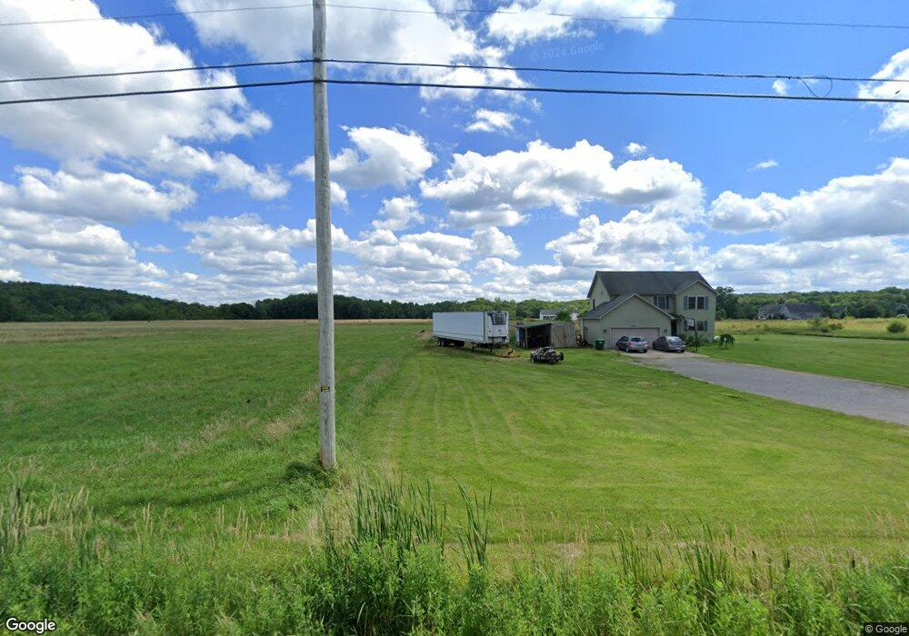
5461 Crane Rd Edinboro, PA 16412
Estimated Value: $409,000 - $478,000
4
Beds
3
Baths
1,926
Sq Ft
$223/Sq Ft
Est. Value
About This Home
This home is located at 5461 Crane Rd, Edinboro, PA 16412 and is currently estimated at $429,791, approximately $223 per square foot. 5461 Crane Rd is a home located in Erie County with nearby schools including Edinboro Elementary School, James W. Parker Middle School, and General McLane High School.
Ownership History
Date
Name
Owned For
Owner Type
Purchase Details
Closed on
Nov 12, 2010
Sold by
Flick Sandy M
Bought by
Singh Sukhdeep and Kaur Maninder
Current Estimated Value
Home Financials for this Owner
Home Financials are based on the most recent Mortgage that was taken out on this home.
Original Mortgage
$202,455
Outstanding Balance
$133,441
Interest Rate
4.25%
Mortgage Type
FHA
Estimated Equity
$296,350
Purchase Details
Closed on
Sep 25, 2009
Sold by
Burbules George J
Bought by
Flick Sandy M
Create a Home Valuation Report for This Property
The Home Valuation Report is an in-depth analysis detailing your home's value as well as a comparison with similar homes in the area
Home Values in the Area
Average Home Value in this Area
Purchase History
| Date | Buyer | Sale Price | Title Company |
|---|---|---|---|
| Singh Sukhdeep | $220,000 | None Available | |
| Flick Sandy M | $30,000 | None Available |
Source: Public Records
Mortgage History
| Date | Status | Borrower | Loan Amount |
|---|---|---|---|
| Open | Singh Sukhdeep | $202,455 |
Source: Public Records
Tax History Compared to Growth
Tax History
| Year | Tax Paid | Tax Assessment Tax Assessment Total Assessment is a certain percentage of the fair market value that is determined by local assessors to be the total taxable value of land and additions on the property. | Land | Improvement |
|---|---|---|---|---|
| 2025 | $4,699 | $205,910 | $51,700 | $154,210 |
| 2024 | $4,551 | $205,910 | $51,700 | $154,210 |
| 2023 | $4,283 | $205,910 | $51,700 | $154,210 |
| 2022 | $4,159 | $205,910 | $51,700 | $154,210 |
| 2021 | $4,106 | $205,910 | $51,700 | $154,210 |
| 2020 | $4,054 | $205,910 | $51,700 | $154,210 |
| 2019 | $4,028 | $205,910 | $51,700 | $154,210 |
| 2018 | $3,941 | $205,910 | $51,700 | $154,210 |
| 2017 | $3,941 | $205,910 | $51,700 | $154,210 |
| 2016 | $4,859 | $205,910 | $51,700 | $154,210 |
| 2015 | $4,808 | $205,910 | $51,700 | $154,210 |
| 2014 | $2,236 | $205,910 | $51,700 | $154,210 |
Source: Public Records
Map
Nearby Homes
- 0 Shenango Dr Unit 3 181852
- 0 Shenango Dr Unit 1
- 0 Shenango Dr
- 0 Dr Unit 175829
- 12180 Angling Rd
- 12191 Skyview Dr
- 12261 Lay Rd
- 5438 Walters Ave
- 12241 Lakeview Dr
- 12281 Lay Rd
- 113 Cherry St
- 214 Maple St
- 0 Ymca Dr
- 5732 Obed Heights Dr
- 5453 Woodlawn Dr
- 205 Washington St
- 111 Washington St
- 0 Beach Ave Extension Unit 1682668
- 12356 Culbertson Dr
- 0 6n Route Unit 187309
- 12015 Lay Rd
- 5491 Crane Rd
- 5421 Crane Rd
- 12041 Lay Rd
- 12051 Lay Rd
- 12055 Lay Rd
- 11941 Lay Rd
- 12061 Lay Rd
- 5520 Crane Rd
- 11860 Lay Rd
- 2008 Creekside Dr
- 2012 Creekside Dr
- 0 Creekside Dr
- 2006 Creekside Dr
- 2014 Creekside Dr
- 2014 Creekside Rental
- 2009 Creekside Dr
- 12069 Lay Rd
- 2016 Creekside Dr
- 5345 Crane Rd