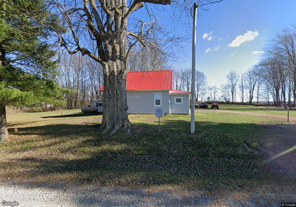
5481 County Road 98 Mount Gilead, OH 43338
Estimated Value: $194,000 - $389,000
3
Beds
1
Bath
1,414
Sq Ft
$201/Sq Ft
Est. Value
About This Home
This home is located at 5481 County Road 98, Mount Gilead, OH 43338 and is currently estimated at $284,069, approximately $200 per square foot. 5481 County Road 98 is a home located in Morrow County with nearby schools including Northmor Elementary School and Northmor High School.
Ownership History
Date
Name
Owned For
Owner Type
Purchase Details
Closed on
Oct 1, 2019
Sold by
Dye Rodger F and Dye Rodger
Bought by
Dye Kurt A
Current Estimated Value
Purchase Details
Closed on
Jul 2, 2019
Sold by
Dye Gary and Dye Gary D
Bought by
Smith Judith and Dye Rodger
Purchase Details
Closed on
Oct 19, 2018
Sold by
Dye Gary
Bought by
Dye Rodger and Dye Judith Smith
Purchase Details
Closed on
Jan 16, 1985
Bought by
Dye Gary
Create a Home Valuation Report for This Property
The Home Valuation Report is an in-depth analysis detailing your home's value as well as a comparison with similar homes in the area
Home Values in the Area
Average Home Value in this Area
Purchase History
| Date | Buyer | Sale Price | Title Company |
|---|---|---|---|
| Dye Kurt A | $31,050 | -- | |
| Smith Judith | -- | -- | |
| Dye Rodger | -- | -- | |
| Dye Gary | $20,000 | -- |
Source: Public Records
Tax History Compared to Growth
Tax History
| Year | Tax Paid | Tax Assessment Tax Assessment Total Assessment is a certain percentage of the fair market value that is determined by local assessors to be the total taxable value of land and additions on the property. | Land | Improvement |
|---|---|---|---|---|
| 2024 | $1,888 | $47,850 | $13,300 | $34,550 |
| 2023 | $1,888 | $47,850 | $13,300 | $34,550 |
| 2022 | $1,377 | $30,700 | $8,510 | $22,190 |
| 2021 | $1,364 | $30,700 | $8,510 | $22,190 |
| 2020 | $1,366 | $30,700 | $8,510 | $22,190 |
| 2019 | $1,240 | $27,170 | $7,530 | $19,640 |
| 2018 | $1,240 | $27,170 | $7,530 | $19,640 |
| 2017 | $1,211 | $27,170 | $7,530 | $19,640 |
| 2016 | $1,110 | $25,100 | $6,580 | $18,520 |
| 2015 | $1,044 | $25,100 | $6,580 | $18,520 |
| 2014 | $1,062 | $25,100 | $6,580 | $18,520 |
| 2013 | $1,031 | $26,430 | $6,930 | $19,500 |
Source: Public Records
Map
Nearby Homes
- 5615 County Road 98
- 5953 County Road 109
- 00 County Road 98 Unit Lot B
- 000 County Road 98 Unit Lot C
- 0 County Road 98 Unit Lot A
- 6043 Township Road 87
- 0 State Route 61 Unit 9066611
- 6351 U S 42
- 6528 Township Road 14
- VL Twp Rd 165
- 6410 Township Road 84
- 7326 State Route 19 Unit 1 Lots 62-63
- 7326 State Route 19 Unit 6 Lots 90 91 92
- 6530 U S 42
- 5343 State Route 95
- 5491 Township Road 14
- 5545 County Road 240-Bryn Zion Rd
- 6713 U S 42
- 5329 Township Road 115
- 7000 Township Road 85
- 5491 County Road 98
- 5491 Co Road 98
- 5491 County Road 98
- 5519 County Road 98
- 5529 County Road 98
- 5520 County Road 98
- 5520 County Road 98
- 5545 County Road 98
- 5517 Township Road 117
- 5518 Township Road 96
- 5548 Township Road 96
- 5538 Township Road 117
- 5538 Township Road 117
- 5695 County Road 98
- 5665 County Road 98
- 5665 County Road 98
- 5534 Township Road 117
- 5695 County Road 98
- 5548 Twp 96 Rd
- 5575 County Road 98