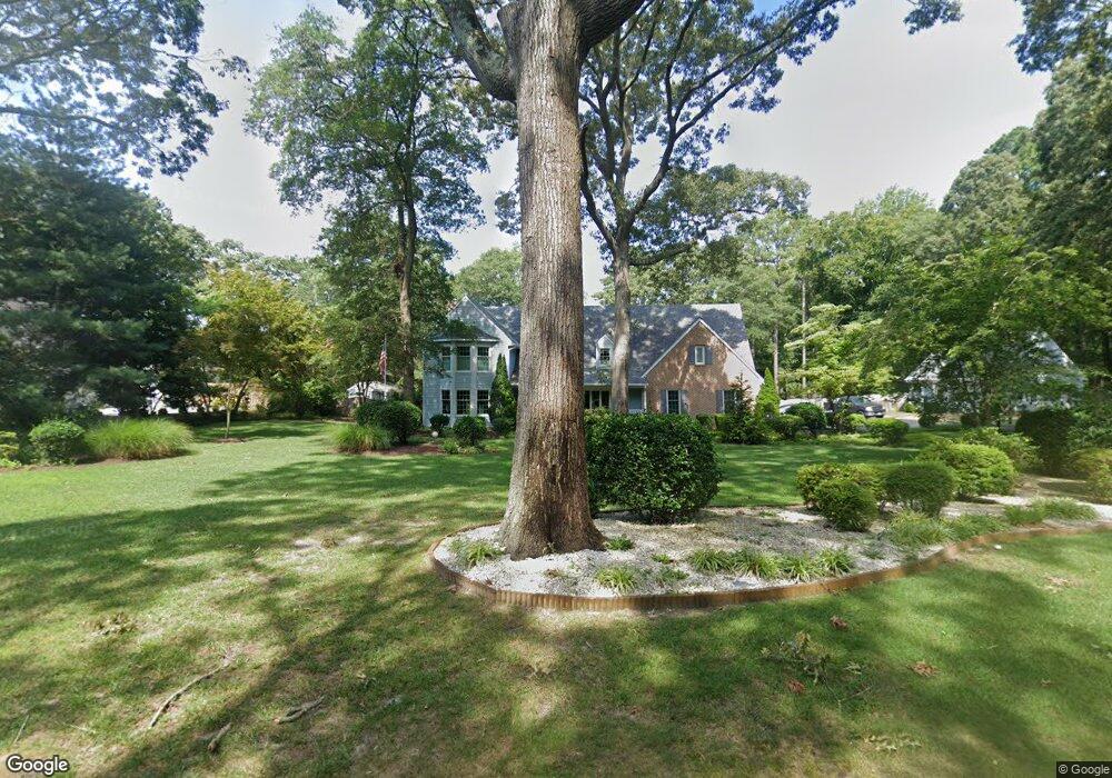
5486 Nithsdale Dr Salisbury, MD 21801
South Salisbury NeighborhoodEstimated Value: $800,051 - $907,000
--
Bed
4
Baths
4,626
Sq Ft
$186/Sq Ft
Est. Value
About This Home
This home is located at 5486 Nithsdale Dr, Salisbury, MD 21801 and is currently estimated at $862,017, approximately $186 per square foot. 5486 Nithsdale Dr is a home located in Wicomico County with nearby schools including Westside Primary School, Westside Intermediate School, and Salisbury Middle School.
Ownership History
Date
Name
Owned For
Owner Type
Purchase Details
Closed on
Jun 4, 2003
Sold by
Panganiban Alan S
Bought by
Sniezek James H and Sniezek Colleen
Current Estimated Value
Purchase Details
Closed on
Jan 25, 1994
Sold by
Gibbs William A and Gibbs Julianne
Bought by
Panganiban Alan S
Purchase Details
Closed on
May 21, 1986
Sold by
Purnell John R
Bought by
Gibbs William A and Gibbs Julianne
Create a Home Valuation Report for This Property
The Home Valuation Report is an in-depth analysis detailing your home's value as well as a comparison with similar homes in the area
Home Values in the Area
Average Home Value in this Area
Purchase History
| Date | Buyer | Sale Price | Title Company |
|---|---|---|---|
| Sniezek James H | $595,000 | -- | |
| Panganiban Alan S | $525,000 | -- | |
| Gibbs William A | $45,000 | -- |
Source: Public Records
Mortgage History
| Date | Status | Borrower | Loan Amount |
|---|---|---|---|
| Closed | Sniezek James H | -- |
Source: Public Records
Tax History Compared to Growth
Tax History
| Year | Tax Paid | Tax Assessment Tax Assessment Total Assessment is a certain percentage of the fair market value that is determined by local assessors to be the total taxable value of land and additions on the property. | Land | Improvement |
|---|---|---|---|---|
| 2025 | $5,314 | $608,100 | $0 | $0 |
| 2024 | $5,314 | $564,000 | $0 | $0 |
| 2023 | $5,200 | $519,900 | $101,200 | $418,700 |
| 2022 | $5,257 | $515,933 | $0 | $0 |
| 2021 | $5,296 | $511,967 | $0 | $0 |
| 2020 | $5,299 | $508,000 | $101,200 | $406,800 |
| 2019 | $5,197 | $496,533 | $0 | $0 |
| 2018 | $5,041 | $485,067 | $0 | $0 |
| 2017 | $4,639 | $473,600 | $0 | $0 |
| 2016 | -- | $445,367 | $0 | $0 |
| 2015 | $4,247 | $417,133 | $0 | $0 |
| 2014 | $4,247 | $388,900 | $0 | $0 |
Source: Public Records
Map
Nearby Homes
- 5437 Nithsdale Dr
- 5461 Loch Ness Terrace
- 5474 Royal Mile Blvd
- 5541 E Nithsdale Dr
- 5686 N Nithsdale Dr Unit N
- 5709 Royal Mile Blvd
- 0 King Stuart Dr Unit MDWC2018516
- 5688 Kirkpatrick Ct
- 26694 Pemberton Dr
- 5079 Old Mill Branch Rd
- 26882 Pratt Rd
- 5973 Smithys Ln
- 5991 Hounds Bay Cir
- 6058 Gloucester Ct
- 4916 Old Mill Branch Rd
- 5088 Sailfish Dr
- 6151 Trails End Ct
- 27620 Appaloosa Dr
- 26924 Black Horse Run
- 6229 Ayrshire Dr
- 5456 Nithsdale Dr
- 5479 Nithsdale Dr
- 5465 Nithsdale Dr
- 5452 Nithsdale Dr
- 5493 Nithsdale Dr
- 5512 Nithsdale Dr
- 5461 Nithsdale Dr
- 5507 Nithsdale Dr
- 5440 Nithsdale Dr
- 5528 Nithsdale Dr
- 27080 Sand Trap Ct
- 0 Tartan Ln Unit 1000836988
- 0 Tartan Ln Unit 1001560920
- 0 Tartan Ln Unit 1009300050
- 5470 Saint Andrews Dr
- 27070 Sand Trap Ct
- 5476 Saint Andrews Dr
- Lot 14 Nithsdale Dr
- 5484 Saint Andrews Dr
- 5434 Nithsdale Dr