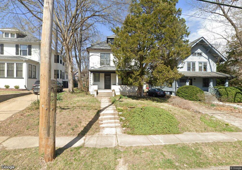
549 Sunnyside Ave Saint Louis, MO 63119
Estimated Value: $479,386 - $622,000
4
Beds
2
Baths
1,911
Sq Ft
$288/Sq Ft
Est. Value
About This Home
This home is located at 549 Sunnyside Ave, Saint Louis, MO 63119 and is currently estimated at $550,847, approximately $288 per square foot. 549 Sunnyside Ave is a home located in St. Louis County with nearby schools including Avery Elementary School, Hixson Middle School, and Webster Groves High School.
Ownership History
Date
Name
Owned For
Owner Type
Purchase Details
Closed on
Aug 31, 2020
Sold by
Tennant Karen L and Shirley F Kirby Trust
Bought by
Till Judith F
Current Estimated Value
Purchase Details
Closed on
Feb 19, 2020
Sold by
Thomas Chester E
Bought by
Till Judith F
Purchase Details
Closed on
Jan 29, 2020
Sold by
Thomas Chester E and Estate Of Marion F Thomas
Bought by
Thomas Chester E
Purchase Details
Closed on
Feb 19, 2010
Sold by
Kirby Shirley F
Bought by
Shirley F Kirby Trust
Create a Home Valuation Report for This Property
The Home Valuation Report is an in-depth analysis detailing your home's value as well as a comparison with similar homes in the area
Home Values in the Area
Average Home Value in this Area
Purchase History
| Date | Buyer | Sale Price | Title Company |
|---|---|---|---|
| Till Judith F | -- | None Available | |
| Till Judith F | -- | None Listed On Document | |
| Till Judith F | -- | None Available | |
| Thomas Chester E | -- | None Available | |
| Shirley F Kirby Trust | -- | None Available |
Source: Public Records
Tax History Compared to Growth
Tax History
| Year | Tax Paid | Tax Assessment Tax Assessment Total Assessment is a certain percentage of the fair market value that is determined by local assessors to be the total taxable value of land and additions on the property. | Land | Improvement |
|---|---|---|---|---|
| 2025 | $4,509 | $84,150 | $66,500 | $17,650 |
| 2024 | $4,509 | $64,690 | $41,550 | $23,140 |
| 2023 | $4,509 | $64,690 | $41,550 | $23,140 |
| 2022 | $3,714 | $49,610 | $33,270 | $16,340 |
| 2021 | $3,701 | $49,610 | $33,270 | $16,340 |
| 2020 | $4,251 | $53,180 | $33,270 | $19,910 |
| 2019 | $4,221 | $53,180 | $33,270 | $19,910 |
| 2018 | $3,471 | $38,740 | $23,290 | $15,450 |
| 2017 | $3,448 | $38,740 | $23,290 | $15,450 |
| 2016 | $3,337 | $35,910 | $19,950 | $15,960 |
| 2015 | $3,348 | $35,910 | $19,950 | $15,960 |
| 2014 | $3,614 | $37,740 | $15,300 | $22,440 |
Source: Public Records
Map
Nearby Homes
- 400 Marion Ave
- 544 Summit Ave
- 808 Greeley Ave
- 619 N Bompart Ave
- 441 Park Rd
- 610 Cornelia Ave
- 450 E Lockwood Ave Unit 303
- 946 Newport Ave
- 716 Clark Ave
- 7826 Grove Ave
- 7723 Suffolk Ave
- 554 N Laclede Station Rd
- 570 N Laclede Station Rd
- 4 Saint Charles Place
- 6 Saint Charles Place
- 25 Saint Charles Place
- 5000 Wilshusen Ave
- 840 Marshall Ave
- 8361 Big Bend Blvd
- 940 Brookside Ave
- 545 Sunnyside Ave
- 553 Sunnyside Ave
- 541 Sunnyside Ave
- 0Lots1-16 Sunnyside Ave
- 601 Sunnyside Ave
- 546 Oakwood Ave
- 533 Sunnyside Ave
- 548 Oakwood Ave
- 540 Oakwood Ave
- 603 Sunnyside Ave
- 546 Sunnyside Ave
- 536 Oakwood Ave
- 602 Oakwood Ave
- 542 Sunnyside Ave
- 529 Sunnyside Ave
- 606 Oakwood Ave
- 130 Summit Ave
- 534 Oakwood Ave
- 538 Sunnyside Ave
- 609 Sunnyside Ave