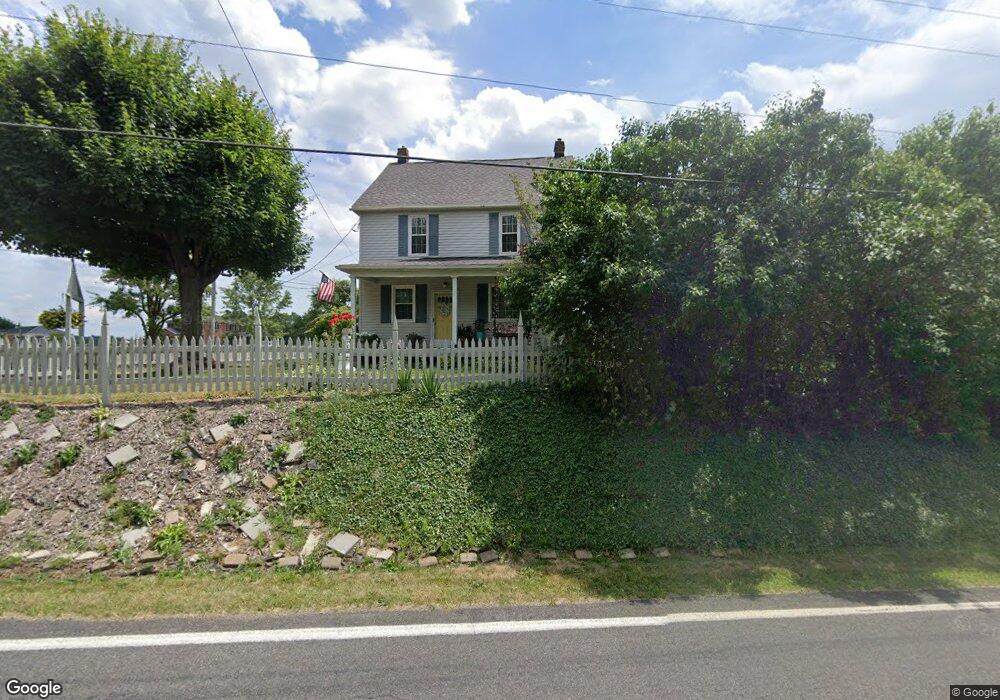
5490 Meese Rd NE Louisville, OH 44641
Estimated Value: $241,000 - $282,000
3
Beds
1
Bath
1,456
Sq Ft
$180/Sq Ft
Est. Value
About This Home
This home is located at 5490 Meese Rd NE, Louisville, OH 44641 and is currently estimated at $261,736, approximately $179 per square foot. 5490 Meese Rd NE is a home located in Stark County with nearby schools including Louisville High School and St. Thomas Aquinas High School & Middle School.
Ownership History
Date
Name
Owned For
Owner Type
Purchase Details
Closed on
Jul 9, 2003
Sold by
Izotic John R
Bought by
Izotic Cynthia L
Current Estimated Value
Home Financials for this Owner
Home Financials are based on the most recent Mortgage that was taken out on this home.
Original Mortgage
$15,000
Outstanding Balance
$6,550
Interest Rate
5.62%
Mortgage Type
Seller Take Back
Estimated Equity
$255,186
Purchase Details
Closed on
Sep 16, 1993
Create a Home Valuation Report for This Property
The Home Valuation Report is an in-depth analysis detailing your home's value as well as a comparison with similar homes in the area
Home Values in the Area
Average Home Value in this Area
Purchase History
| Date | Buyer | Sale Price | Title Company |
|---|---|---|---|
| Izotic Cynthia L | -- | -- | |
| -- | $62,000 | -- |
Source: Public Records
Mortgage History
| Date | Status | Borrower | Loan Amount |
|---|---|---|---|
| Open | Izotic Cynthia L | $15,000 |
Source: Public Records
Tax History Compared to Growth
Tax History
| Year | Tax Paid | Tax Assessment Tax Assessment Total Assessment is a certain percentage of the fair market value that is determined by local assessors to be the total taxable value of land and additions on the property. | Land | Improvement |
|---|---|---|---|---|
| 2025 | -- | $62,510 | $36,610 | $25,900 |
| 2024 | -- | $62,510 | $36,610 | $25,900 |
| 2023 | $1,937 | $48,590 | $25,310 | $23,280 |
| 2022 | $1,023 | $50,270 | $26,990 | $23,280 |
| 2021 | $2,515 | $50,270 | $26,990 | $23,280 |
| 2020 | $2,129 | $44,840 | $24,330 | $20,510 |
| 2019 | $2,134 | $44,860 | $24,330 | $20,530 |
| 2018 | $2,134 | $44,860 | $24,330 | $20,530 |
| 2017 | $1,980 | $39,730 | $20,970 | $18,760 |
| 2016 | $1,938 | $39,730 | $20,970 | $18,760 |
| 2015 | $1,943 | $39,730 | $20,970 | $18,760 |
| 2014 | $1,831 | $34,630 | $18,270 | $16,360 |
| 2013 | $919 | $34,630 | $18,270 | $16,360 |
Source: Public Records
Map
Nearby Homes
- 5495 Meese Rd NE
- 6052 N Nickelplate St
- 5765 Maplegrove St
- 2015 E Main St
- 203 Brookfield St
- 0 Michigan Blvd
- 1170 Winding Ridge Ave
- 910 Crosswyck Cir
- 1812 E Broad St
- 1715 High St
- 316 E Reno Dr
- 308 Superior St
- 5474 Ravenna Ave
- 2110 Edmar St
- 325 Lincoln Ave
- 641 S Nickelplate St
- 428 Honeycrisp Dr NE
- 3047 Mcintosh Dr NE
- 432 Honeycrisp Dr NE
- 2962 Mcintosh Dr NE
- 0 Meese Rd NE Unit 3932047
- 5440 Eshelman St
- 5473 Meese Rd NE
- 5363 Eshelman St
- 5327 Eshelman St
- 5460 Meese Rd
- 5356 Eshelman St
- 5570 Meese Rd NE
- 5321 Eshelman St
- 5449 Meese Rd NE
- 5449 Meese Rd NE
- 5292 Eshelman St
- 5601 Meese Rd
- 5596 Meese Rd NE
- 5275 Eshelman St
- 5440 Meese Rd
- 0 Meese Rd NE Unit 3052618
- 0 Meese Rd NE Unit 3143284
- 0 Meese Rd NE Unit 3288427
- 0 Meese Rd NE Unit 3678327