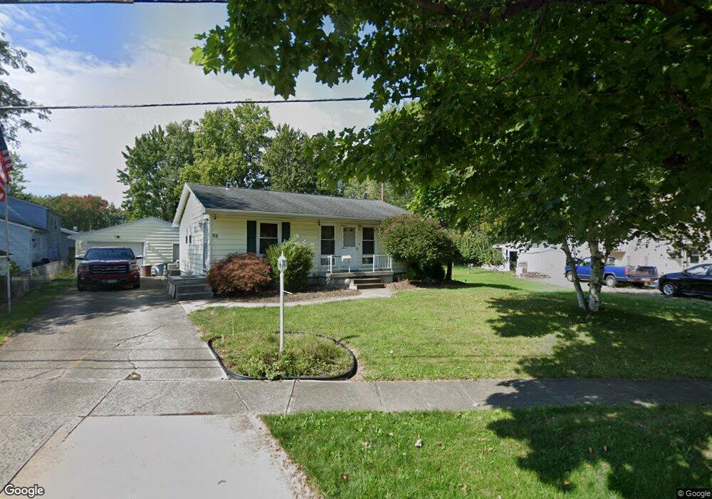
55 Central Blvd Norwalk, OH 44857
Estimated Value: $162,000 - $178,000
3
Beds
2
Baths
1,044
Sq Ft
$163/Sq Ft
Est. Value
About This Home
This home is located at 55 Central Blvd, Norwalk, OH 44857 and is currently estimated at $170,031, approximately $162 per square foot. 55 Central Blvd is a home located in Huron County with nearby schools including Maplehurst Elementary School, League Elementary School, and Pleasant Elementary School.
Ownership History
Date
Name
Owned For
Owner Type
Purchase Details
Closed on
Sep 22, 2018
Sold by
Binting David R and Neel Dana L
Bought by
Binting David R
Current Estimated Value
Home Financials for this Owner
Home Financials are based on the most recent Mortgage that was taken out on this home.
Original Mortgage
$51,354
Outstanding Balance
$44,691
Interest Rate
4.5%
Mortgage Type
FHA
Estimated Equity
$125,340
Purchase Details
Closed on
Mar 29, 1996
Sold by
Neel Dale D
Bought by
Binting David R and Binting Dana
Home Financials for this Owner
Home Financials are based on the most recent Mortgage that was taken out on this home.
Original Mortgage
$64,000
Interest Rate
6.98%
Mortgage Type
New Conventional
Create a Home Valuation Report for This Property
The Home Valuation Report is an in-depth analysis detailing your home's value as well as a comparison with similar homes in the area
Home Values in the Area
Average Home Value in this Area
Purchase History
| Date | Buyer | Sale Price | Title Company |
|---|---|---|---|
| Binting David R | -- | None Available | |
| Binting David R | $80,000 | -- | |
| Binting David R | $80,000 | -- |
Source: Public Records
Mortgage History
| Date | Status | Borrower | Loan Amount |
|---|---|---|---|
| Open | Binting David R | $51,354 | |
| Closed | Binting David R | $64,000 |
Source: Public Records
Tax History Compared to Growth
Tax History
| Year | Tax Paid | Tax Assessment Tax Assessment Total Assessment is a certain percentage of the fair market value that is determined by local assessors to be the total taxable value of land and additions on the property. | Land | Improvement |
|---|---|---|---|---|
| 2024 | $2,124 | $52,040 | $7,440 | $44,600 |
| 2023 | $2,124 | $38,040 | $5,960 | $32,080 |
| 2022 | $1,534 | $38,040 | $5,960 | $32,080 |
| 2021 | $1,534 | $38,040 | $5,960 | $32,080 |
| 2020 | $1,417 | $33,420 | $5,960 | $27,460 |
| 2019 | $1,386 | $33,420 | $5,960 | $27,460 |
| 2018 | $1,362 | $33,420 | $5,960 | $27,460 |
| 2017 | $1,177 | $28,780 | $5,960 | $22,820 |
| 2016 | $1,155 | $28,780 | $5,960 | $22,820 |
| 2015 | $1,154 | $28,790 | $5,970 | $22,820 |
| 2014 | $1,158 | $28,630 | $5,950 | $22,680 |
| 2013 | $1,006 | $28,630 | $5,950 | $22,680 |
Source: Public Records
Map
Nearby Homes
- 203 Spino St
- 45 Grove Ave
- 173 Saint Marys St
- 14 Republic St
- 6 Blossom Dr Unit B
- 154 Gallup Ave
- 34 Old State Rd N
- 112 State Route 61 Unit 25
- 0 Milan Ave
- 121 Leisure Ln
- 17 Sara Dr
- 123 E Main St
- 0 Cleveland Rd
- 57 Milan Ave
- 29 Corwin St
- 14 Corwin St
- 6 White Tail Way Unit A
- 85 Woodlawn Ave
- 11 Granny Smith St
- 15 E Washington St
- 191 Scottwood Ave
- 192 Spino St
- 189 Scottwood Ave
- 194 Spino St
- 190 Spino St
- 187 Scottwood Ave
- 197 Scottwood Ave
- 56 Central Blvd
- 196 Scottwood Ave
- 190 Scottwood Ave
- 188 Spino St
- 185 Scottwood Ave
- 46 Central Blvd
- 45 Central Blvd
- 198 Scottwood Ave
- 193 Spino St
- 186 Spino St
- 186 Spino St
- 195 Spino St
- 191 Spino St