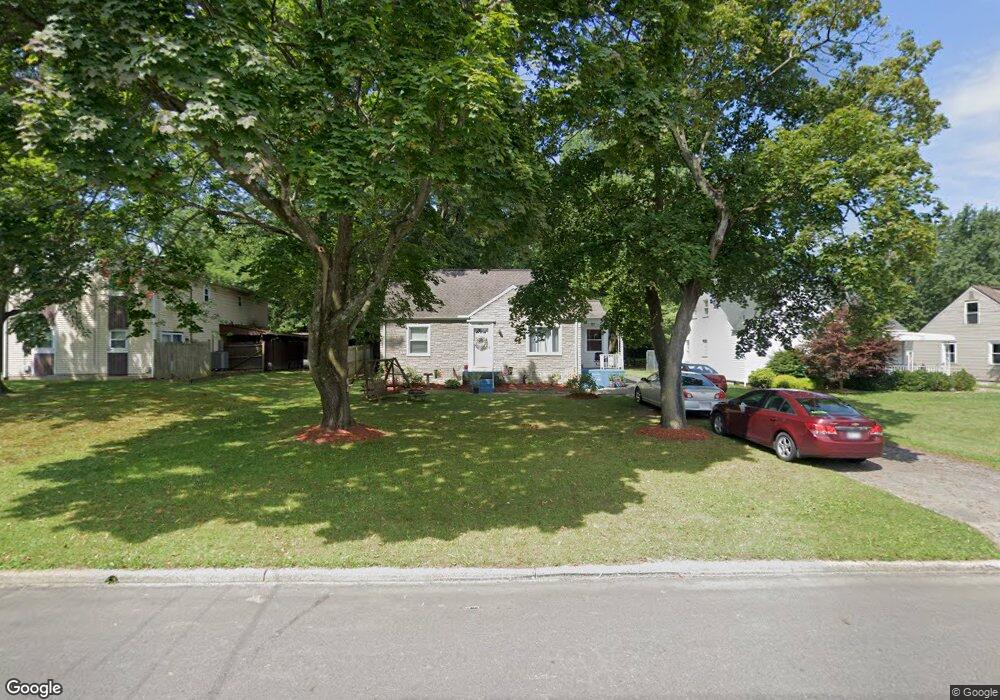
550 Forest Hill Dr Youngstown, OH 44515
Austintown NeighborhoodEstimated Value: $147,000 - $178,000
3
Beds
1
Bath
1,248
Sq Ft
$130/Sq Ft
Est. Value
About This Home
This home is located at 550 Forest Hill Dr, Youngstown, OH 44515 and is currently estimated at $162,028, approximately $129 per square foot. 550 Forest Hill Dr is a home located in Mahoning County with nearby schools including Austintown Elementary School, Austintown Intermediate School, and Austintown Middle School.
Ownership History
Date
Name
Owned For
Owner Type
Purchase Details
Closed on
Oct 28, 2003
Sold by
Ferguson John C and Ferguson Rachel R
Bought by
Weimer Chasity A and Summerville Alan S
Current Estimated Value
Home Financials for this Owner
Home Financials are based on the most recent Mortgage that was taken out on this home.
Original Mortgage
$70,200
Interest Rate
9%
Mortgage Type
Purchase Money Mortgage
Purchase Details
Closed on
Aug 19, 1998
Sold by
Watt Helen
Bought by
Ferguson John C and Ferguson Rachael R
Purchase Details
Closed on
Nov 5, 1973
Bought by
Watt Helen
Create a Home Valuation Report for This Property
The Home Valuation Report is an in-depth analysis detailing your home's value as well as a comparison with similar homes in the area
Home Values in the Area
Average Home Value in this Area
Purchase History
| Date | Buyer | Sale Price | Title Company |
|---|---|---|---|
| Weimer Chasity A | $78,000 | -- | |
| Ferguson John C | $60,000 | -- | |
| Watt Helen | -- | -- |
Source: Public Records
Mortgage History
| Date | Status | Borrower | Loan Amount |
|---|---|---|---|
| Previous Owner | Weimer Chasity A | $70,200 |
Source: Public Records
Tax History Compared to Growth
Tax History
| Year | Tax Paid | Tax Assessment Tax Assessment Total Assessment is a certain percentage of the fair market value that is determined by local assessors to be the total taxable value of land and additions on the property. | Land | Improvement |
|---|---|---|---|---|
| 2024 | $1,810 | $39,160 | $4,190 | $34,970 |
| 2023 | $1,778 | $39,160 | $4,190 | $34,970 |
| 2022 | $1,450 | $25,590 | $3,500 | $22,090 |
| 2021 | $1,451 | $25,590 | $3,500 | $22,090 |
| 2020 | $1,456 | $25,590 | $3,500 | $22,090 |
| 2019 | $1,379 | $21,870 | $2,990 | $18,880 |
| 2018 | $1,328 | $21,870 | $2,990 | $18,880 |
| 2017 | $1,314 | $21,870 | $2,990 | $18,880 |
| 2016 | $1,392 | $22,950 | $2,990 | $19,960 |
| 2015 | $1,350 | $22,950 | $2,990 | $19,960 |
| 2014 | $1,423 | $22,950 | $2,990 | $19,960 |
| 2013 | $1,341 | $22,950 | $2,990 | $19,960 |
Source: Public Records
Map
Nearby Homes
- 3972 Artmar Dr
- 532 Westgate Blvd
- 4102 Burkey Rd
- 3811 Artmar Dr
- 4234 Burkey Rd
- 3890 Ayrshire Dr
- 4262 Pembrook Rd
- 3852 Edinburgh Dr
- 263 S Main St
- 252 Rosemont Ave
- 1560 S Meridian Rd
- 653 S Meridian Rd
- 565 S Meridian Rd
- 4235 Patricia Ave
- 902 S Meridian Rd
- 0 Elmwood Ave
- 136 Rosemont Ave
- 603 S Raccoon Rd Unit 9
- 603 S Raccoon Rd Unit 14
- 603 S Raccoon Rd Unit 61
- 546 Forest Hill Dr
- 554 Forest Hill Dr Unit 556
- 546 Forest-Hill Dr
- 542 Forest Hill Dr
- 568 Forest Hill Dr
- 534 Forest Hill Dr
- 551 Forest Hill Dr
- 545 Forest Hill Dr
- 573 Forest Hill Dr
- 541 Forest Hill Dr
- 528 Forest Hill Dr
- 539 Forest Hill Dr
- 537 Forest Hill Dr
- 3934 Burkey Rd
- 3908 Burkey Rd
- 522 Forest Hill Dr
- 535 Forest Hill Dr
- 3948 Artmar Dr
- 3954 Artmar Dr
- 3942 Artmar Dr