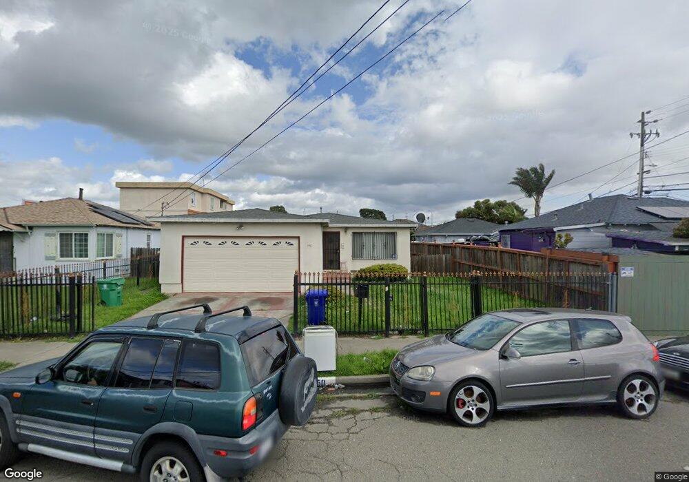
550 S 22nd St Richmond, CA 94804
Coronado NeighborhoodEstimated Value: $507,907 - $556,000
3
Beds
2
Baths
1,158
Sq Ft
$458/Sq Ft
Est. Value
About This Home
This home is located at 550 S 22nd St, Richmond, CA 94804 and is currently estimated at $530,477, approximately $458 per square foot. 550 S 22nd St is a home located in Contra Costa County with nearby schools including Coronado Elementary School, Lovonya DeJean Middle School, and John F. Kennedy High School.
Ownership History
Date
Name
Owned For
Owner Type
Purchase Details
Closed on
Nov 11, 2022
Sold by
Carter Pamela L
Bought by
Pamela L Carter Living Trust
Current Estimated Value
Purchase Details
Closed on
Apr 20, 2000
Sold by
Carter James
Bought by
Carter Pamela L
Home Financials for this Owner
Home Financials are based on the most recent Mortgage that was taken out on this home.
Original Mortgage
$109,250
Interest Rate
8.24%
Mortgage Type
Purchase Money Mortgage
Purchase Details
Closed on
Mar 10, 2000
Sold by
City Of Richmond
Bought by
Richmond Neighborhood Housing Svcs Inc
Home Financials for this Owner
Home Financials are based on the most recent Mortgage that was taken out on this home.
Original Mortgage
$109,250
Interest Rate
8.24%
Mortgage Type
Purchase Money Mortgage
Create a Home Valuation Report for This Property
The Home Valuation Report is an in-depth analysis detailing your home's value as well as a comparison with similar homes in the area
Home Values in the Area
Average Home Value in this Area
Purchase History
| Date | Buyer | Sale Price | Title Company |
|---|---|---|---|
| Pamela L Carter Living Trust | -- | -- | |
| Carter Pamela L | -- | First California Title Compa | |
| Carter Pamela L | $115,000 | First California Title Compa | |
| Richmond Neighborhood Housing Svcs Inc | $115,000 | Fidelity National Title Co |
Source: Public Records
Mortgage History
| Date | Status | Borrower | Loan Amount |
|---|---|---|---|
| Previous Owner | Carter Pamela L | $109,250 |
Source: Public Records
Tax History Compared to Growth
Tax History
| Year | Tax Paid | Tax Assessment Tax Assessment Total Assessment is a certain percentage of the fair market value that is determined by local assessors to be the total taxable value of land and additions on the property. | Land | Improvement |
|---|---|---|---|---|
| 2025 | $3,958 | $176,725 | $79,140 | $97,585 |
| 2024 | $3,911 | $173,261 | $77,589 | $95,672 |
| 2023 | $3,911 | $169,865 | $76,068 | $93,797 |
| 2022 | $3,811 | $166,535 | $74,577 | $91,958 |
| 2021 | $3,740 | $163,270 | $73,115 | $90,155 |
| 2019 | $4,181 | $158,430 | $70,948 | $87,482 |
| 2018 | $4,041 | $155,324 | $69,557 | $85,767 |
| 2017 | $3,943 | $152,280 | $68,194 | $84,086 |
| 2016 | $3,823 | $149,295 | $66,857 | $82,438 |
| 2015 | $3,790 | $147,053 | $65,853 | $81,200 |
| 2014 | $3,752 | $144,174 | $64,564 | $79,610 |
Source: Public Records
Map
Nearby Homes
- 557 S 22nd St
- 5146 Blossom Cir
- 628 S 17th St
- 1817 Virginia Ave
- 447 S 16th St
- 2626 Maine Ave
- 338 S 16th St
- 330 S 16th St
- 715 S 29th St
- 1496 Seawind Dr
- 1503 Jetty Dr
- 2502 Jetty Dr Unit 152
- 350 Marina Way S
- 1426 Seawind Dr
- 1465 Latitudes Way
- 146 S 17th St
- 201 Jetty Dr
- 138 S 17th St
- 104 Jetty Dr
- 2107 Ohio Ave
- 2209 Potrero Ave
- 536 S 22nd St
- 2217 Potrero Ave
- 528 S 22nd St
- 535 Marina Bay Pkwy
- 2221 Potrero Ave
- 551 S 22nd St
- 537 S 22nd St
- 531 S 22nd St
- 525 S 22nd St
- 2200 Potrero Ave
- 2208 Potrero Ave
- 519 S 22nd St
- 2218 Potrero Ave
- 2111 Potrero Ave
- 540 S 21st St
- 603 S 22nd St
- 534 S 21st St
- 2128 Cutting Blvd
- 530 S 21st St